- Population
- 4,908
- 4.9K
- Local time
- UTC+09:00
- Asia/Tokyo · UTC+09:00
- Airports
- RNJ Yoron Airport39 km
- OKA Naha International Airport82 km
About Kunigami
Kunigami is a village. Location: Okinawa, Japan. Population: 4,908.
Kunigami (Japanese: 国頭村, Hepburn: Kunigami-son; Kunigami: Kunzan; Okinawan: Kunjan) is a village in Kunigami District, Okinawa Prefecture, Japan. It occupies the north tip of Okinawa Island, with the East China Sea to the west, Pacific Ocean to the east, and villages of Higashi and Ōgimi to the south. As of 2015, the village has a population of 4,908 and a population density of 25.20 persons per km2. The total area is 194.80 km2.
Read more on Wikipedia Text: Wikipedia contributors · CC BY-SA 4.0 · shortened
Places bordering Kunigami
- Ōgimi
- Higashi Village
Population of Kunigami over time
| 2010 | 5,188 | |
|---|---|---|
| 2015 | 4,908 | |
| 2021 | 4,517 |
Censuses and official estimates; source: Wikidata.
Climate of Kunigami
Best months for sightseeingBest months for sightseeing: March–May, November–December.
Bars: average monthly low and high temperature. Below: precipitation. Monthly averages for 1970–2000 at about 18 km resolution, adjusted for elevation. Highlighted months are mild and relatively dry. Source: WorldClim 2.1 (CC BY 4.0).
Show values as a table
| Month | Jan | Feb | Mar | Apr | May | Jun | Jul | Aug | Sep | Oct | Nov | Dec |
|---|---|---|---|---|---|---|---|---|---|---|---|---|
| Average high (°C) | 18° | 18° | 20° | 23° | 25° | 28° | 30° | 30° | 29° | 26° | 23° | 20° |
| Average low (°C) | 14° | 14° | 16° | 18° | 21° | 24° | 26° | 26° | 25° | 22° | 19° | 16° |
| Precipitation (mm) | 125 | 129 | 167 | 200 | 244 | 243 | 177 | 226 | 183 | 169 | 142 | 111 |
Other places to visit in this season: March April May November December
Airports nearest to Kunigami
- Yoron Airport (RNJ) Yoron 39 km
- Naha International Airport (OKA) Naha 82 km
- Okinoerabu Airport (OKE) Wadomari 92 km
Straight-line distance; airports with scheduled flights only. Source: OurAirports (public domain).
Nearby attractions & nature
Everything nearby-
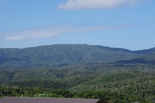 Mount Yonaha Mountain, Kunigami Village7.4 km SE
-
 Okinawa Islands Island, Okinawa14 km SW
-
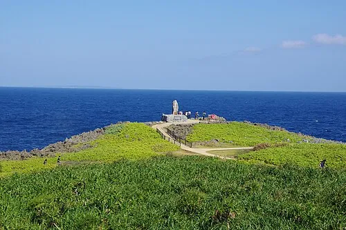 Hedo Misaki Natural site, Kunigami Village16 km NE
Sources & licences
Data last updated: · 2 independent sources