Kitadaitō Village
Local name: 北大東村
Located in Shimajiri-gun, Okinawa Coordinates: 25°56′24″ N 131°18′25″ E
- Population
- 558
- 558
- Elevation
- 3 m
- above sea level
- Local time
- UTC+09:00
- Asia/Tokyo · UTC+09:00
- Airports
- KTD Kitadaito Airport2 km
- MMD Minamidaito Airport11 km
About Kitadaitō Village
Kitadaitō Village is a municipality. Location: Shimajiri-gun, Okinawa. Population: 558. Elevation: 3 m.
Kitadaitō (北大東村, Kitadaitō-son) is a village consisting of the islands of Kitadaitōjima and Okidaitōjima of Shimajiri District, Okinawa Prefecture, Japan. As of October 2016, the village has an estimated population of 615 and a density of 47 persons per km2. The total area is 13.10 km2. All of the inhabitants live on Kitadaitōjima.
Source: Wikipedia · CC BY-SA 4.0
Photos of Kitadaitō Village
-
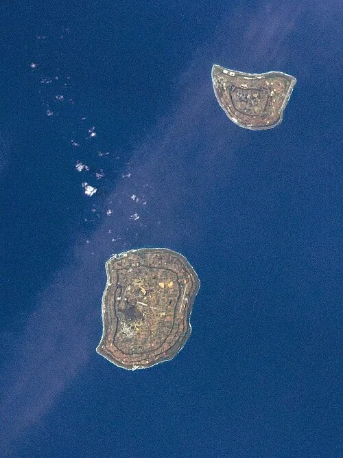
Daitō Islands Image Science and Analysis Laboratory, NASA-Johnson Space Center. "The Gateway to Astronaut Photography of Earth." · Public domain -
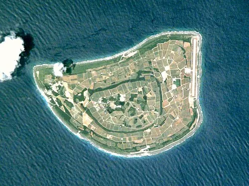
Kitadaitō Jima NASA Johnson Space Center · Public domain


Population of Kitadaitō Village over time
| 2010 | 665 | |
|---|---|---|
| 2015 | 629 | |
| 2021 | 604 |
Censuses and official estimates; source: Wikidata.
Climate of Kitadaitō Village
Best months for sightseeingBest months for sightseeing: November–May.
This month · November
A good month to visit
Day 25° · Night 20° · Rain 206 mm
- Hottest month
- July (day 31°)
- Coldest month
- January (night 15°)
- Wettest month
- May (277 mm)
- Driest month
- January (150 mm)
Bars: average monthly low and high temperature. Below: precipitation. Monthly averages for 1970–2000 at about 18 km resolution, adjusted for elevation. Highlighted months are mild and relatively dry. Source: WorldClim 2.1 (CC BY 4.0).
Show values as a table
| Month | Jan | Feb | Mar | Apr | May | Jun | Jul | Aug | Sep | Oct | Nov | Dec |
|---|---|---|---|---|---|---|---|---|---|---|---|---|
| Average high (°C) | 21° | 21° | 22° | 25° | 27° | 29° | 31° | 31° | 31° | 28° | 25° | 22° |
| Average low (°C) | 15° | 15° | 17° | 19° | 22° | 24° | 26° | 26° | 25° | 23° | 20° | 17° |
| Precipitation (mm) | 150 | 156 | 192 | 227 | 277 | 273 | 189 | 203 | 205 | 229 | 206 | 155 |
Other places to visit in this season: January February March April May November December
How to get to Kitadaitō Village
The nearest airport is Kitadaito Airport (KTD), 2 km to the east as the crow flies. The nearest large city is Uruma, 348 km to the west.
Airports
- Kitadaito Airport (KTD) Kitadaitōjima 2 kmeast
- Minamidaito Airport (MMD) Minamidaito 11 kmsouthwest
Nearby large cities
- Uruma Population: 125.3K 348 kmwest
- Okinawa Population: 142.8K 353 kmwest
- Ginowan Population: 100.1K 356 kmwest
- Urasoe Population: 115.7K 360 kmwest
- Naha Population: 317.6K 364 kmwest
Straight-line distances; road distances are longer. Airport data: OurAirports.
Day trips from Kitadaitō Village
Within 100 km: 3 lakes, rivers and coasts.
0–25 km3 places
- Daitō Islands Island 6 kmSW
- Borodino Island Island 13 kmSW
- Kitadaitō Jima Island 1 kmN
Straight-line distances.
Nearby attractions & nature
Everything nearby-
Kitadaitō Jima Island, Okinawa0.8 km N
-
Daitō Islands Island, Okinawa6 km SW
-
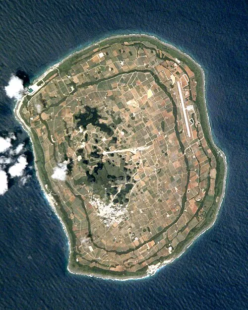 Borodino Island Island, Okinawa13 km SW
Sources & licences
Data last updated: · 2 independent sources