- Population
- 112,819
- 112.8K
- Elevation
- 124 m
- above sea level
- Local time
- UTC+09:00
- Asia/Tokyo · UTC+09:00
- Airports
- NGO Chubu Centrair International Airport62 km
- NKM Nagoya Airport / JASDF Komaki Air Base68 km
About Youkaichi
Youkaichi is a city. Location: Higashiōmi-shi, Shiga Prefecture. Population: 112,819. Elevation: 124 m. The best months to visit are May–June, September–October. The nearest airport is Chubu Centrair International Airport (62 km). Nearby sights include Hikone castle and Lake Biwa.
Photos of Youkaichi
-
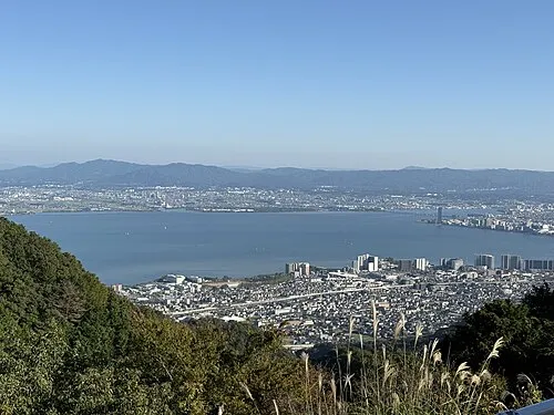
Lake Biwa Lonely Planet Japan · CC BY-SA 4.0 -
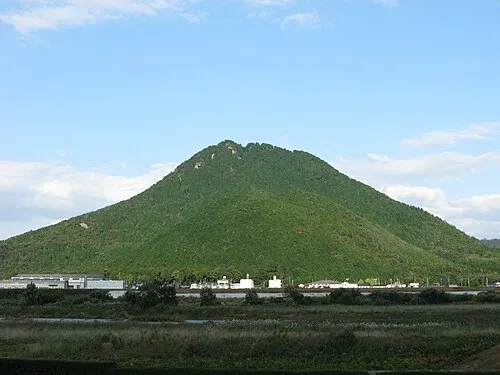
Mount Mikami Haruno Akiha · CC BY-SA 3.0 -
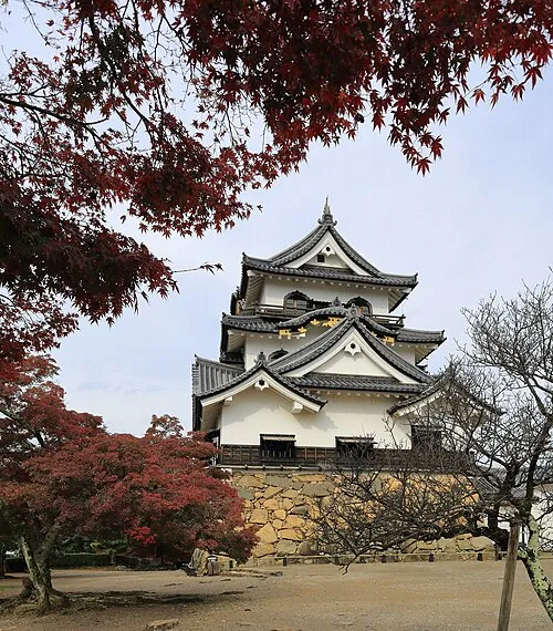
Hikone castle Martin Falbisoner · CC BY-SA 4.0


Climate of Youkaichi
Best months for sightseeingBest months for sightseeing: May–June, September–October.
This month · November
Outside the best season
Day 16° · Night 6° · Rain 85 mm
Better nearby cities in November
- Fujinomiya · 220 km east18°
- Kofu · 223 km east17°
- Fuji · 226 km east20°
- Hottest month
- August (day 31°)
- Coldest month
- January (night 0°)
- Wettest month
- June (245 mm)
- Driest month
- December (65 mm)
Bars: average monthly low and high temperature. Below: precipitation. Monthly averages for 1970–2000 at about 18 km resolution, adjusted for elevation. Highlighted months are mild and relatively dry. Source: WorldClim 2.1 (CC BY 4.0).
Show values as a table
| Month | Jan | Feb | Mar | Apr | May | Jun | Jul | Aug | Sep | Oct | Nov | Dec |
|---|---|---|---|---|---|---|---|---|---|---|---|---|
| Average high (°C) | 7° | 8° | 11° | 18° | 22° | 25° | 29° | 31° | 27° | 21° | 16° | 10° |
| Average low (°C) | 0° | 0° | 2° | 8° | 13° | 17° | 22° | 23° | 19° | 12° | 6° | 2° |
| Precipitation (mm) | 77 | 85 | 120 | 157 | 160 | 245 | 234 | 152 | 217 | 129 | 85 | 65 |
Other places to visit in this season: May June September October
How to get to Youkaichi
The nearest airport is Chubu Centrair International Airport (NGO), 62 km to the southeast as the crow flies. The nearest large city is Hikone, 16 km to the north.
Airports
- Chubu Centrair International Airport (NGO) Tokoname 62 kmsoutheast
- Nagoya Airport / JASDF Komaki Air Base (NKM) Nagoya 68 kmeast
- Osaka Itami International Airport (ITM) Osaka 79 kmsouthwest
Nearby large cities
- Hikone Population: 113.6K 16 kmnorth
- Kusatsu Population: 143.9K 24 kmsouthwest
- Nagahama Population: 113.6K 30 kmnorth
- Ōtsu Population: 345.1K 33 kmsouthwest
- Yokkaichi Population: 305.4K 42 kmsoutheast
Straight-line distances; road distances are longer. Airport data: OurAirports.
Day trips from Youkaichi
Within 100 km: 33 historic and cultural sites, 40 natural sites, 40 lakes, rivers and coasts.
0–25 km6 places
- Lake Biwa Lake 18 kmNW
- Mount Mikami Mountain 16 kmSW
- Yasu River River 20 kmW
- Mount Ryōzen Mountain 25 kmNE
25–60 km43 places
- Lake Suigetsu Lake 59 kmNW
- Kita-gawa River 60 kmNW
- Neo River River 52 kmNE
- Nanzen-ji Attraction 39 kmW
60–100 km64 places
- Tōshi-jima Island 91 kmSE
- Himakajima Island 87 kmSE
- Mount Rokkō Mountain 93 kmSW
- Sakate-jima Island 92 kmSE
Straight-line distances.
Youkaichi and similar cities
Side by side with cities of similar size in the same country: population, elevation and climate.
| Measure | Youkaichi | Kazo | Ōshū | Fujimino |
|---|---|---|---|---|
| Population | 112.8K | 112.8K | 112.9K | 113.6K |
| Elevation | 124 m | 12 m | 36 m | 7 m |
| Summer day (hottest month) | 31° | 30° | 28° | 30° |
| Winter night (coldest month) | 0° | -2° | -5° | -1° |
| Annual rainfall | 1,726 mm | 1,295 mm | 1,300 mm | 1,376 mm |
| Best months | May–Jun, Sep–Oct | May–Jun, Oct | May–Jul, Sep | May–Jun, Oct |
| Distance | — | 328 km | 628 km | 314 km |
Climate values are 1970–2000 monthly averages; straight-line distance.
Nearby attractions & nature
Everything nearby-
Hikone castle Historic site, Hikone18 km N
-
Lake Biwa Lake, Shiga Prefecture18 km NW
-
Mount Mikami Mountain, Yasu-shi16 km SW
-
Yasu River River, Japan20 km W
-
Mount Ryōzen Mountain, Taga Chō25 km NE
-
 Mount Gozaisho Mountain, Shiga Prefecture23 km SE
Sources & licences
Data last updated: