Kusatsu
Local name: 草津市
Located in Kusatsu Shi, Shiga Prefecture Coordinates: 35°01′00″ N 135°58′00″ E
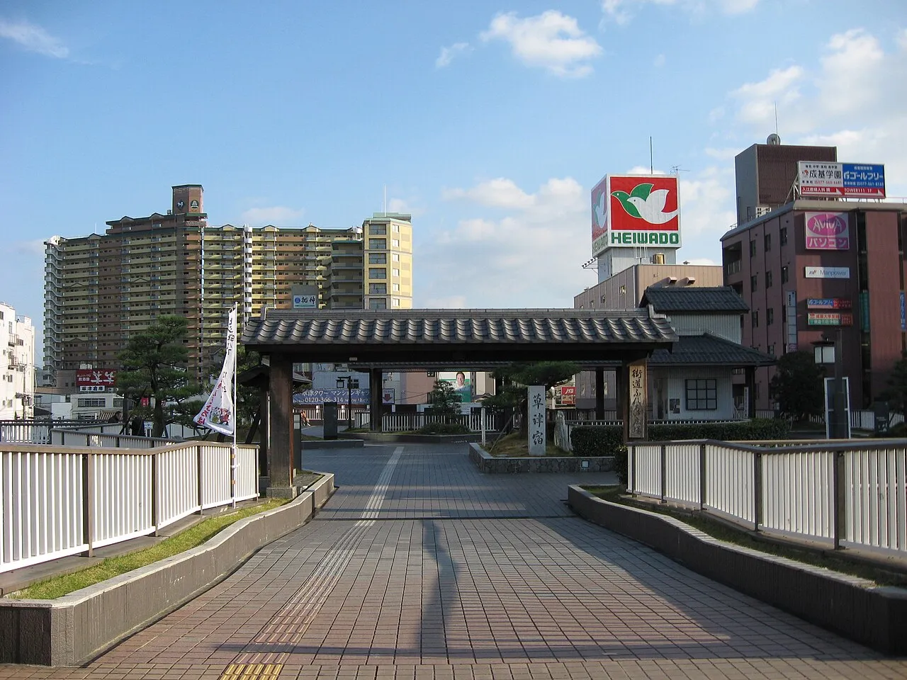
- Population
- 143,913
- 143.9K
- Elevation
- 102 m
- above sea level
- Local time
- UTC+09:00
- Asia/Tokyo · UTC+09:00
- Airports
- ITM Osaka Itami International Airport55 km
- NGO Chubu Centrair International Airport79 km
About Kusatsu
Kusatsu is a city. Location: Kusatsu Shi, Shiga Prefecture. Population: 143,913. Elevation: 102 m.
Kusatsu (草津市, Kusatsu-shi) is a city located in Shiga Prefecture, Japan. The city lies on Lake Biwa, Japan's largest freshwater lake. As of 31 January 2024, the city had an estimated population of 139,913 in 63,942 households and a population density of 2100 persons per km2. The total area of the city is 67.82 square kilometres (26.19 sq mi). The city is often confused with Kusatsu, Gunma Prefecture, which is a famous hot spring resort.
Source: Wikipedia · CC BY-SA 4.0
Photos of Kusatsu
-

A.fujimoto · CC0 -

Guido Pinchi · CC BY-SA 4.0 -

Mount Hiei Moja · CC BY-SA 3.0 -
Mount Hiei Moja · CC BY-SA 3.0 -
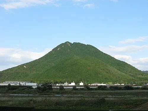
Mount Mikami Haruno Akiha · CC BY-SA 3.0


Travel notes for Kusatsu
From Wikivoyage
For the Kusatsu Onsen in Gunma Prefecture, see Kusatsu.
Kusatsu (草津市) is a city in Shiga prefecture.
Understand+
Kusatsu city used to be a prosperous town as a crossroads of the Nakasendo road and Tokaido road for travelers to Tokyo from all over Japan.
Tourist information site:
The local tourist association has a Japanese-only guide site and info pages in English on Matcha.
Get in+
Kusatsu has two stations along JR's Tokaido Main Line, Kusatsu Station and Minami-Kusatsu Station, so it is very easy to access from Kyoto, Osaka, and Kobe. All local, kaisoku, and shin-kaisoku trains stop at both stations. Kusatsu Station is also served by the Kusatsu Line, which connects Kusatsu to Ritto, Koka, and Iga (Tsuge Station) in Mie.
Source: Wikivoyage · CC BY-SA 4.0 · abridged
Places bordering Kusatsu
- Ōtsu
- Moriyama
- Rittō
Twin towns and sister cities of Kusatsu
- Date-shi· Japan
Source: Wikidata. Only places with a page on this site are shown.
Population of Kusatsu over time
| 2010 | 130,874 | |
|---|---|---|
| 2015 | 137,247 | |
| 2021 | 143,230 |
Censuses and official estimates; source: Wikidata.
Climate of Kusatsu
Best months for sightseeingBest months for sightseeing: May–June, September–October.
This month · November
Outside the best season
Day 16° · Night 7° · Rain 84 mm
Better nearby cities in November
- Fujinomiya · 242 km east18°
- Kofu · 247 km east17°
- Fuji · 248 km east20°
- Hottest month
- August (day 31°)
- Coldest month
- February (night 0°)
- Wettest month
- June (229 mm)
- Driest month
- December (66 mm)
Bars: average monthly low and high temperature. Below: precipitation. Monthly averages for 1970–2000 at about 18 km resolution, adjusted for elevation. Highlighted months are mild and relatively dry. Source: WorldClim 2.1 (CC BY 4.0).
Show values as a table
| Month | Jan | Feb | Mar | Apr | May | Jun | Jul | Aug | Sep | Oct | Nov | Dec |
|---|---|---|---|---|---|---|---|---|---|---|---|---|
| Average high (°C) | 8° | 8° | 11° | 18° | 22° | 25° | 30° | 31° | 27° | 21° | 16° | 11° |
| Average low (°C) | 0° | 0° | 3° | 8° | 13° | 18° | 22° | 23° | 19° | 13° | 7° | 2° |
| Precipitation (mm) | 79 | 85 | 116 | 144 | 150 | 229 | 218 | 142 | 199 | 122 | 84 | 66 |
Other places to visit in this season: May June September October
How to get to Kusatsu
The nearest airport is Osaka Itami International Airport (ITM), 55 km to the southwest as the crow flies. The nearest large city is Ōtsu, 9 km to the west.
Airports
- Osaka Itami International Airport (ITM) Osaka 55 kmsouthwest
- Chubu Centrair International Airport (NGO) Tokoname 79 kmeast
- Kobe Airport (UKB) Kobe 80 kmsouthwest
Nearby large cities
- Ōtsu Population: 345.1K 9 kmwest
- Uji Population: 192.9K 20 kmsouthwest
- Youkaichi Population: 112.8K 24 kmnortheast
- Hikone Population: 113.6K 37 kmnortheast
- Hirakata Population: 406.3K 37 kmsouthwest
Straight-line distances; road distances are longer. Airport data: OurAirports.
Day trips from Kusatsu
Within 100 km: 33 historic and cultural sites, 46 natural sites, 31 lakes, rivers and coasts.
0–25 km22 places
- Nanzen-ji Attraction 16 kmW
- Eikan-dō Attraction 16 kmW
- National Museum of Modern Art, Kyoto Museum 17 kmW
- Mount Kurama Mountain 21 kmNW
25–60 km28 places
- Mount Miwa Mountain 54 kmS
- Mount Amanokagu Mountain 59 kmS
- Mount Miminashi Mountain 58 kmS
- Kita-gawa River 58 kmN
60–100 km60 places
- Mount Rokkō Mountain 70 kmW
- Kumozu River River 68 kmSE
- Mount Unebi Mountain 61 kmS
- Mount Ōdaigahara Mountain 93 kmS
Straight-line distances.
Kusatsu and similar cities
Side by side with cities of similar size in the same country: population, elevation and climate.
| Measure | Kusatsu | Tsuchiura | Kakamigahara | Moriguchi |
|---|---|---|---|---|
| Population | 143.9K | 144.4K | 144.5K | 143.1K |
| Elevation | 102 m | 5 m | 40 m | 3 m |
| Summer day (hottest month) | 31° | 29° | 31° | 33° |
| Winter night (coldest month) | 0° | -2° | -1° | 1° |
| Annual rainfall | 1,634 mm | 1,348 mm | 2,087 mm | 1,381 mm |
| Best months | May–Jun, Sep–Oct | May–Jul, Sep–Oct | May–Jun, Oct | May, Oct |
| Distance | — | 403 km | 93 km | 48 km |
Climate values are 1970–2000 monthly averages; straight-line distance.
Nearby attractions & nature
Everything nearby-
Mount Mikami Mountain, Yasu-shi7.5 km NE
-
Mount Hiei Mountain, Sakyō Ku13 km W
-
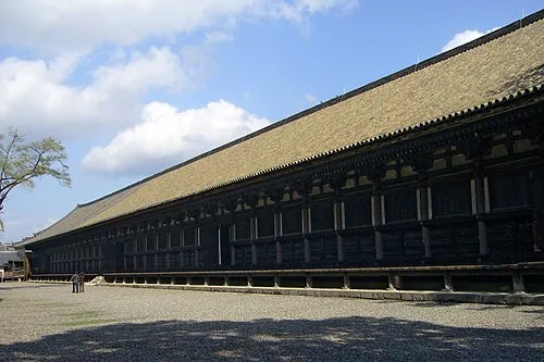 Sanjusangen-do Attraction, Higashiyama District18 km W
-
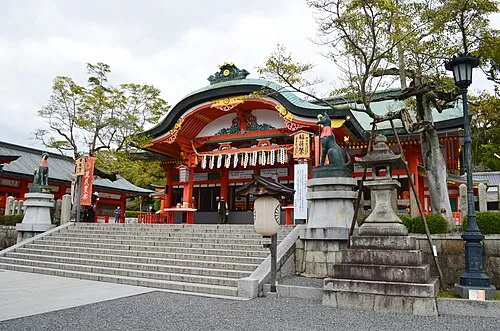 Fushimi Inari-taisha Attraction, Fushimi-ku18 km W
-
Mount Hiei Mountain, Ōtsu Shi13 km NW
-
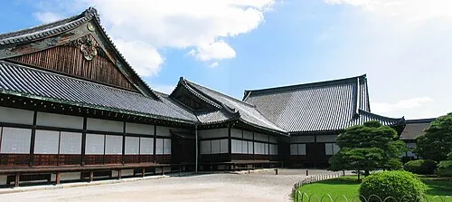 Nijo castle Historic site, Nakagyō Ku20 km W
-
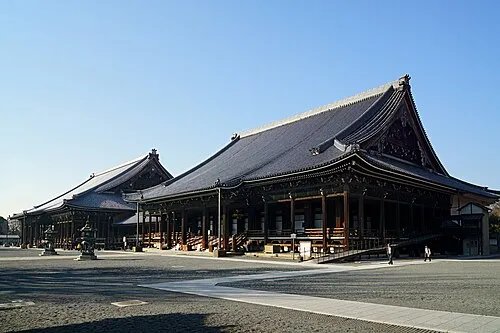 Nishi Hongan Ji Attraction, Shimogyo Ku20 km W
-
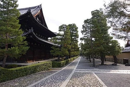 Daitokuji Attraction, Kita Ku20 km W
Sources & licences
Data last updated: · 2 independent sources