Ōmihachiman
Located in Ōmi-hachiman Shi, Shiga Prefecture Coordinates: 35°07′43″ N 136°05′51″ E
- Population
- 82,233
- 82.2K
- Elevation
- 91 m
- above sea level
- Local time
- UTC+09:00
- Asia/Tokyo · UTC+09:00
- Airports
- NGO Chubu Centrair International Airport71 km
- ITM Osaka Itami International Airport71 km
About Ōmihachiman
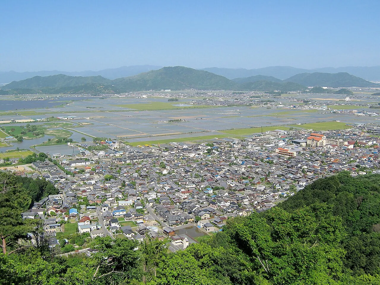
Ōmihachiman is a city. Location: Ōmi-hachiman Shi, Shiga Prefecture. Population: 82,233. Elevation: 91 m. The best months to visit are May–June, October. The nearest airport is Chubu Centrair International Airport (71 km). Nearby sights include Mount Mikami and Yasu River.
Photos of Ōmihachiman
-

先従隗始 · CC0 -

先従隗始 · CC0 -

Nankou Oronain · CC BY-SA 3.0 -

shikabane taro · CC BY 3.0 -

Kok Leng Yeo from Singapore, Singapore · CC BY 2.0


Travel notes for Ōmihachiman
From Wikivoyage
Ōmihachiman (近江八幡市) is a city in Shiga prefecture, Japan.
Understand+
Tourist information site:
The local tourist association has a partly multilingual guide site.
Get in+
By train:
Ōmihachiman is on the JR Main Line, also called the JR Biwako Line between Kyoto and Maibara, which are the closest Shinkansen stops. JR Ōmihachiman is about 30 min from Kyoto and 20 min from Maibara.
By car:
From the Meishin Expressway, Ōmihachiman is about 20 min north of the Ryuo (竜王) Interchange, 20 min west of the Yokaichi (八日市) Interchange, and about 40 min southwest of the Hikone (彦根) Interchange. Parking is available at the Obata-cho Visitor Center: ¥500 for cars and ¥2000 for buses.
Source: Wikivoyage · CC BY-SA 4.0 · abridged
Climate of Ōmihachiman
Best months for sightseeingBest months for sightseeing: May–June, October.
This month · November
Outside the best season
Day 16° · Night 7° · Rain 83 mm
Better nearby cities in November
- Fujinomiya · 229 km east18°
- Kofu · 232 km east17°
- Fuji · 235 km east20°
- Hottest month
- August (day 31°)
- Coldest month
- January (night 0°)
- Wettest month
- June (231 mm)
- Driest month
- December (66 mm)
Bars: average monthly low and high temperature. Below: precipitation. Monthly averages for 1970–2000 at about 18 km resolution, adjusted for elevation. Highlighted months are mild and relatively dry. Source: WorldClim 2.1 (CC BY 4.0).
Show values as a table
| Month | Jan | Feb | Mar | Apr | May | Jun | Jul | Aug | Sep | Oct | Nov | Dec |
|---|---|---|---|---|---|---|---|---|---|---|---|---|
| Average high (°C) | 8° | 8° | 12° | 18° | 23° | 26° | 30° | 31° | 27° | 21° | 16° | 11° |
| Average low (°C) | 0° | 0° | 2° | 8° | 13° | 18° | 22° | 23° | 19° | 12° | 7° | 2° |
| Precipitation (mm) | 78 | 85 | 116 | 146 | 149 | 231 | 218 | 137 | 199 | 122 | 83 | 66 |
How to get to Ōmihachiman
The nearest airport is Chubu Centrair International Airport (NGO), 71 km to the southeast as the crow flies. The nearest large city is Youkaichi, 9 km to the east.
Airports
- Chubu Centrair International Airport (NGO) Tokoname 71 kmsoutheast
- Osaka Itami International Airport (ITM) Osaka 71 kmsouthwest
- Nagoya Airport / JASDF Komaki Air Base (NKM) Nagoya 77 kmeast
Nearby large cities
- Youkaichi Population: 112.8K 9 kmeast
- Kusatsu Population: 143.9K 17 kmsouthwest
- Hikone Population: 113.6K 19 kmnortheast
- Ōtsu Population: 345.1K 25 kmsouthwest
- Nagahama Population: 113.6K 32 kmnortheast
Straight-line distances; road distances are longer. Airport data: OurAirports.
Day trips from Ōmihachiman
Within 100 km: 33 historic and cultural sites, 42 natural sites, 37 lakes, rivers and coasts.
0–25 km6 places
- Mount Hiei Mountain 25 kmW
- Lake Biwa Lake 14 kmN
- Mount Bunagatake Mountain 24 kmNW
- Mount Mikami Mountain 10 kmSW
25–60 km41 places
- Lake Suigetsu Lake 54 kmN
- Mimi River River 56 kmN
- Kita-gawa River 53 kmNW
- Neo River River 58 kmNE
60–100 km65 places
- Tōshi-jima Island 98 kmSE
- Himakajima Island 95 kmSE
- Mount Rokkō Mountain 86 kmSW
- Sakate-jima Island 100 kmSE
Straight-line distances.
Ōmihachiman and similar cities
Side by side with cities of similar size in the same country: population, elevation and climate.
| Measure | Ōmihachiman | Akiruno | Shikokuchūō | Kimitsu |
|---|---|---|---|---|
| Population | 82.2K | 81.9K | 82.8K | 83.1K |
| Elevation | 91 m | 163 m | 41 m | 4 m |
| Summer day (hottest month) | 31° | 30° | 31° | 30° |
| Winter night (coldest month) | 0° | -2° | 2° | 1° |
| Annual rainfall | 1,630 mm | 1,429 mm | 2,000 mm | 1,553 mm |
| Best months | May–Jun, Oct | Apr–Jun, Sep–Oct | May–Jun, Oct | May–Jun, Sep–Oct |
| Distance | — | 292 km | 267 km | 344 km |
Climate values are 1970–2000 monthly averages; straight-line distance.
Nearby attractions & nature
Everything nearby-
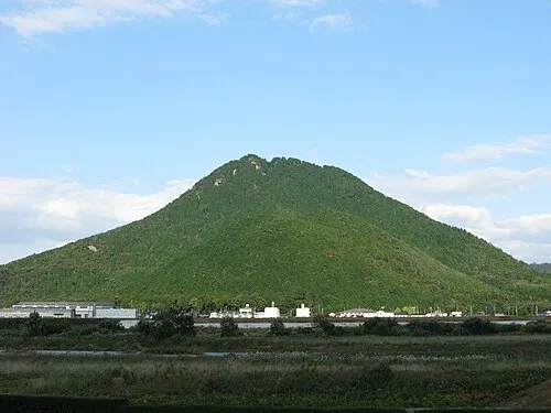 Mount Mikami Mountain, Yasu-shi10 km SW
-
Yasu River River, Japan11 km W
-
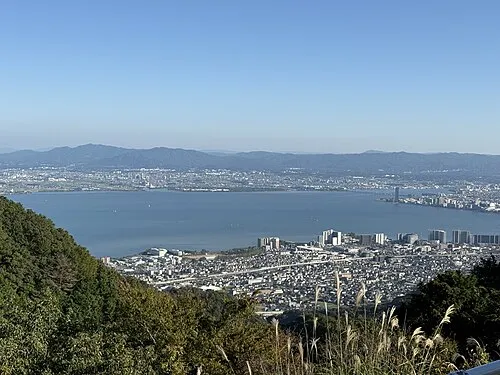 Lake Biwa Lake, Shiga Prefecture14 km N
-
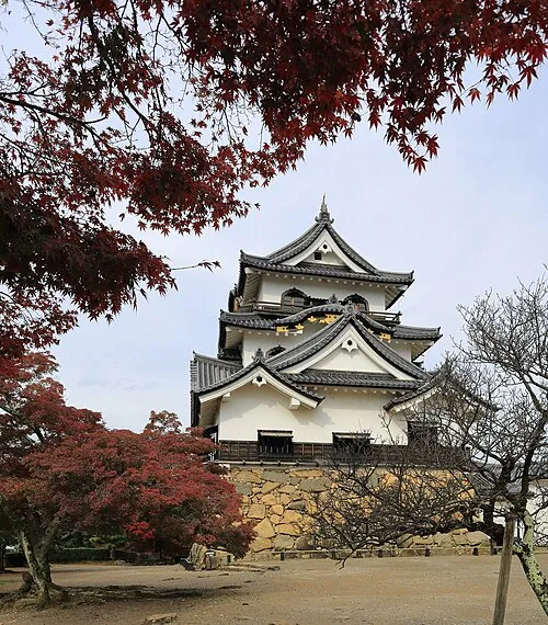 Hikone castle Historic site, Hikone22 km NE
-
 Mount Hiei Mountain, Ōtsu Shi25 km W
-
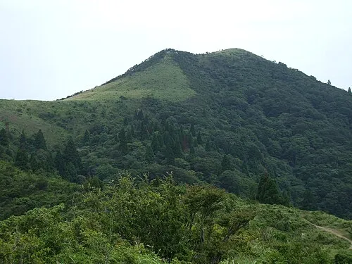 Mount Bunagatake Mountain, Ōtsu Shi24 km NW
Sources & licences
Data last updated: