Kakegawa
Local name: 掛川市
Located in Kakegawa Shi, Shizuoka Coordinates: 34°46′00″ N 138°01′00″ E
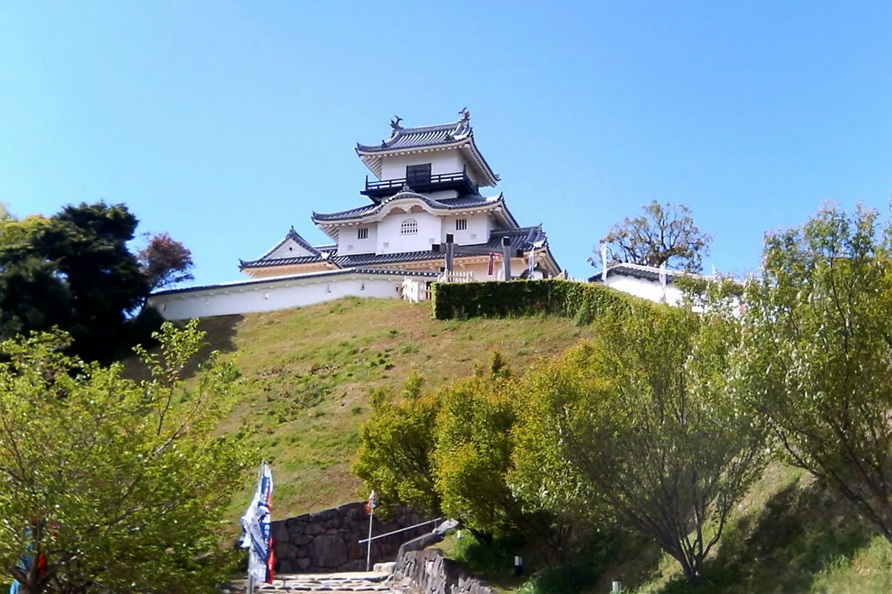
- Population
- 117,925
- 117.9K
- Elevation
- 32 m
- above sea level
- Local time
- UTC+09:00
- Asia/Tokyo · UTC+09:00
- Airports
- FSZ Mount Fuji Shizuoka Airport16 km
- NGO Chubu Centrair International Airport111 km
About Kakegawa
Kakegawa is a city. Location: Kakegawa Shi, Shizuoka. Population: 117,925. Elevation: 32 m.
Kakegawa (掛川市, Kakegawa-shi) is a city in western Shizuoka Prefecture, Japan. As of 10 October 2019, the city had an estimated population of 117,925 in 45,519 households. The total area of the city is 265.69 square kilometres (102.58 sq mi).
Source: Wikipedia · CC BY-SA 4.0
Photos of Kakegawa
-

Oka21000 · CC0 -

社会教育課 · CC BY 4.0 -

Sato S · CC BY-SA 3.0 -

Mikkabie · CC BY-SA 4.0 -

USARJ NCO CORPS · CC BY 2.0


Travel notes for Kakegawa
From Wikivoyage
Kakegawa (掛川) is a city in Shizuoka.
Understand+
Tourist information sites:
The local tourist association has a Japanese-only guide site with integrated Google Translate.
The city government's official site has a good Japanese-only tourism section.
Get in+
By train - Kakegawa is linked by normal train to Tokyo to the north and the rest of Shizuoka Prefecture to the south by the Tokaido line. It is also served by Shinkansen from Tokyo: all Kodama services will stop at Kakegawa and a few Hikari also stop. Nozomi services do not stop at Kakegawa.
Kakegawa's neighbouring cities include Kikugawa and Aino.
Source: Wikivoyage · CC BY-SA 4.0 · abridged
Places bordering Kakegawa
- Fukuroi
- Shimada
- Kikugawa-shi
- Omaezaki-shi
- Mori
Twin towns and sister cities of Kakegawa
- Corning· United States
- Eugene· United States
- Ōshū· Japan
Source: Wikidata. Only places with a page on this site are shown.
Population of Kakegawa over time
| 2010 | 116,363 | |
|---|---|---|
| 2015 | 114,602 | |
| 2021 | 113,954 |
Censuses and official estimates; source: Wikidata.
Climate of Kakegawa
Best months for sightseeingBest months for sightseeing: May–June, September–October.
This month · November
A wet month
Day 18° · Night 9° · Rain 139 mm
Better nearby cities in November
- Fujinomiya · 74 km northeast18°
- Fuji · 75 km northeast20°
- Numazu · 86 km northeast18°
- Hottest month
- August (day 30°)
- Coldest month
- January (night 1°)
- Wettest month
- June (302 mm)
- Driest month
- December (83 mm)
Bars: average monthly low and high temperature. Below: precipitation. Monthly averages for 1970–2000 at about 18 km resolution, adjusted for elevation. Highlighted months are mild and relatively dry. Source: WorldClim 2.1 (CC BY 4.0).
Show values as a table
| Month | Jan | Feb | Mar | Apr | May | Jun | Jul | Aug | Sep | Oct | Nov | Dec |
|---|---|---|---|---|---|---|---|---|---|---|---|---|
| Average high (°C) | 10° | 11° | 14° | 19° | 22° | 25° | 28° | 30° | 27° | 22° | 18° | 13° |
| Average low (°C) | 1° | 2° | 5° | 10° | 14° | 19° | 22° | 23° | 20° | 15° | 9° | 4° |
| Precipitation (mm) | 90 | 108 | 185 | 211 | 216 | 302 | 228 | 216 | 260 | 216 | 139 | 83 |
Other places to visit in this season: May June September October
How to get to Kakegawa
The nearest airport is Mount Fuji Shizuoka Airport (FSZ), 16 km to the east as the crow flies. The nearest large city is Iwata, 17 km to the southwest.
Airports
- Mount Fuji Shizuoka Airport (FSZ) Makinohara / Shimada 16 kmeast
- Chubu Centrair International Airport (NGO) Tokoname 111 kmwest
- Nagoya Airport / JASDF Komaki Air Base (NKM) Nagoya 114 kmnorthwest
Nearby large cities
- Iwata Population: 166.7K 17 kmsouthwest
- Fujieda Population: 145K 25 kmnortheast
- Yaizu Population: 139.6K 30 kmeast
- Shizuoka Population: 693.4K 41 kmnortheast
- Toyokawa Population: 184.7K 57 kmwest
Straight-line distances; road distances are longer. Airport data: OurAirports.
Day trips from Kakegawa
Within 100 km: 4 historic and cultural sites, 19 natural sites, 15 lakes, rivers and coasts.
0–25 km2 places
- Kiku River River 14 kmS
- Tenryu River River 24 kmSW
25–60 km6 places
- Suruga Bay Natural site 50 kmE
- Oi River River 25 kmE
- Abe River River 39 kmNE
- Hongū-zan Mountain 57 kmW
60–100 km30 places
- Himakajima Island 93 kmW
- Kami-jima Island 98 kmW
- Lake Shoji Lake 97 kmNE
- Mount Aino Mountain 99 kmN
Straight-line distances.
Kakegawa and similar cities
Side by side with cities of similar size in the same country: population, elevation and climate.
| Measure | Kakegawa | Handa | Aizu-Wakamatsu | Sano |
|---|---|---|---|---|
| Population | 117.9K | 117.9K | 118.2K | 117.7K |
| Elevation | 32 m | 1 m | 238 m | 36 m |
| Summer day (hottest month) | 30° | 31° | 29° | 30° |
| Winter night (coldest month) | 1° | 1° | -4° | -2° |
| Annual rainfall | 2,254 mm | 1,867 mm | 1,353 mm | 1,265 mm |
| Best months | May–Jun, Sep–Oct | May–Jun, Oct | May–Jun, Sep–Oct | May–Jun, Sep–Oct |
| Distance | — | 100 km | 349 km | 223 km |
Climate values are 1970–2000 monthly averages; straight-line distance.
Nearby attractions & nature
Everything nearby-
Kiku River River, Shizuoka14 km S
-
Tenryu River River, Shizuoka24 km SW
Sources & licences
Data last updated: · 2 independent sources