- Population
- 6,563
- 6.6K
- Elevation
- 6 m
- above sea level
- Local time
- UTC+09:00
- Asia/Tokyo · UTC+09:00
- Airports
- OIM Oshima Airport54 km
- FSZ Mount Fuji Shizuoka Airport54 km
About Matsuzaki
Matsuzaki is a town. Location: Matsuzaki Chō, Kamo. Population: 6,563. Elevation: 6 m.
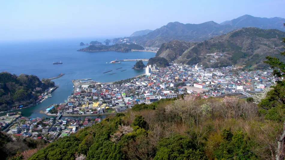
Matsuzaki (松崎町, Matsuzaki-chō) is a town located in on the southwest coast of Izu Peninsula in Kamo District, Shizuoka Prefecture, Japan. As of 31 July 2019, the town had an estimated population of 6,563 in 2969 households, and a population density of 77 persons per km². The total area of the town is 85.23 square kilometres (32.91 sq mi). Sakuramochi is a noted local specialty. Matsuzaki is listed as one of The Most Beautiful Villages in Japan.
Source: Wikipedia · CC BY-SA 4.0
Photos of Matsuzaki
-

Taisuke.Kasuya · CC BY-SA 4.0 -

Taisuke.Kasuya · CC BY-SA 4.0 -

inunami · CC BY 2.0 -

ion66 · CC BY 3.0 -

Aimaimyi · CC BY-SA 3.0


Places bordering Matsuzaki
- Shimoda
- Minamiizu Chō
- Nishiizu Chō
- Kōchi
Twin towns and sister cities of Matsuzaki
- Obihiro· Japan
Source: Wikidata. Only places with a page on this site are shown.
Population of Matsuzaki over time
| 2010 | 7,653 | |
|---|---|---|
| 2015 | 6,837 | |
| 2021 | 5,932 |
Censuses and official estimates; source: Wikidata.
Climate of Matsuzaki
Best months for sightseeingBest months for sightseeing: May–June, September–November.
This month · November
A good month to visit
Day 18° · Night 11° · Rain 122 mm
- Hottest month
- August (day 29°)
- Coldest month
- February (night 3°)
- Wettest month
- June (264 mm)
- Driest month
- December (71 mm)
Bars: average monthly low and high temperature. Below: precipitation. Monthly averages for 1970–2000 at about 18 km resolution, adjusted for elevation. Highlighted months are mild and relatively dry. Source: WorldClim 2.1 (CC BY 4.0).
Show values as a table
| Month | Jan | Feb | Mar | Apr | May | Jun | Jul | Aug | Sep | Oct | Nov | Dec |
|---|---|---|---|---|---|---|---|---|---|---|---|---|
| Average high (°C) | 11° | 11° | 14° | 18° | 22° | 24° | 28° | 29° | 27° | 22° | 18° | 14° |
| Average low (°C) | 4° | 3° | 6° | 11° | 15° | 19° | 22° | 24° | 21° | 16° | 11° | 6° |
| Precipitation (mm) | 72 | 91 | 155 | 185 | 189 | 264 | 217 | 241 | 247 | 185 | 122 | 71 |
Other places to visit in this season: May June September October November
How to get to Matsuzaki
The nearest airport is Oshima Airport (OIM), 54 km to the east as the crow flies. For international flights: Mount Fuji Shizuoka Airport (FSZ) (54 km). The nearest large city is Numazu, 39 km to the north.
Airports
- Oshima Airport (OIM) Izu Oshima 54 kmeast
- Mount Fuji Shizuoka Airport (FSZ) Makinohara / Shimada 54 kmwest
- Miyakejima Airport (MYE) Miyakejima 104 kmsoutheast
Nearby large cities
- Numazu Population: 189.5K 39 kmnorth
- Mishima Population: 107.9K 42 kmnorth
- Yaizu Population: 139.6K 44 kmwest
- Shizuoka Population: 693.4K 44 kmnorthwest
- Fuji Population: 245.4K 47 kmnorth
Straight-line distances; road distances are longer. Airport data: OurAirports.
Day trips from Matsuzaki
Within 100 km: 12 historic and cultural sites, 27 natural sites, 32 lakes, rivers and coasts.
0–25 km3 places
- Suruga Bay Natural site 23 kmNW
- Izu Hantō Natural site 18 kmNE
- Banzaburō Dake Mountain 24 kmNE
25–60 km16 places
- Ō Shima Island 57 kmE
- To Shima Island 53 kmSE
- Hatsu-shima Island 48 kmNE
- Mount Echizen-dake Mountain 54 kmN
60–100 km52 places
- Izu Islands Island 94 kmSE
- Nii-jima Island 61 kmSE
- Kōzu Shima Island 69 kmSE
- Shikine-jima Island 62 kmSE
Straight-line distances.
Nearby attractions & nature
Everything nearby-
 Izu Hantō Natural site, Shizuoka18 km NE
-
 Banzaburō Dake Mountain, Izu-shi24 km NE
-
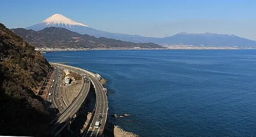 Suruga Bay Natural site, Tokyo23 km NW
Sources & licences
Data last updated: · 2 independent sources