Shizuoka-shi
Local name: 静岡市
Located in Shizuoka, Japan Coordinates: 35°12′06″ N 138°18′51″ E
- Population
- 723,317
- 723.3K
- Elevation
- 565 m
- above sea level
- Local time
- UTC+09:00
- Asia/Tokyo · UTC+09:00
- Places inside
- 4
- listed under Shizuoka-shi
- Airports
- FSZ Mount Fuji Shizuoka Airport46 km
- OIM Oshima Airport106 km
About Shizuoka-shi
Shizuoka-shi is a district. Location: Shizuoka, Japan. Population: 723,317.
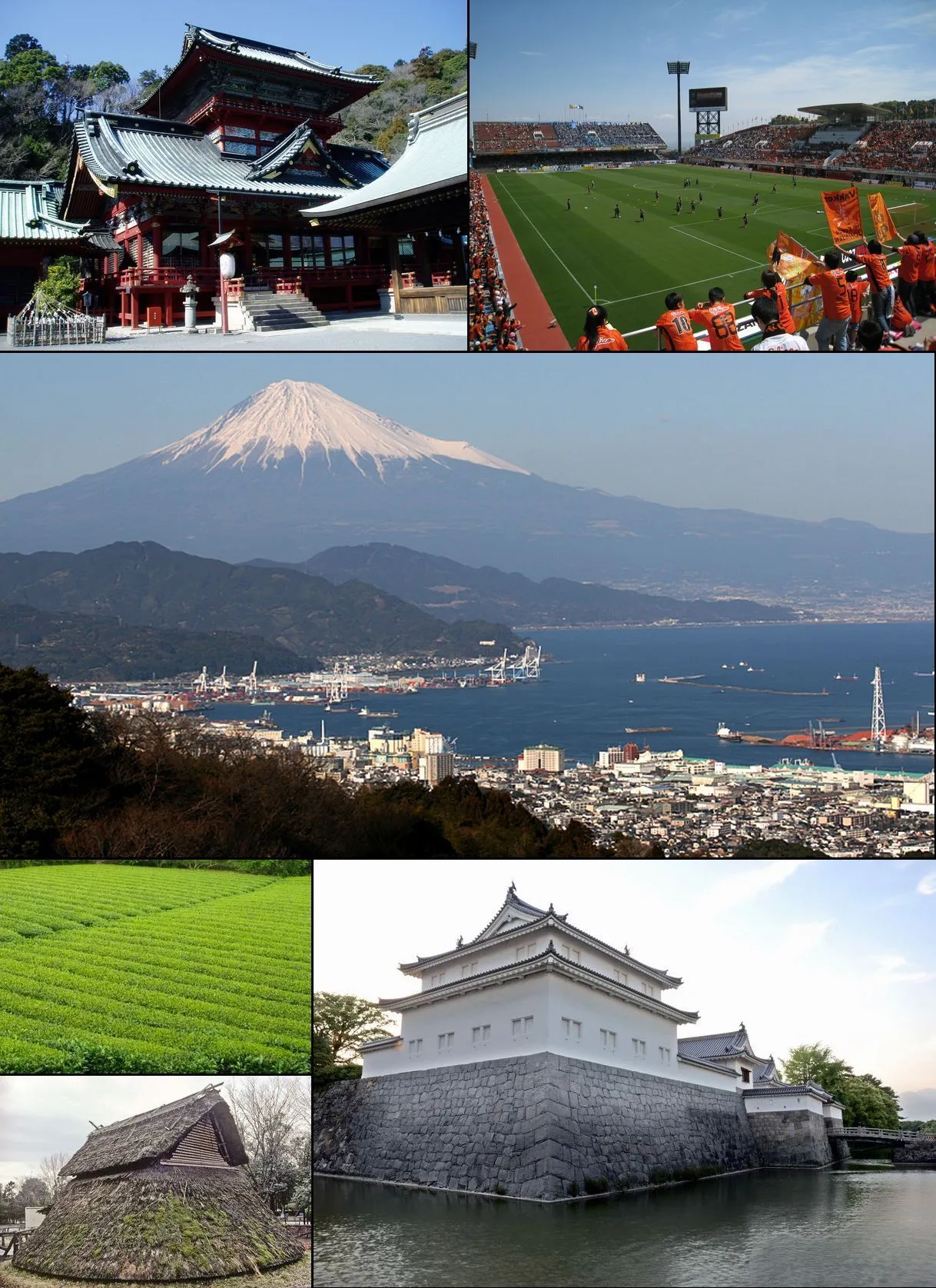
Shizuoka (静岡市, Shizuoka-shi; Japanese pronunciation: [ɕì.(d͡)zɨ́.ò̞.kä̀, -ó̞.kä́.ɕì]) is the capital city of Shizuoka Prefecture, Japan, and the prefecture's second-largest city in both population and area. It has been populated since prehistoric times. As of 1 September 2023, the city had an estimated population of 677,867 in 106,087 households, and a population density of 480 inhabitants per square kilometre (1,200/sq mi).
Source: Wikipedia · CC BY-SA 4.0
Photos of Shizuoka-shi
-

Mount Shiomi Alpsdake · Public domain -

Mount Akaishi alpsdake · Public domain -
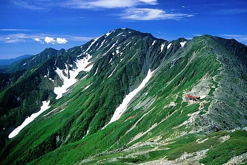
Mount Aino Alpsdake · Public domain -
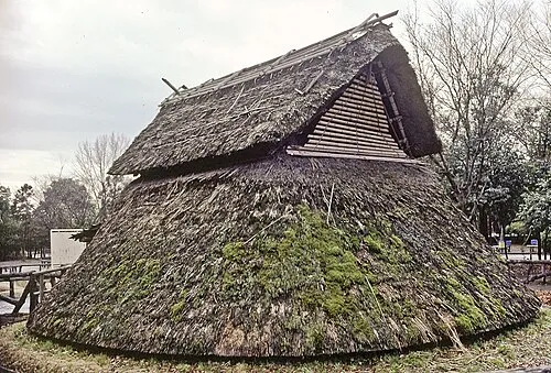
Toro Iseki Wikimedia Commons · Public domain


Places bordering Shizuoka-shi
- Fuji
- Fujieda
- Yaizu
- Shimada
- Fujinomiya
- Kawanehon Chō
- Minami Alps Shi
- Hayakawa Town
- Minobu Town
- Nambu
- Iida
- Ina
- Ōshika Mura
Twin towns and sister cities of Shizuoka-shi
- Stockton· United States
- Muroran· Japan
- Jōetsu· Japan
- Izu· Japan
- Saku· Japan
- Kofu· Japan
- Kanazawa· Japan
- Nagano· Japan
Source: Wikidata. Only places with a page on this site are shown.
Population of Shizuoka-shi over time
| 2010 | 716,197 | |
|---|---|---|
| 2015 | 704,989 | |
| 2021 | 685,589 |
Censuses and official estimates; source: Wikidata.
Climate of Shizuoka-shi
Best months for sightseeingBest months for sightseeing: May–June, September–October.
This month · November
Outside the best season
Day 16° · Night 6° · Rain 89 mm
Better nearby cities in November
- Fujinomiya · 28 km east18°
- Fuji · 34 km east20°
- Numazu · 51 km east18°
- Hottest month
- August (day 29°)
- Coldest month
- January (night -2°)
- Wettest month
- September (266 mm)
- Driest month
- December (46 mm)
Bars: average monthly low and high temperature. Below: precipitation. Monthly averages for 1970–2000 at about 18 km resolution, adjusted for elevation. Highlighted months are mild and relatively dry. Source: WorldClim 2.1 (CC BY 4.0).
Show values as a table
| Month | Jan | Feb | Mar | Apr | May | Jun | Jul | Aug | Sep | Oct | Nov | Dec |
|---|---|---|---|---|---|---|---|---|---|---|---|---|
| Average high (°C) | 8° | 9° | 12° | 18° | 22° | 24° | 28° | 29° | 25° | 20° | 16° | 11° |
| Average low (°C) | -2° | -2° | 1° | 7° | 12° | 16° | 20° | 21° | 18° | 11° | 6° | 1° |
| Precipitation (mm) | 49 | 70 | 124 | 162 | 172 | 252 | 224 | 260 | 266 | 169 | 89 | 46 |
Other places to visit in this season: May June September October
How to get to Shizuoka-shi
The nearest airport is Mount Fuji Shizuoka Airport (FSZ), 46 km to the south as the crow flies. The nearest large city is Shizuoka, 25 km to the south.
Airports
- Mount Fuji Shizuoka Airport (FSZ) Makinohara / Shimada 46 kmsouth
- Oshima Airport (OIM) Izu Oshima 106 kmsoutheast
- Shinshu-Matsumoto Airport (MMJ) Matsumoto 113 kmnorth
Nearby large cities
- Shizuoka Population: 693.4K 25 kmsouth
- Fujinomiya Population: 132.5K 28 kmeast
- Fuji Population: 245.4K 34 kmeast
- Yaizu Population: 139.6K 37 kmsouth
- Fujieda Population: 145K 37 kmsouth
Straight-line distances; road distances are longer. Airport data: OurAirports.
Day trips from Shizuoka-shi
Within 100 km: 2 historic and cultural sites, 45 natural sites, 21 lakes, rivers and coasts.
0–25 km1 place
- Shiba River River 22 kmE
25–60 km26 places
- Lake Shoji Lake 42 kmNE
- Mount Senjō Mountain 59 kmN
- Mount Aino Mountain 50 kmN
- Mount Echizen-dake Mountain 44 kmE
60–100 km41 places
- Honshu Island 93 kmN
- Hatsu-shima Island 80 kmE
- Mount Nokogiri Mountain 65 kmN
- Chausu-yama Mountain 82 kmNW
Straight-line distances.
Places in Shizuoka-shi
4 placesBar: population relative to the most populous place in this list.
Nature and heritage in Shizuoka-shi
Sources & licences
Data last updated: · 2 independent sources