Kichijōji-honchō
Local name: 吉祥寺
Located in Musashino-shi, Tokyo Coordinates: 35°42′20″ N 139°34′37″ E
- Population
- 11,551
- 11.6K
- Elevation
- 60 m
- above sea level
- Local time
- UTC+09:00
- Asia/Tokyo · UTC+09:00
- Airports
- HND Tokyo Haneda International Airport26 km
- NRT Narita International Airport74 km
About Kichijōji-honchō
Kichijōji-honchō is a town. Location: Musashino-shi, Tokyo. Population: 11,551. Elevation: 60 m.
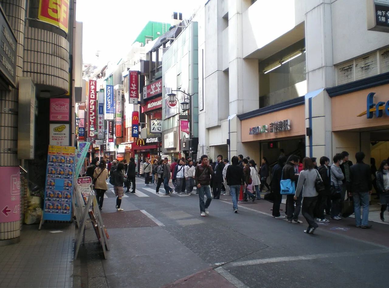
Kichijōji (吉祥寺) is a neighborhood in the city of Musashino in Western Tokyo, Japan. It is centered on a compact commercial area to the north and south of Kichijōji Station, with a full range of shops, restaurants, bars, and coffee houses. The area is a popular center for shopping and leisure in the Tokyo metropolitan area due in part to its close proximity to Inokashira Park and Inokashira Park Zoo.
Source: Wikipedia · CC BY-SA 4.0
Photos of Kichijōji-honchō
-
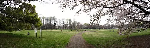
Koganei park Itasan · CC BY 3.0 -
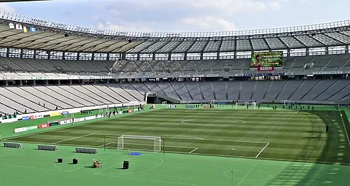
Ajinomoto Stadium vil · CC BY-SA 3.0


Travel notes for Kichijōji-honchō
From Wikivoyage
Kichijoji (吉祥寺 Kichijōji) is a western suburb of Musashino, Tokyo. The general area also extends into Mitaka. The highlight is Inokashira Park, with long walking paths surrounding a lake. The park is filled with both cherry trees and maple trees, making Inokashira Park an excellent choice for both flower viewing in the spring, and seeing the autumn colors in the fall. Kichijoji once enjoyed a reputation as an artists' colony, and today it is filled with stores from little boutiques to the big department stores. Kichijoji seems to attract everyone, from upscale shoppers, hip-hop dancers practicing in the train station to musicians playing live music in the park and at the many live houses in the vicinity.
Get in+
By train:
Kichijoji is on the JR Chūō Line (中央線) and Sōbu Line (総武線) from Shinjuku Station, and the Inokashira Line (井の頭線) from Shibuya Station. Chūō trains depart from Tokyo Station on platforms 1 and 2 (30 minutes; ¥410), and from Shinjuku on platform 10 (15 minutes; ¥230). Avoid the Chuo Special Rapid (中央特快) and Ome Special Rapid (青梅特快), which do not stop here.
Kichijoji is also the terminus of the Keio Inokashira Line (京王井の頭線) from Shibuya. This is the best way to reach Kichijoji from Shibuya (18 minutes; ¥230). The local train takes a long time, so it is often worth waiting for or switching to the express train.
By bus:
Bus service connects Kichijoji directly with Narita Airport and Haneda Airport. Pick up the bus on the east side of the train station, underneath the JR tracks. Reservations are highly recommended during peak times, with tickets available at the Odakyu Bus ticket window (小田急バス案内所) on the north side of the station, across from Sun Road. Buses for Narita depart once every hour or two, take 90-120 minutes depending on traffic, and the one-way fare is ¥3000. Buses for Haneda run in the morning and evening, cost 50-90 minutes, and the one-way fare is ¥1200.
By bicycle:
When arriving in Kichijoji by bicycle, parking is a concern. The police are vigilant about bikes parked illegally, particularly near the station and in busy areas. Illegally parked bikes might be tagged with a warning or impounded. There are numerous bike parking areas. The easiest to find is a 24h multi-floor bicycle parking area about 30m north of Yodobashi Camera. This parking area, and many of the others, has the first two hours free and ¥100 for 12 hour segments thereafter.
Source: Wikivoyage · CC BY-SA 4.0 · abridged
Climate of Kichijōji-honchō
Best months for sightseeingBest months for sightseeing: May–June, October.
This month · November
Outside the best season
Day 16° · Night 7° · Rain 80 mm
Better nearby cities in November
- Isehara · 42 km southwest18°
- Odawara · 63 km southwest19°
- Mishima · 89 km southwest18°
- Hottest month
- August (day 30°)
- Coldest month
- January (night -1°)
- Wettest month
- September (205 mm)
- Driest month
- January (41 mm)
Bars: average monthly low and high temperature. Below: precipitation. Monthly averages for 1970–2000 at about 18 km resolution, adjusted for elevation. Highlighted months are mild and relatively dry. Source: WorldClim 2.1 (CC BY 4.0).
Show values as a table
| Month | Jan | Feb | Mar | Apr | May | Jun | Jul | Aug | Sep | Oct | Nov | Dec |
|---|---|---|---|---|---|---|---|---|---|---|---|---|
| Average high (°C) | 9° | 10° | 13° | 19° | 23° | 25° | 29° | 30° | 26° | 21° | 16° | 12° |
| Average low (°C) | -1° | 0° | 3° | 9° | 14° | 18° | 21° | 23° | 19° | 13° | 7° | 2° |
| Precipitation (mm) | 41 | 56 | 94 | 114 | 136 | 185 | 162 | 176 | 205 | 171 | 80 | 41 |
How to get to Kichijōji-honchō
The nearest airport is Tokyo Haneda International Airport (HND), 26 km to the southeast as the crow flies. The nearest large city is Musashino, 2 km to the west.
Airports
- Tokyo Haneda International Airport (HND) Tokyo 26 kmsoutheast
- Narita International Airport (NRT) Narita 74 kmeast
- Ibaraki Airport (IBR) Omitama 92 kmnortheast
Nearby large cities
- Musashino Population: 150.1K 2 kmwest
- Nishi-Tokyo-shi Population: 207.4K 4 kmnorthwest
- Chōfu Population: 242.6K 6 kmsouthwest
- Koganei Population: 126.1K 6 kmwest
- Higashikurume Population: 117K 8 kmnorthwest
Straight-line distances; road distances are longer. Airport data: OurAirports.
Day trips from Kichijōji-honchō
Within 100 km: 50 historic and cultural sites, 44 natural sites, 45 lakes, rivers and coasts.
0–25 km47 places
- Saitama Super Arena Landmark 22 kmN
- Iruma River River 23 kmN
- Ueno Dōbutsuen Attraction 18 kmE
- National Museum of Modern Art Museum 16 kmE
25–60 km52 places
- Enoshima Island 46 kmS
- Mount Bukō Mountain 51 kmNW
- Mount Ōyama Natural site 45 kmS
- Obitsu River River 44 kmSE
60–100 km40 places
- Jōga Shima Island 64 kmS
- Hatsu-shima Island 83 kmSW
- Umeda Ko Lake 87 kmN
- Nagatsuro Saki Lighthouse Landmark 63 kmS
Straight-line distances.
Nearby attractions & nature
Everything nearby-
Koganei park Natural site, Koganei5.3 km W
-
Ajinomoto Stadium Landmark, Chōfu-shi6.4 km SW
-
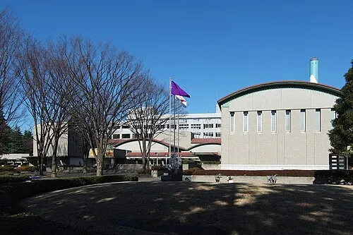 Setagaya Art Museum Museum, Setagaya-ku9.2 km SE
-
 Kinuta Park Natural site, Setagaya-ku9.3 km SE
-
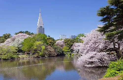 Shinjuku Gyōen Attraction, Shinjuku12 km E
-
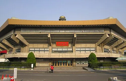 Nippon Budōkan Landmark, Chiyoda-ku16 km E
-
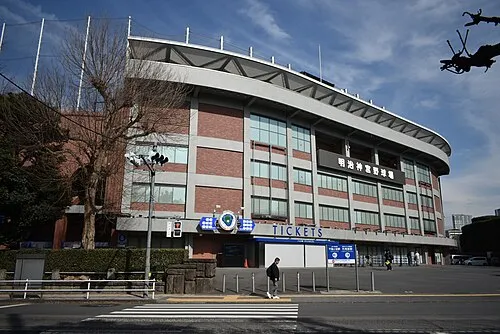 Meiji Jingu Stadium Landmark, Shinjuku13 km E
-
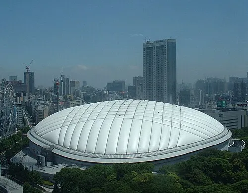 Tokyo Dome Landmark, Bunkyō-ku16 km E
Sources & licences
Data last updated: · 2 independent sources