- Local time
- UTC+09:00
- Asia/Tokyo · UTC+09:00
- Airports
- TOY Toyama Kitokito Airport19 km
- NTQ Noto Satoyama Airport56 km
About Oyabe River
Oyabe River is a river. Location: Toyama, Japan.
The Oyabe River (小矢部川, Oyabe-gawa) is a Class A river in Toyama Prefecture, Japan. The river rises from Mount Daimon on the border of Ishikawa Prefecture and enters the sea at Toyama Bay. The river runs through the city of Fukumitsu in Toyama, where two kilometres (1.2 mi) are lined with trees for cherry blossom-viewing.
Read more on Wikipedia Text: Wikipedia contributors · CC BY-SA 4.0 · shortened
At a glance
- Length
- 68 km
Source: Wikidata
Climate of Oyabe River
Best months for sightseeingBest months for sightseeing: May–June, September–October.
Bars: average monthly low and high temperature. Below: precipitation. Monthly averages for 1970–2000 at about 18 km resolution, adjusted for elevation. Highlighted months are mild and relatively dry. Source: WorldClim 2.1 (CC BY 4.0).
Show values as a table
| Month | Jan | Feb | Mar | Apr | May | Jun | Jul | Aug | Sep | Oct | Nov | Dec |
|---|---|---|---|---|---|---|---|---|---|---|---|---|
| Average high (°C) | 5° | 6° | 10° | 17° | 21° | 25° | 29° | 30° | 26° | 20° | 15° | 9° |
| Average low (°C) | -1° | -1° | 1° | 7° | 12° | 17° | 21° | 22° | 18° | 12° | 6° | 2° |
| Precipitation (mm) | 214 | 152 | 132 | 127 | 127 | 193 | 226 | 162 | 233 | 158 | 186 | 210 |
Other places to visit in this season: May June September October
Airports nearest to Oyabe River
- Toyama Kitokito Airport (TOY) Toyama 19 km
- Noto Satoyama Airport (NTQ) Wajima 56 km
- Komatsu Airport / JASDF Komatsu Air Base (KMQ) Kanazawa 74 km
Straight-line distance; airports with scheduled flights only. Source: OurAirports (public domain).
Nearest towns and villages
Nearby attractions & nature
Everything nearby-
Sho River River, Toyama1 km SE
-
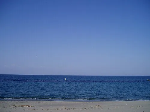 Toyama-wan Natural site, Japan9.9 km NE
-
Jinzu River River, Toyama14 km E
-
Joganji River River, Toyama21 km E
-
Mount Sekidō Mountain, Nakanoto Machi21 km NW
Sources & licences
Data last updated: · 2 independent sources