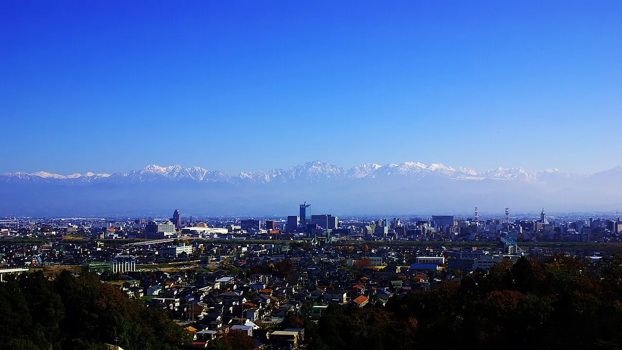
- Population
- 420,434
- 420.4K
- Elevation
- 590 m
- above sea level
- Local time
- UTC+09:00
- Asia/Tokyo · UTC+09:00
- Places inside
- 4
- listed under Toyama Shi
- Airports
- TOY Toyama Kitokito Airport15 km
- MMJ Shinshu-Matsumoto Airport70 km
About Toyama Shi
Toyama Shi is a district. Location: Toyama, Japan. Population: 420,434.
Toyama (富山市, Toyama-shi; Japanese pronunciation: [tó̞.jä̀.mä̀, tò̞.jä́.mä́.ɕì]) is the capital city of Toyama Prefecture, Japan, located on the coast of the Sea of Japan in the Chūbu region on central Honshū, about 200 km (120 mi) north of the city of Nagoya and 300 km (190 mi) northwest of Tokyo. As of 1 June 2019, the city had an estimated population of 415,844 in 176,643 households, and a population density of 335 persons per km2. Its total area was 1,241.77 square kilometres (479.45 sq mi).
Source: Wikipedia · CC BY-SA 4.0
Places bordering Toyama Shi
- Imizu
- Namerikawa-shi
- Tonami
- Nanto-shi
- Kamiichi
- Tateyama Machi
- Funahashi Mura
- Furukawa
- Takayama
- Ōmachi-shi
Twin towns and sister cities of Toyama Shi
- Durham· United States
Source: Wikidata. Only places with a page on this site are shown.
Population of Toyama Shi over time
| 1972 | 276,200 | |
|---|---|---|
| 1989 | 314,000 | |
| 2001 | 350,000 | |
| 2010 | 421,953 | |
| 2015 | 418,686 | |
| 2021 | 413,028 |
Censuses and official estimates; source: Wikidata.
Climate of Toyama Shi
Best months for sightseeingBest months for sightseeing: May–July, September.
This month · November
A wet month
Day 11° · Night 2° · Rain 143 mm
Better nearby cities in November
- Kofu · 151 km southeast17°
- Fujinomiya · 190 km southeast18°
- Fuji · 198 km southeast20°
- Hottest month
- August (day 27°)
- Coldest month
- February (night -6°)
- Wettest month
- September (232 mm)
- Driest month
- February (120 mm)
Bars: average monthly low and high temperature. Below: precipitation. Monthly averages for 1970–2000 at about 18 km resolution, adjusted for elevation. Highlighted months are mild and relatively dry. Source: WorldClim 2.1 (CC BY 4.0).
Show values as a table
| Month | Jan | Feb | Mar | Apr | May | Jun | Jul | Aug | Sep | Oct | Nov | Dec |
|---|---|---|---|---|---|---|---|---|---|---|---|---|
| Average high (°C) | 1° | 2° | 6° | 14° | 19° | 22° | 25° | 27° | 22° | 17° | 11° | 5° |
| Average low (°C) | -5° | -6° | -3° | 3° | 8° | 13° | 18° | 19° | 14° | 8° | 2° | -3° |
| Precipitation (mm) | 155 | 120 | 126 | 130 | 132 | 202 | 226 | 163 | 232 | 147 | 143 | 147 |
Other places to visit in this season: May June July September
How to get to Toyama Shi
The nearest airport is Toyama Kitokito Airport (TOY), 15 km to the northwest as the crow flies. For international flights: Komatsu Airport / JASDF Komatsu Air Base (KMQ) (82 km). The nearest large city is Toyama, 18 km to the northwest.
Airports
- Toyama Kitokito Airport (TOY) Toyama 15 kmnorthwest
- Shinshu-Matsumoto Airport (MMJ) Matsumoto 70 kmsoutheast
- Komatsu Airport / JASDF Komatsu Air Base (KMQ) Kanazawa 82 kmwest
Nearby large cities
- Toyama Population: 415.8K 18 kmnorthwest
- Takaoka Population: 170.1K 33 kmnorthwest
- Kanazawa Population: 466K 61 kmwest
- Matsutō Population: 110.4K 66 kmwest
- Matsumoto Population: 241.1K 70 kmsoutheast
Straight-line distances; road distances are longer. Airport data: OurAirports.
Places in Toyama Shi
4 places
Toyama
Population: 415.8K
Yatsuomachi-higashikumisaka
Population: 22.2K

Nearby attractions & nature
Everything nearby-
Takahara River River, Japan11 km SW
-
Jinzu River River, Toyama24 km N
-
Joganji River River, Toyama23 km N
Sources & licences
Data last updated: · 2 independent sources