Kushimoto Chō
Located in Higashimuro-gun, Wakayama Coordinates: 33°30′56″ N 135°45′48″ E
- Population
- 18,063
- 18.1K
- Elevation
- 160 m
- above sea level
- Local time
- UTC+09:00
- Asia/Tokyo · UTC+09:00
- Places inside
- 2
- listed under Kushimoto Chō
- Airports
- SHM Nanki Shirahama Airport40 km
- KIX Kansai International Airport112 km
About Kushimoto Chō
Kushimoto Chō is a municipality. Location: Higashimuro-gun, Wakayama. Population: 18,063. Elevation: 160 m.
Kushimoto (串本町, Kushimoto-chō; Japanese pronunciation: [kɯ̥.ɕiꜜ.mo.to, -ɕi.mo.toꜜ.tɕoː]) is a coastal town located in Higashimuro District, Wakayama Prefecture, Japan. As of 30 November 2021, the town had an estimated population of 15,192 in 8354 households and a population density of 110 persons per km2. The total area of the town is 135.67 square kilometres (52.38 sq mi).
Source: Wikipedia · CC BY-SA 4.0
Photos of Kushimoto Chō
-
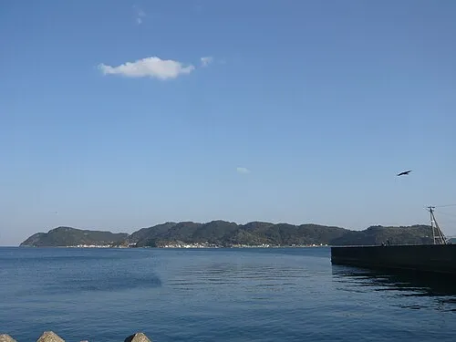
Kii Ōshima Opqr · CC BY-SA 3.0

Travel notes for Kushimoto Chō
From Wikivoyage
Kushimoto (串本町 Kushimoto-chō) is a small coastal town in Wakayama Prefecture in the Kansai region of Japan. It is a useful base for exploring and enjoying the activities of the prefecture's extreme south. In relation, the town sits on the southernmost point of Japan's main island of Honshu, which serves as tourist attraction itself.
Understand+
Tourist information site:
The local tourist association has a Japanese-only guide site with integrated Google Translate.
Get in+
By plane:
The nearest airport is Nanki-Shirahama Airport in the town of Shirahama (白浜) about 2 hours away. There are daily flights to/from Tokyo-Haneda Airport, but international routes are not served. Take a bus to Shirahama Station (白浜駅) take one of the limited express trains mentioned above to get into town.
The nearest international airport is Kansai International Airport. Take a train or limousine bus to Wakayama Station (和歌山駅) and transfer onto one of the limited express trains mentioned above to get into town.
By train:
The town is served by Kushimoto Station (串本駅 Kushimoto Eki).
From Kyoto, Osaka, and Wakayama, the quickest way to reach Kushimoto is via limited express train, either on the Kuroshio (くろしお), Super Kuroshio (スーパーくろしお), or Ocean Arrow (オーシャンアロー) services. Cheaper but slower train service is also available and will require one or more transfers. Both express and local services go via the JR Hanwa Line (阪和線), directly connecting to the JR Kinokuni Line (きのくに線), which is also sometimes labeled as the JR Kisei Line (紀勢線). Total fare from Wakayama City via limited express is ¥4170 (about 2hr 10min) and via local is ¥2520 (about 3 hr 40 min).
Insider's Tip: on Kushimoto bound trains, ask for a seat on the right side (右側 migi-gawa) of the train to ensure unobstructed views of the coast. Moreover, a viewing car open to all passengers is available on all Ocean Arrow trains.
From Nagoya, the best way to reach Kushimoto via train is through the limited express Nanki (南紀) leading to Kii-Katsuura Station (紀伊勝浦駅), then transferring to a local train bound for Kushimoto or Kii-Tanabe Station (紀伊田辺駅). This costs ¥9470 and takes about 4hr 30min. Local train travel from Nagoya is not recommended.
Train services run roughly once per hour from the big cities. All lines are run by JR, and Japan Rail Pass holders are covered when riding them.
By car:
Source: Wikivoyage · CC BY-SA 4.0 · abridged
Places bordering Kushimoto Chō
- Nachi-katsuura Chō
- Kozagawa Chō
- Susami Chō
Twin towns and sister cities of Kushimoto Chō
- Hemet· United States
Source: Wikidata. Only places with a page on this site are shown.
Population of Kushimoto Chō over time
| 2010 | 18,249 | |
|---|---|---|
| 2015 | 16,558 | |
| 2021 | 14,661 |
Censuses and official estimates; source: Wikidata.
Climate of Kushimoto Chō
Best months for sightseeingBest months for sightseeing: May–June, September–October.
This month · November
A wet month
Day 17° · Night 10° · Rain 150 mm
Better nearby cities in November
- Kochi · 207 km west18°
- Fujinomiya · 323 km northeast18°
- Fuji · 325 km northeast20°
- Hottest month
- August (day 29°)
- Coldest month
- January (night 2°)
- Wettest month
- June (342 mm)
- Driest month
- December (68 mm)
Bars: average monthly low and high temperature. Below: precipitation. Monthly averages for 1970–2000 at about 18 km resolution, adjusted for elevation. Highlighted months are mild and relatively dry. Source: WorldClim 2.1 (CC BY 4.0).
Show values as a table
| Month | Jan | Feb | Mar | Apr | May | Jun | Jul | Aug | Sep | Oct | Nov | Dec |
|---|---|---|---|---|---|---|---|---|---|---|---|---|
| Average high (°C) | 10° | 10° | 14° | 19° | 22° | 25° | 28° | 29° | 27° | 22° | 17° | 12° |
| Average low (°C) | 2° | 2° | 5° | 11° | 15° | 19° | 23° | 23° | 20° | 15° | 10° | 5° |
| Precipitation (mm) | 79 | 95 | 151 | 217 | 235 | 342 | 256 | 239 | 311 | 203 | 150 | 68 |
Other places to visit in this season: May June September October
How to get to Kushimoto Chō
The nearest airport is Nanki Shirahama Airport (SHM), 40 km to the northwest as the crow flies. For international flights: Kansai International Airport (KIX) (112 km). The nearest large city is Minato, 96 km to the northwest.
Airports
- Nanki Shirahama Airport (SHM) Shirahama 40 kmnorthwest
- Kansai International Airport (KIX) Osaka 112 kmnorthwest
- Tokushima Awaodori Airport / JMSDF Tokushima Air Base (TKS) Tokushima 127 kmnorthwest
Nearby large cities
- Minato Population: 375.3K 96 kmnorthwest
- Wakayama Population: 356.7K 97 kmnorthwest
- Kashiwara Population: 120.9K 104 kmnorth
- Kawachi-Nagano Population: 101.7K 104 kmnorth
- Izumisano Population: 100.1K 108 kmnorth
Straight-line distances; road distances are longer. Airport data: OurAirports.
Day trips from Kushimoto Chō
Within 100 km: 10 natural sites, 4 lakes, rivers and coasts.
0–25 km1 place
- Kii Ōshima Island 8 kmSE
25–60 km2 places
- Kumano River River 33 kmNE
- Kii Hantō Natural site 54 kmN
60–100 km11 places
- Mount Ōdaigahara Mountain 80 kmN
- Mount Kunimi Mountain 92 kmNE
- Mount Azami Mountain 98 kmN
- Mount Shisuniwa Mountain 90 kmN
Straight-line distances.
Places in Kushimoto Chō
2 placesKushimoto
Population: 16.2K
-
Kii Ōshima
Population: 2K
Sources & licences
Data last updated: · 2 independent sources