Ksar Sghir
Local name: القصر الصغير
Located in Fahs-Anjra, Tanger-Tetouan-Al Hoceima Coordinates: 35°48′13″ N 5°38′22″ W

- Population
- 12,997
- 13K
- Elevation
- 13 m
- above sea level
- Local time
- UTC+00:00
- Africa/Casablanca · UTC+00:00
- Airports
- TNG Tangier Ibn Battuta Airport27 km
- TTU Sania Ramel Airport37 km
About Ksar Sghir
Ksar Sghir is a municipality. Location: Fahs-Anjra, Tanger-Tetouan-Al Hoceima. Population: 12,997. Elevation: 13 m.
Ksar es-Seghir (Arabic: القصر الصغير, romanized: al-Qṣar aṣ-Ṣeghīr), also known by numerous other spellings and names, is a small town on the Mediterranean coast in the Jebala region of northwest Morocco, between Tangier and Ceuta, on the right bank of the river of the same name. Administratively, it belongs to Fahs-Anjra Province and the region of Tanger-Tetouan-Al Hoceima. By the census of 2004, it had a population of 10,995 inhabitants. The city is circular, a design unusual in medieval Moroccan town planning.
Source: Wikipedia · CC BY-SA 4.0
Population of Ksar Sghir over time
| 1994 | 8,818 | |
|---|---|---|
| 2004 | 10,995 | |
| 2014 | 12,997 | |
| 2024 | 17,125 |
Censuses and official estimates; source: Wikidata.
Climate of Ksar Sghir
Best months for sightseeingBest months for sightseeing: April–June, October.
This month · November
A wet month
Day 21° · Night 13° · Rain 112 mm
Better nearby cities in November
- Ksar El Kebir · 92 km south21°
- Al Hoceima · 166 km east20°
- Salé Al Jadida · 225 km southwest21°
- Hottest month
- August (day 31°)
- Coldest month
- January (night 9°)
- Wettest month
- January (158 mm)
- Driest month
- July (1 mm)
Bars: average monthly low and high temperature. Below: precipitation. Monthly averages for 1970–2000 at about 18 km resolution, adjusted for elevation. Highlighted months are mild and relatively dry. Source: WorldClim 2.1 (CC BY 4.0).
Show values as a table
| Month | Jan | Feb | Mar | Apr | May | Jun | Jul | Aug | Sep | Oct | Nov | Dec |
|---|---|---|---|---|---|---|---|---|---|---|---|---|
| Average high (°C) | 16° | 17° | 19° | 21° | 23° | 28° | 31° | 31° | 28° | 24° | 21° | 18° |
| Average low (°C) | 9° | 9° | 11° | 13° | 15° | 18° | 20° | 21° | 19° | 16° | 13° | 10° |
| Precipitation (mm) | 158 | 136 | 126 | 56 | 35 | 5 | 1 | 2 | 16 | 59 | 112 | 143 |
Other places to visit in this season: April May June October
How to get to Ksar Sghir
The nearest airport is Tangier Ibn Battuta Airport (TNG), 27 km to the west as the crow flies. The nearest large city is Tétouan, 35 km to the southeast.
Airports
- Tangier Ibn Battuta Airport (TNG) Tangier 27 kmwest
- Sania Ramel Airport (TTU) Tétouan 37 kmsoutheast
- Gibraltar Airport (GIB) Gibraltar 47 kmnortheast
Nearby large cities
- Tétouan Population: 415.8K 35 kmsoutheast
- Algeciras Population: 121.4K 40 kmnortheast
- Ksar El Kebir Population: 138.3K 92 kmsouth
- Cadiz Population: 117K 99 kmnorthwest
- Marbella Population: 156.3K 104 kmnortheast
Straight-line distances; road distances are longer. Airport data: OurAirports.
Day trips from Ksar Sghir
Within 100 km: 170 historic and cultural sites, 118 natural sites, 208 lakes, rivers and coasts.
0–25 km18 places
- Isla Perejil Island 23 kmNE
- Iglesia San Francisco De Asis Attraction 23 kmN
- Tarifa Light Landmark 22 kmN
- Puerta de Jerez Landmark 24 kmN
25–60 km207 places
- Playa de Zahora Beach 57 kmNW
- Laguna de la Janda Lake 53 kmN
- Cerro del Moral Mountain 52 kmNE
- Cerro del Mirador Mountain 55 kmN
60–100 km271 places
- Arroyo del Valle River 98 kmN
- Plaza de Toros Attraction 98 kmN
- Roman Baths of Ocuri Historic site 100 kmN
- Playa Puerto Banús Beach 98 kmNE
Straight-line distances.
Nearby attractions & nature
Everything nearby-
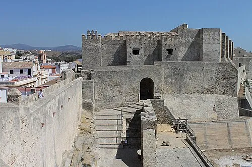 Castle of Tarifa Historic site, Tarifa23 km N
-
Jebel Zem Zem Mountain, Fahs-Anjra13 km S
-
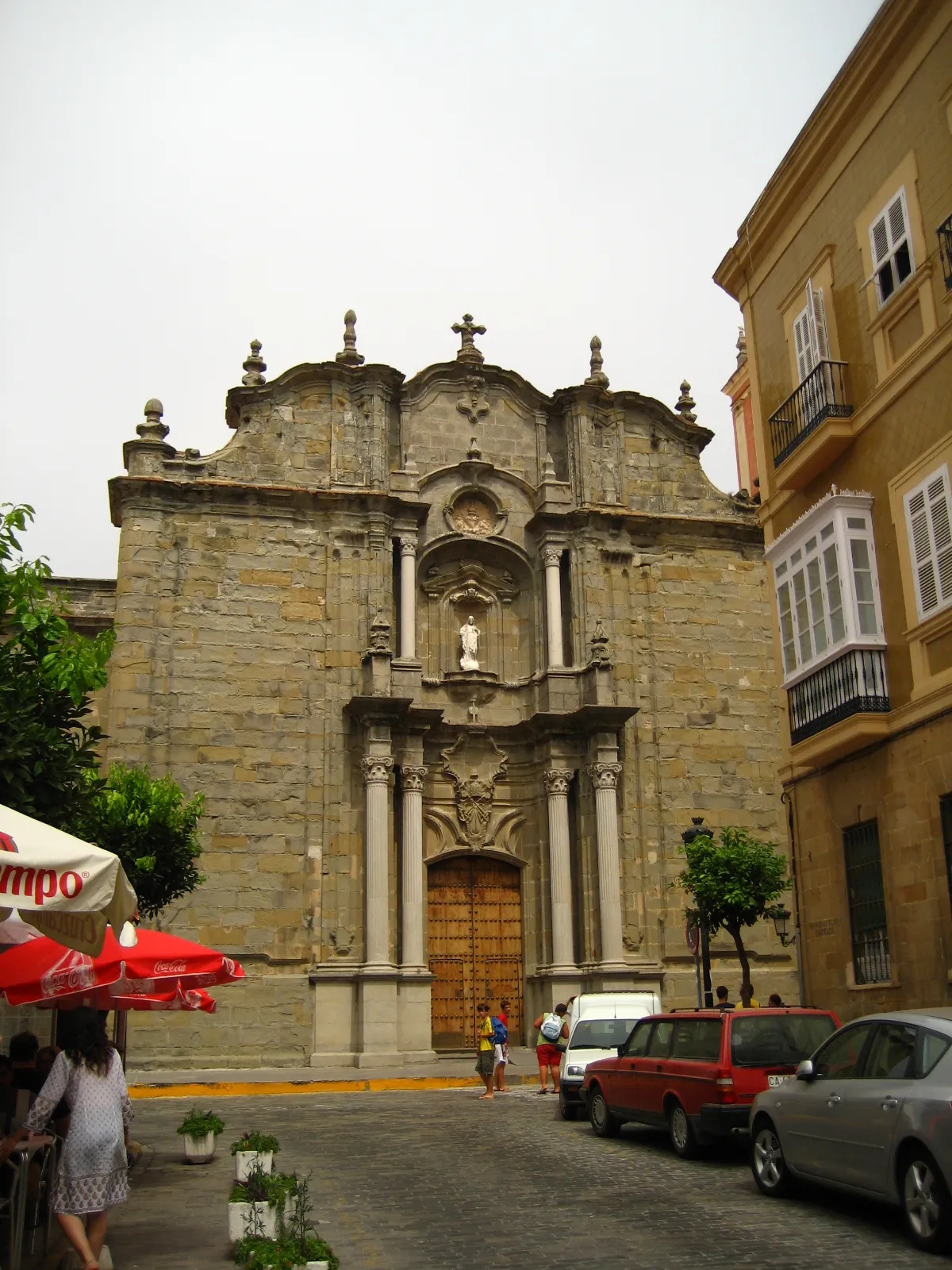 Iglesia de San Mateo Attraction, Tarifa24 km N
-
 Baie De Tanger Natural site, Tanger-Tetouan-Al Hoceima13 km W
-
 Jbel Moussa Mountain, Tanger-Tetouan-Al Hoceima23 km NE
-
Grand Mosque of Tangier Attraction, Tanger-Assilah15 km W
-
Kasbah Mosque Attraction, Tanger-Assilah16 km W
-
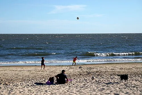 Playa Santa Catalina Beach, Cadiz23 km N
Sources & licences
Data last updated: · 2 independent sources