
- Elevation
- 1,523 m
- above sea level
- Local time
- UTC+01:00
- Europe/Skopje · UTC+01:00
- Airports
- KZI Kozani National Airport Filippos85 km
- OHD Ohrid St. Paul the Apostle Airport97 km
About Dóbro Pólie
Dóbro Pólie is a mountain. Location: North Macedonia. Elevation: 1,523 m.
Dobro Pole or Dóbro Pólie (Macedonian: Добро Поле; Bulgarian: Добро Поле; Serbian: Добро Поље; Greek: Ντόμπρο Πόλε, romanized: Ntómpro Póle) is a peak situated on the Greece–North Macedonia border. The nearest villages are Zoviḱ in the Novaci Municipality in the Mariovo region of North Macedonia, and Prómachoi in the Voras Mountains in the Pella regional unit, northern Greece. The World War I Battle of Dobro Pole was fought here from 15 to 18 September 1918.
Source: Wikipedia · CC BY-SA 4.0
Photos of Dóbro Pólie
-

Македонец · CC BY-SA 4.0 -

Македонец · CC BY-SA 4.0 -

Македонец · CC BY-SA 4.0


Climate of Dóbro Pólie
Best months for sightseeingBest months for sightseeing: June–August.
This month · November
A cold month
Day 6° · Night -2° · Rain 61 mm
- Hottest month
- July (day 22°)
- Coldest month
- January (night -6°)
- Wettest month
- May (63 mm)
- Driest month
- September (40 mm)
Bars: average monthly low and high temperature. Below: precipitation. Monthly averages for 1970–2000 at about 18 km resolution, adjusted for elevation. Highlighted months are mild and relatively dry. Source: WorldClim 2.1 (CC BY 4.0).
Show values as a table
| Month | Jan | Feb | Mar | Apr | May | Jun | Jul | Aug | Sep | Oct | Nov | Dec |
|---|---|---|---|---|---|---|---|---|---|---|---|---|
| Average high (°C) | 0° | 2° | 5° | 10° | 15° | 19° | 22° | 22° | 18° | 12° | 6° | 2° |
| Average low (°C) | -6° | -6° | -3° | 1° | 4° | 8° | 9° | 9° | 7° | 2° | -2° | -5° |
| Precipitation (mm) | 42 | 44 | 51 | 59 | 63 | 51 | 43 | 41 | 40 | 60 | 61 | 50 |
How to get to Dóbro Pólie
The nearest airport is Kozani National Airport Filippos (KZI), 85 km to the south as the crow flies. For international flights: Ohrid St. Paul the Apostle Airport (OHD) (97 km). The nearest large city is Skopje, 112 km to the north.
Airports
- Kozani National Airport Filippos (KZI) Kozani 85 kmsouth
- Ohrid St. Paul the Apostle Airport (OHD) Ohrid 97 kmwest
- Skopje International Airport (SKP) Ilinden 103 kmnorth
Nearby large cities
- Skopje Population: 474.9K 112 kmnorth
- Prizren Population: 171.5K 161 kmnorthwest
- Tirana Population: 418.5K 176 kmwest
- Pristina Population: 550K 190 kmnorth
- Durrës Population: 195.9K 206 kmwest
Straight-line distances; road distances are longer. Airport data: OurAirports.
Day trips from Dóbro Pólie
Within 100 km: 14 historic and cultural sites, 29 natural sites, 14 lakes, rivers and coasts.
0–25 km4 places
- Voras Mountain 16 kmSW
- Kajmakčalan Mountain 16 kmSW
- Áno Koryfí Historic site 13 kmS
- Stena Mountain 16 kmNE
25–60 km17 places
- Marko Češma Natural site 43 kmNW
- Óros Vérno Mountain 60 kmSW
- Pelister Mountain 59 kmW
- Ušici Mountain 45 kmW
60–100 km36 places
- Moní Agíon Anargyron Attraction 67 kmSW
- Monastery of Agios Athanasios Sfinissis Attraction 76 kmSE
- Orman Natural site 64 kmN
- Crvivci River 94 kmNW
Straight-line distances.
Nearest towns and villages
-
 Lykostomo Village, Almopia11 km SE
-
Loutraki Village, Almopia10 km SE
-
Prómachoi Village, Almopia11 km E
-
 Gradešnica Village, Novaci11 km W
-
Áno Loutráki Village, Almopia7.7 km S
-
 Sosandra Village, Almopia14 km SE
Nearby attractions & nature
Everything nearby-
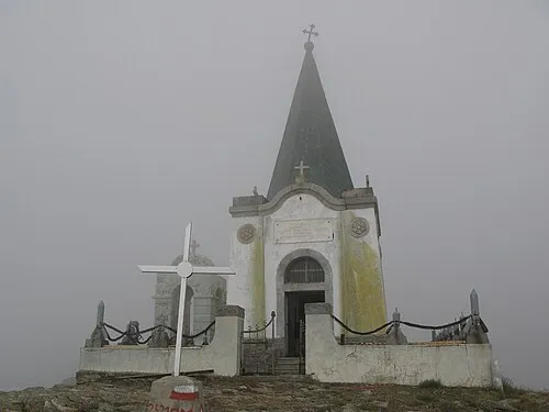 Kajmakčalan Mountain, Neos Ágios Athanásios16 km SW
-
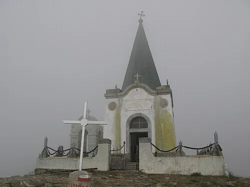 Voras Mountain, Florina16 km SW
-
Stena Mountain, Kavadarci16 km NE
-
Áno Koryfí Historic site, Almopia13 km S
Sources & licences
Data last updated: · 2 independent sources