- Population
- 830
- 830
- Elevation
- 119 m
- above sea level
- Local time
- UTC+01:00
- Europe/Warsaw · UTC+01:00
- Airports
- LCJ Łódź Władysław Reymont Airport64 km
- WMI Warsaw Modlin Airport114 km
About Gmina Chodów
Gmina Chodów is a village. Location: Chodów, Koło County. Population: 830. Elevation: 119 m. The best months to visit are May–September. The nearest airport is Łódź Władysław Reymont Airport (64 km). Nearby sights include Kulmhof Extermination Camp and Warta Ghetto.
Climate of Gmina Chodów
Best months for sightseeingBest months for sightseeing: May–September.
This month · November
A cold month
Day 5° · Night 1° · Rain 38 mm
- Hottest month
- August (day 24°)
- Coldest month
- January (night -5°)
- Wettest month
- July (76 mm)
- Driest month
- February (22 mm)
Bars: average monthly low and high temperature. Below: precipitation. Monthly averages for 1970–2000 at about 18 km resolution, adjusted for elevation. Highlighted months are mild and relatively dry. Source: WorldClim 2.1 (CC BY 4.0).
Show values as a table
| Month | Jan | Feb | Mar | Apr | May | Jun | Jul | Aug | Sep | Oct | Nov | Dec |
|---|---|---|---|---|---|---|---|---|---|---|---|---|
| Average high (°C) | 0° | 1° | 7° | 14° | 19° | 22° | 24° | 24° | 19° | 13° | 5° | 1° |
| Average low (°C) | -5° | -5° | 0° | 4° | 8° | 11° | 13° | 12° | 9° | 5° | 1° | -3° |
| Precipitation (mm) | 28 | 22 | 30 | 32 | 48 | 67 | 76 | 62 | 50 | 36 | 38 | 39 |
Other places to visit in this season: May June July August September
How to get to Gmina Chodów
The nearest airport is Łódź Władysław Reymont Airport (LCJ), 64 km to the southeast as the crow flies. The nearest large city is Brno, 380 km to the southwest.
Airports
- Łódź Władysław Reymont Airport (LCJ) Łódź 64 kmsoutheast
- Warsaw Modlin Airport (WMI) Nowy Dwór Mazowiecki 114 kmeast
- Ignacy Jan Paderewski Bydgoszcz Airport (BZG) Bydgoszcz 117 kmnorthwest
Nearby large cities
- Brno Population: 404.3K 380 kmsouthwest
- Berlin Population: 3.4M 383 kmwest
- Dresden Population: 564.9K 389 kmwest
Straight-line distances; road distances are longer. Airport data: OurAirports.
Day trips from Gmina Chodów
Within 100 km: 62 historic and cultural sites, 1 natural site.
0–25 km8 places
- Krośniewice Ghetto Historic site 12 kmE
- Warta Ghetto Historic site 10 kmS
- Dąbie Ghetto Historic site 22 kmSW
- Kutno Ghetto Historic site 24 kmE
25–60 km25 places
- Złota Góra Mountain 48 kmW
- Piotrków Kujawski Ghetto Historic site 50 kmNW
- Gąbin Ghetto Historic site 52 kmE
- Brześć Kujawski Ghetto Historic site 40 kmN
60–100 km30 places
- Sochaczew Ghetto Historic site 85 kmE
- Wyszogród Ghetto Historic site 82 kmE
- Thorn Concentration Camp Historic site 90 kmN
- Thorn-Winkenau Concentration Camp Historic site 92 kmN
Straight-line distances.
Nearby attractions & nature
Everything nearby-
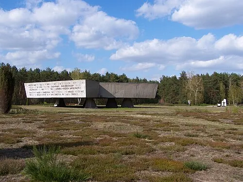 Kulmhof Extermination Camp Historic site, Dąbie23 km SW
-
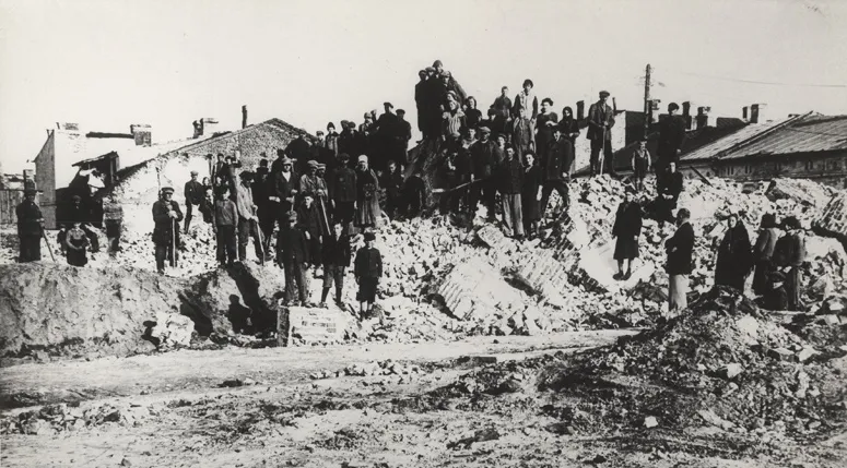 Warta Ghetto Historic site, Grabów9.6 km S
-
Krośniewice Ghetto Historic site, Krośniewice12 km E
-
Miłosna Ghetto Historic site, Krośniewice12 km E
-
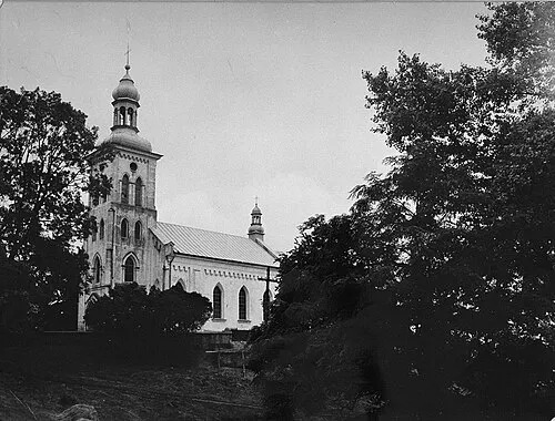 Dąbie Ghetto Historic site, Dąbie22 km SW
-
Nowiny Brdowskie Ghetto Historic site, Babiak20 km NW
Sources & licences
Data last updated: