Gmina Damasławek
Located in Wągrowiec County, Greater Poland Voivodeship Coordinates: 52°50′38″ N 17°26′12″ E
- Population
- 5,437
- 5.4K
- Elevation
- 93 m
- above sea level
- Local time
- UTC+01:00
- Europe/Warsaw · UTC+01:00
- Places inside
- 2
- listed under Gmina Damasławek
- Airports
- BZG Ignacy Jan Paderewski Bydgoszcz Airport46 km
- POZ Poznań-Ławica Airport63 km
About Gmina Damasławek
Gmina Damasławek is a municipality. Location: Wągrowiec County, Greater Poland Voivodeship. Population: 5,437. Elevation: 93 m. The best months to visit are May–September. The nearest airport is Ignacy Jan Paderewski Bydgoszcz Airport (46 km).
Climate of Gmina Damasławek
Best months for sightseeingBest months for sightseeing: May–September.
This month · November
A cold month
Day 6° · Night 1° · Rain 39 mm
- Hottest month
- August (day 24°)
- Coldest month
- January (night -4°)
- Wettest month
- July (74 mm)
- Driest month
- February (23 mm)
Bars: average monthly low and high temperature. Below: precipitation. Monthly averages for 1970–2000 at about 18 km resolution, adjusted for elevation. Highlighted months are mild and relatively dry. Source: WorldClim 2.1 (CC BY 4.0).
Show values as a table
| Month | Jan | Feb | Mar | Apr | May | Jun | Jul | Aug | Sep | Oct | Nov | Dec |
|---|---|---|---|---|---|---|---|---|---|---|---|---|
| Average high (°C) | 1° | 2° | 7° | 13° | 19° | 22° | 24° | 24° | 18° | 12° | 6° | 2° |
| Average low (°C) | -4° | -4° | -1° | 3° | 8° | 11° | 13° | 12° | 9° | 5° | 1° | -3° |
| Precipitation (mm) | 31 | 23 | 31 | 33 | 49 | 64 | 74 | 56 | 46 | 37 | 39 | 40 |
Other places to visit in this season: May June July August September
How to get to Gmina Damasławek
The nearest airport is Ignacy Jan Paderewski Bydgoszcz Airport (BZG), 46 km to the northeast as the crow flies. For international flights: Poznań-Ławica Airport (POZ) (63 km). The nearest large city is Berlin, 275 km to the west.
Airports
- Ignacy Jan Paderewski Bydgoszcz Airport (BZG) Bydgoszcz 46 kmnortheast
- Poznań-Ławica Airport (POZ) Poznań 63 kmsouthwest
- Zielona Góra-Babimost Airport (IEG) Nowe Kramsko 136 kmsouthwest
Nearby large cities
- Berlin Population: 3.4M 275 kmwest
- Potsdam Population: 184.8K 300 kmwest
- Dresden Population: 564.9K 323 kmsouthwest
- Prague Population: 1.2M 371 kmsouthwest
- Rostock Population: 198.3K 378 kmnorthwest
Straight-line distances; road distances are longer. Airport data: OurAirports.
Day trips from Gmina Damasławek
Within 100 km: 15 historic and cultural sites, 12 natural sites, 1 lake, river or coast.
25–60 km10 places
- Dębowa Góra Mountain 34 kmNW
- Budzyń Concentration Camp Historic site 35 kmW
- Treskau Concentration Camp Historic site 48 kmSW
- Ostrów Lednicki Island 35 kmS
60–100 km18 places
- Góry Obkaskie Mountain 81 kmN
- Wzgorze nad Niezywieciem Mountain 97 kmN
- Góra Wolność Mountain 98 kmN
- Petershagen Concentration Camp Historic site 92 kmW
Straight-line distances.
Places in Gmina Damasławek
2 placesBar: population relative to the most populous place in this list.
Other cities and towns in Wągrowiec County
-
Gmina Gołańcz Municipality, Wągrowiec County15 km NW
-
Wągrowiec Municipality, Wągrowiec County17 km W
-
Wągrowiec Municipality, Wągrowiec County16 km W
-
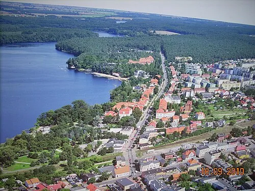 Wągrowiec Town, Wągrowiec16 km W
-
Skoki Municipality, Wągrowiec County27 km SW
Sources & licences
Data last updated: