- Population
- 6,719
- 6.7K
- Elevation
- 205 m
- above sea level
- Local time
- UTC+01:00
- Europe/Warsaw · UTC+01:00
- Airports
- WRO Copernicus Wrocław Airport33 km
- PED Pardubice Airport116 km
About Żarów
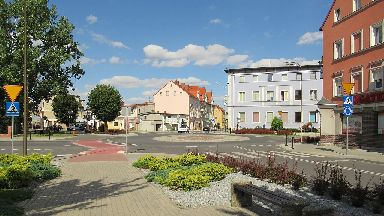
Żarów is a town. Location: Gmina Żarów, Świdnica County. Population: 6,719. Elevation: 205 m.
Żarów [ˈʐaruf] (German: Saarau) is a town in Świdnica County, Lower Silesian Voivodeship, in south-western Poland. It is the seat of the administrative district (gmina) called Gmina Żarów. As of 2020, the town has a population of 12,335. 53.9% of the population is classified as urban, while 46.1% is classified as rural. In 2016, town limits were expanded by including a part of the village of Mrowiny.
Source: Wikipedia · CC BY-SA 4.0
Photos of Żarów
-

Grzegorz W. Tężycki · CC BY-SA 4.0 -

Awdrgy · CC BY-SA 3.0 pl -

MOs810 · CC BY-SA 4.0 -

MOs810 · CC BY-SA 4.0 -

Grzegorz W. Tężycki · CC BY-SA 4.0


Climate of Żarów
Best months for sightseeingBest months for sightseeing: June–September.
This month · November
A cold month
Day 7° · Night 1° · Rain 35 mm
- Hottest month
- August (day 23°)
- Coldest month
- January (night -5°)
- Wettest month
- July (88 mm)
- Driest month
- February (23 mm)
Bars: average monthly low and high temperature. Below: precipitation. Monthly averages for 1970–2000 at about 18 km resolution, adjusted for elevation. Highlighted months are mild and relatively dry. Source: WorldClim 2.1 (CC BY 4.0).
Show values as a table
| Month | Jan | Feb | Mar | Apr | May | Jun | Jul | Aug | Sep | Oct | Nov | Dec |
|---|---|---|---|---|---|---|---|---|---|---|---|---|
| Average high (°C) | 1° | 3° | 8° | 13° | 19° | 21° | 23° | 23° | 19° | 13° | 7° | 3° |
| Average low (°C) | -5° | -4° | -1° | 3° | 7° | 10° | 12° | 12° | 8° | 5° | 1° | -3° |
| Precipitation (mm) | 25 | 23 | 29 | 37 | 56 | 77 | 88 | 69 | 47 | 37 | 35 | 34 |
Other places to visit in this season: June July August September
How to get to Żarów
The nearest airport is Copernicus Wrocław Airport (WRO), 33 km to the northeast as the crow flies. The nearest large city is Prague, 175 km to the southwest.
Airports
- Copernicus Wrocław Airport (WRO) Wrocław 33 kmnortheast
- Pardubice Airport (PED) Pardubice 116 kmsouthwest
- Zielona Góra-Babimost Airport (IEG) Nowe Kramsko 142 kmnorth
Nearby large cities
- Prague Population: 1.2M 175 kmsouthwest
- Dresden Population: 564.9K 194 kmwest
- Brno Population: 404.3K 194 kmsouth
- Chemnitz Population: 247.2K 251 kmwest
- Berlin Population: 3.4M 276 kmnorthwest
Straight-line distances; road distances are longer. Airport data: OurAirports.
Day trips from Żarów
Within 100 km: 68 historic and cultural sites, 453 natural sites.
0–25 km12 places
- Góra Wały Mountain 19 kmSW
- Kielczyńskie Góry Mountain 15 kmSE
- Wiezyca - 415 m npm Mountain 18 kmE
- Ślęża - 718 m npm3 Mountain 17 kmSE
25–60 km275 places
- Bielec Mountain 42 kmW
- Baranek Wawrzyn Mountain 52 kmNE
- Parkowa Mountain 49 kmW
- Ptak Mountain 54 kmS
60–100 km234 places
- Tvarožník Mountain 71 kmW
- Sucha Kopa Mountain 83 kmS
- Jastrzębiec Mountain 70 kmW
- Goworek Mountain 87 kmS
Straight-line distances.
Nearby attractions & nature
Everything nearby-
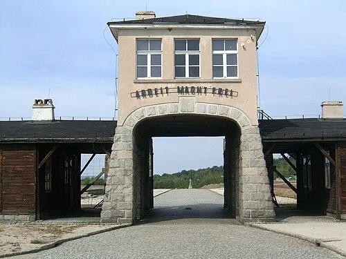 Groß-Rosen Concentration Camp Historic site, Strzegom17 km NW
-
Gräben Concentration Camp Historic site, Strzegom10 km W
-
Kielczyńskie Góry Mountain, Lower Silesian Voivodeship15 km SE
-
Ślęża - 718 m npm3 Mountain, Gmina Sobótka17 km SE
-
Wiezyca - 415 m npm Mountain, Gmina Sobótka18 km E
-
Fürstenstein Concentration Camp Historic site, Wałbrzych18 km SW
-
Przełęcz Tępadła - Masyw Ślęży 384 mnpm Mountain, Gmina Sobótka18 km SE
-
Góra Wały Mountain, Stare Bogaczowice19 km SW
Sources & licences
Data last updated: · 2 independent sources