Frysztak Ghetto
Located in Gmina Frysztak, Strzyżów County Coordinates: 49°50′00″ N 21°37′00″ E
- Local time
- UTC+01:00
- Europe/Warsaw · UTC+01:00
- Elevation
- 241 m
- above sea level
- Airports
- RZE Rzeszów-Jasionka Airport42 km
- TAT Poprad-Tatry Airport131 km
About Frysztak Ghetto
Frysztak Ghetto is a historic site. Location: Gmina Frysztak, Strzyżów County.
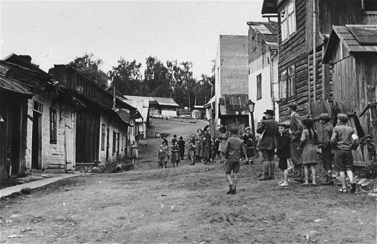
Frysztak Ghetto was created in the Polish shtetl of Frysztak during World War II by Nazi Germany and existed until 18 August 1942, when it was liquidated.
Source: Wikipedia · CC BY-SA 4.0
Climate of Frysztak Ghetto
Best months for sightseeingBest months for sightseeing: May–September.
This month · November
A cold month
Day 6° · Night 0° · Rain 40 mm
- Hottest month
- July (day 24°)
- Coldest month
- January (night -6°)
- Wettest month
- July (98 mm)
- Driest month
- February (28 mm)
Bars: average monthly low and high temperature. Below: precipitation. Monthly averages for 1970–2000 at about 18 km resolution, adjusted for elevation. Highlighted months are mild and relatively dry. Source: WorldClim 2.1 (CC BY 4.0).
Show values as a table
| Month | Jan | Feb | Mar | Apr | May | Jun | Jul | Aug | Sep | Oct | Nov | Dec |
|---|---|---|---|---|---|---|---|---|---|---|---|---|
| Average high (°C) | 1° | 2° | 8° | 14° | 19° | 22° | 24° | 24° | 19° | 13° | 6° | 2° |
| Average low (°C) | -6° | -5° | -1° | 4° | 8° | 11° | 13° | 12° | 9° | 5° | 0° | -4° |
| Precipitation (mm) | 32 | 28 | 34 | 52 | 76 | 97 | 98 | 78 | 64 | 48 | 40 | 40 |
Other places to visit in this season: May June July August September
How to get to Frysztak Ghetto
The nearest airport is Rzeszów-Jasionka Airport (RZE), 42 km to the northeast as the crow flies. The nearest large city is Košice, 127 km to the south.
Airports
- Rzeszów-Jasionka Airport (RZE) Jasionka 42 kmnortheast
- Poprad-Tatry Airport (TAT) Poprad 131 kmsouthwest
- Košice International Airport (KSC) Košice 133 kmsouth
Nearby large cities
- Košice Population: 225K 127 kmsouth
- Miskolc Population: 154.5K 202 kmsouth
- Nyíregyháza Population: 117.7K 209 kmsouth
- Satu Mare Population: 112.5K 244 kmsouth
- Debrecen Population: 202.4K 256 kmsouth
Straight-line distances; road distances are longer. Airport data: OurAirports.
Day trips from Frysztak Ghetto
Within 100 km: 61 historic and cultural sites, 152 natural sites, 2 lakes, rivers and coasts.
0–25 km13 places
- Lewocz Mountain 19 kmW
- Gora Królewska Mountain 15 kmSE
- Góra Sucha Mountain 17 kmSE
- Dabrowa Mountain 24 kmNW
25–60 km81 places
- Kolanin Mountain 34 kmS
- Słonny Mountain 56 kmSE
- Dziamera Mountain 39 kmSW
- Dział Mountain 39 kmSE
60–100 km121 places
- Branisko Mountain 98 kmSW
- Cigelka River 61 kmSW
- Červený Kláštor Attraction 99 kmSW
- Jaworzyna Mountain 99 kmSW
Straight-line distances.
Nearby attractions & nature
Everything nearby-
Kołaczyce Ghetto Historic site, Gmina Kołaczyce13 km W
-
Strzyżów Ghetto Historic site, Gmina Strzyżów14 km E
-
Wielopole Skrzyńskie Ghetto Historic site, Wielopole Skrzyńskie13 km N
-
Jasło Ghetto Historic site, Jasło14 km SW
-
Żmigród Nowy Ghetto Historic site, Gmina Nowy Żmigród25 km S
-
Krosno Ghetto Historic site, Krosno21 km SE
-
Czudec Ghetto Historic site, Czudec20 km NE
-
Niebylec Ghetto Historic site, Gmina Niebylec21 km E
Nearest towns and villages

Sources & licences
Data last updated: · 2 independent sources