Pasmo Orłowińskie
Located in Świętokrzyskie Voivodship, Poland Coordinates: 50°46′48″ N 20°57′13″ E
- Elevation
- 390 m
- above sea level
- Local time
- UTC+01:00
- Europe/Warsaw · UTC+01:00
- Airports
- RDO Warsaw Radom Airport70 km
- RZE Rzeszów-Jasionka Airport106 km
About Pasmo Orłowińskie
Pasmo Orłowińskie is a mountain. Location: Świętokrzyskie Voivodship, Poland. Elevation: 390 m. The best months to visit are June–August. The nearest airport is Warsaw Radom Airport (70 km). Nearby sights include Wysokówka and Zamczysko.
Climate of Pasmo Orłowińskie
Best months for sightseeingBest months for sightseeing: June–August.
This month · November
A cold month
Day 5° · Night -1° · Rain 41 mm
- Hottest month
- July (day 22°)
- Coldest month
- January (night -7°)
- Wettest month
- July (89 mm)
- Driest month
- February (29 mm)
Bars: average monthly low and high temperature. Below: precipitation. Monthly averages for 1970–2000 at about 18 km resolution, adjusted for elevation. Highlighted months are mild and relatively dry. Source: WorldClim 2.1 (CC BY 4.0).
Show values as a table
| Month | Jan | Feb | Mar | Apr | May | Jun | Jul | Aug | Sep | Oct | Nov | Dec |
|---|---|---|---|---|---|---|---|---|---|---|---|---|
| Average high (°C) | -1° | 1° | 6° | 12° | 18° | 21° | 22° | 22° | 17° | 12° | 5° | 1° |
| Average low (°C) | -7° | -6° | -2° | 2° | 7° | 10° | 11° | 11° | 7° | 3° | -1° | -5° |
| Precipitation (mm) | 35 | 29 | 35 | 44 | 58 | 78 | 89 | 78 | 58 | 44 | 41 | 42 |
How to get to Pasmo Orłowińskie
The nearest airport is Warsaw Radom Airport (RDO), 70 km to the north as the crow flies. For international flights: Rzeszów-Jasionka Airport (RZE) (106 km). The nearest large city is Košice, 231 km to the south.
Airports
- Warsaw Radom Airport (RDO) Radom 70 kmnorth
- Rzeszów-Jasionka Airport (RZE) Jasionka 106 kmsoutheast
- Kraków John Paul II International Airport (KRK) Balice 114 kmsouthwest
Nearby large cities
- Košice Population: 225K 231 kmsouth
- Miskolc Population: 154.5K 298 kmsouth
- Nyíregyháza Population: 117.7K 319 kmsouth
- Brno Population: 404.3K 358 kmsouthwest
- Satu Mare Population: 112.5K 359 kmsoutheast
Straight-line distances; road distances are longer. Airport data: OurAirports.
Day trips from Pasmo Orłowińskie
Within 100 km: 93 historic and cultural sites, 28 natural sites.
0–25 km24 places
- Góra Miejska Mountain 17 kmN
- Pasmo Masłowskie Mountain 21 kmNW
- Łysogóry Mountain 11 kmN
- Zamczysko Mountain 3 kmS
25–60 km38 places
- Pasmo Małogoskie Mountain 57 kmW
- Kamieniarska Góra Mountain 55 kmNW
- Pasmo Dymińskie Mountain 29 kmW
- Góra Cymbra Mountain 51 kmN
60–100 km59 places
- Góra Diabla Mountain 83 kmNW
- Dabrowa Mountain 98 kmS
- Pasmo Przedborskie Mountain 77 kmW
- Góra Kozłowa Mountain 73 kmW
Straight-line distances.
Nearest towns and villages
-
Bieliny Municipality, Kielce County5.8 km N
-
Gmina Łagów Municipality, Kielce County8 km E
-
Smyków Village, Gmina Daleszyce6.7 km NW
-
Bieliny Village, Bieliny7.8 km N
-
Gmina Daleszyce Municipality, Kielce County11 km W
-
Gmina Raków Municipality, Kielce County10 km S
Nearby attractions & nature
Everything nearby-
Wysokówka Mountain, Gmina Daleszyce1.2 km NW
-
Zamczysko Mountain, Gmina Raków2.5 km S
-
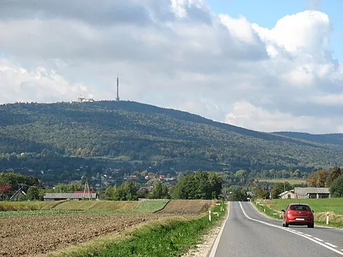 Góry Świętokrzyskie Mountain, Poland8.8 km W
-
Łysogóry Mountain, Świętokrzyskie Voivodship11 km N
-
Szczygiełkowa - Przełęcz Św. Mikołaja 535m. Mountain, Bieliny12 km N
-
Jeleniowska Mountain, Gmina Nowa Słupia12 km NE
-
Lysica - 612 m. n. p. m. Mountain, Bodzentyn13 km N
-
Sikorza Mountain, Gmina Daleszyce14 km NW
Sources & licences
Data last updated: · 2 independent sources