Salsas
Located in Bragança Municipality, Braganza District Coordinates: 41°38′21″ N 6°48′51″ W
- Population
- 269
- 269
- Elevation
- 796 m
- above sea level
- Local time
- UTC+00:00
- Europe/Lisbon · UTC+00:00
- Airports
- BGC Bragança Airport26 km
- VRL Vila Real Airport86 km
About Salsas
Salsas is a municipality. Location: Bragança Municipality, Braganza District. Population: 269. Elevation: 796 m. The best months to visit are June–September. The nearest airport is Bragança Airport (26 km). Nearby sights include Serra de Nogueira and Monte de Morais.
Climate of Salsas
Best months for sightseeingBest months for sightseeing: June–September.
This month · November
A wet month
Day 12° · Night 4° · Rain 110 mm
- Hottest month
- July (day 27°)
- Coldest month
- January (night 0°)
- Wettest month
- December (139 mm)
- Driest month
- August (18 mm)
Bars: average monthly low and high temperature. Below: precipitation. Monthly averages for 1970–2000 at about 18 km resolution, adjusted for elevation. Highlighted months are mild and relatively dry. Source: WorldClim 2.1 (CC BY 4.0).
Show values as a table
| Month | Jan | Feb | Mar | Apr | May | Jun | Jul | Aug | Sep | Oct | Nov | Dec |
|---|---|---|---|---|---|---|---|---|---|---|---|---|
| Average high (°C) | 8° | 10° | 13° | 14° | 18° | 23° | 27° | 27° | 23° | 17° | 12° | 10° |
| Average low (°C) | 0° | 1° | 3° | 4° | 7° | 11° | 13° | 13° | 11° | 7° | 4° | 2° |
| Precipitation (mm) | 130 | 108 | 62 | 72 | 76 | 45 | 19 | 18 | 49 | 98 | 110 | 139 |
Other places to visit in this season: June July August September
How to get to Salsas
The nearest airport is Bragança Airport (BGC), 26 km to the north as the crow flies. The nearest large city is Ourense, 116 km to the northwest.
Airports
- Bragança Airport (BGC) Bragança 26 kmnorth
- Vila Real Airport (VRL) Vila Real 86 kmsouthwest
- Salamanca Airport (SLM) Salamanca 134 kmsoutheast
Nearby large cities
- Ourense Population: 105.2K 116 kmnorthwest
- Salamanca Population: 144.8K 122 kmsoutheast
- Braga Population: 193.3K 134 kmwest
- León Population: 124.8K 148 kmnortheast
- Porto Population: 252.7K 160 kmwest
Straight-line distances; road distances are longer. Airport data: OurAirports.
Day trips from Salsas
Within 100 km: 44 historic and cultural sites, 151 natural sites, 229 lakes, rivers and coasts.
0–25 km8 places
- Río de las Cuevas River 23 kmE
- Río Colmenares River 23 kmE
- Río de San Mamed River 24 kmE
- Cabeço da Pedrosa Mountain 24 kmNW
25–60 km119 places
- Serra da Garraia Mountain 53 kmSW
- Lago de Sanabria Lake 54 kmN
- Sierra de Casica Mountain 32 kmE
- Sierra de la Gamoneda Mountain 40 kmN
60–100 km297 places
- Embalse de Ricobayo Lake 80 kmE
- Embalse del Esla Lake 74 kmE
- Sierra de Larouca Mountain 77 kmNW
- Monteagudo Mountain 89 kmW
Straight-line distances.
Nearby attractions & nature
Everything nearby-
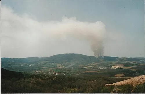 Serra de Nogueira Mountain, Braganza District9.5 km NW
-
Monte de Morais Mountain, Braganza District14 km S
-
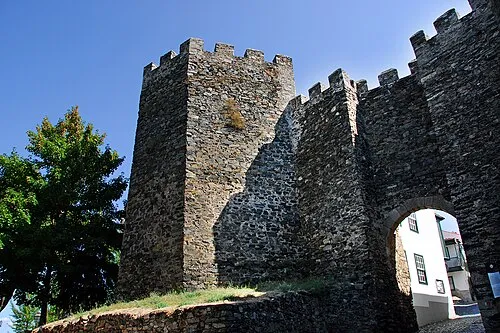 Castelo de Bragança Historic site, União das freguesias de Sé, Santa Maria e Meixedo19 km N
-
Cabeço da Pedrosa Mountain, União das freguesias de Castrelos e Carrazedo24 km NW
-
Serra de Ala Mountain, União das freguesias de Ala e Vilarinho do Monte17 km W
-
Río Colmenares River, Trabazos23 km E
-
Río de las Cuevas River, Trabazos23 km E
-
Río de San Mamed River, Trabazos24 km E
Sources & licences
Data last updated: