Bragança Municipality
Located in Braganza District, Portugal Coordinates: 41°45′22″ N 6°45′19″ W
- Population
- 35,341
- 35.3K
- Elevation
- 714 m
- above sea level
- Local time
- UTC+00:00
- Europe/Lisbon · UTC+00:00
- Places inside
- 39
- listed under Bragança Municipality
- Airports
- BGC Bragança Airport12 km
- VRL Vila Real Airport97 km
About Bragança Municipality
Bragança Municipality is a district. Location: Braganza District, Portugal. Population: 35,341. The best months to visit are June–September. The nearest airport is Bragança Airport (12 km). Nearby sights include Serra de Nogueira and Vale do Prado.
Climate of Bragança Municipality
Best months for sightseeingBest months for sightseeing: June–September.
This month · November
Outside the best season
Day 13° · Night 4° · Rain 98 mm
- Hottest month
- July (day 28°)
- Coldest month
- January (night 0°)
- Wettest month
- December (126 mm)
- Driest month
- August (19 mm)
Bars: average monthly low and high temperature. Below: precipitation. Monthly averages for 1970–2000 at about 18 km resolution, adjusted for elevation. Highlighted months are mild and relatively dry. Source: WorldClim 2.1 (CC BY 4.0).
Show values as a table
| Month | Jan | Feb | Mar | Apr | May | Jun | Jul | Aug | Sep | Oct | Nov | Dec |
|---|---|---|---|---|---|---|---|---|---|---|---|---|
| Average high (°C) | 8° | 10° | 14° | 15° | 18° | 24° | 28° | 28° | 24° | 18° | 13° | 10° |
| Average low (°C) | 0° | 1° | 3° | 5° | 8° | 11° | 14° | 13° | 11° | 8° | 4° | 3° |
| Precipitation (mm) | 114 | 88 | 51 | 64 | 75 | 42 | 20 | 19 | 47 | 90 | 98 | 126 |
Other places to visit in this season: June July August September
How to get to Bragança Municipality
The nearest airport is Bragança Airport (BGC), 12 km to the north as the crow flies. The nearest large city is Ourense, 112 km to the northwest.
Airports
- Bragança Airport (BGC) Bragança 12 kmnorth
- Vila Real Airport (VRL) Vila Real 97 kmsouthwest
- León Airport (LEN) La Virgen del Camino 130 kmnortheast
Nearby large cities
- Ourense Population: 105.2K 112 kmnorthwest
- Salamanca Population: 144.8K 126 kmsoutheast
- León Population: 124.8K 136 kmnortheast
- Braga Population: 193.3K 141 kmwest
- Porto Population: 252.7K 169 kmsouthwest
Straight-line distances; road distances are longer. Airport data: OurAirports.
Places in Bragança Municipality
39 places- 1 União das freguesias de Sé, Santa Maria e Meixedo 22.7K
- 2 Samil 1.4K
- 3 União das freguesias de Izeda, Calvelhe e Paradinha Nova 851
- 4 União das freguesias de Parada e Faílde 539
- 5 Rebordãos 533
- 6 Nogueira 462
- 7 Baçal 460
- 8 Castro de Avelãs 430
- 9 Donai 419
- 10 Gostei 397
- 11 São Pedro de Sarracenos 380
- 12 Gimonde 358
- 13 União das freguesias de São Julião de Palácios e Deilão 319
- 14 União das freguesias de Rio Frio e Milhão 287
- 15 Coelhoso 279
- 16 Santa Comba de Rossas 276
- 17 Salsas 269
- 18 Sortes 262
- 19 Grijó de Parada 248
- 20 Outeiro 234
- 21 Espinhosela 227
- 22 Pinela 227
- 23 União das freguesias de Aveleda e Rio de Onor 227
- 24 Quintanilha 217
- 25 União das freguesias de Castrelos e Carrazedo 214
- 26 Babe 209
- 27 França 199
- 28 Parâmio 195
- 29 Serapicos 187
- 30 Quintela de Lampaças 184
- 31 Macedo do Mato 178
- 32 Mós 175
- 33 Alfaião 164
- 34 Carragosa 162
- 35 Rabal 152
- 36 Sendas 150
- 37 União das freguesias de Rebordainhos e Pombares 148
- 38 Zoio 141
- 39 Gondesende 139
Bar: population relative to the most populous place in this list.
Nature and heritage in Bragança Municipality
Nearby attractions & nature
Everything nearby-
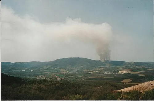 Serra de Nogueira Mountain, Braganza District11 km SW
-
Vale do Prado Natural site, Braganza District18 km NE
-
Vale das Cabanas Natural site, Braganza District24 km NE
-
Serro de Soeiro Mountain, União das freguesias de Soeira, Fresulfe e Mofreita18 km NW
-
Cabeço da Maceira Mountain, Paçó18 km NW
-
Alto da Costa Mountain, União das freguesias de Soeira, Fresulfe e Mofreita19 km NW
Sources & licences
Data last updated: