Amoreira
Located in Óbidos Municipality, Leiria District Coordinates: 39°21′58″ N 9°14′20″ W
- Population
- 1,033
- 1K
- Elevation
- 67 m
- above sea level
- Local time
- UTC+00:00
- Europe/Lisbon · UTC+00:00
- Places inside
- 1
- listed under Amoreira
- Airports
- LIS Lisbon Humberto Delgado Airport66 km
- CAT Cascais Airport72 km
About Amoreira
Amoreira is a municipality. Location: Óbidos Municipality, Leiria District. Population: 1,033. Elevation: 67 m. The best months to visit are June–September. The nearest airport is Lisbon Humberto Delgado Airport (66 km). Nearby sights include Museu de Cerâmica and Ciranda.
Climate of Amoreira
Best months for sightseeingBest months for sightseeing: June–September.
This month · November
Outside the best season
Day 17° · Night 11° · Rain 90 mm
- Hottest month
- August (day 23°)
- Coldest month
- January (night 8°)
- Wettest month
- December (96 mm)
- Driest month
- July (6 mm)
Bars: average monthly low and high temperature. Below: precipitation. Monthly averages for 1970–2000 at about 18 km resolution, adjusted for elevation. Highlighted months are mild and relatively dry. Source: WorldClim 2.1 (CC BY 4.0).
Show values as a table
| Month | Jan | Feb | Mar | Apr | May | Jun | Jul | Aug | Sep | Oct | Nov | Dec |
|---|---|---|---|---|---|---|---|---|---|---|---|---|
| Average high (°C) | 14° | 15° | 16° | 17° | 19° | 21° | 23° | 23° | 22° | 20° | 17° | 15° |
| Average low (°C) | 8° | 9° | 10° | 11° | 13° | 15° | 16° | 16° | 16° | 14° | 11° | 9° |
| Precipitation (mm) | 92 | 74 | 47 | 57 | 52 | 20 | 6 | 9 | 27 | 77 | 90 | 96 |
Other places to visit in this season: June July August September
How to get to Amoreira
The nearest airport is Lisbon Humberto Delgado Airport (LIS), 66 km to the south as the crow flies. The nearest large city is Lisbon, 72 km to the south.
Airports
- Lisbon Humberto Delgado Airport (LIS) Lisbon 66 kmsouth
- Cascais Airport (CAT) Cascais 72 kmsouth
- Aerodromo Goncalves Lobato (Viseu Airport) (VSE) Viseu 190 kmnortheast
Nearby large cities
- Lisbon Population: 517.8K 72 kmsouth
- Setúbal Population: 118.2K 98 kmsouth
- Badajoz Population: 150.5K 203 kmeast
- Porto Population: 252.7K 205 kmnorth
- Braga Population: 193.3K 252 kmnorth
Straight-line distances; road distances are longer. Airport data: OurAirports.
Day trips from Amoreira
Within 100 km: 40 historic and cultural sites, 134 natural sites, 2 lakes, rivers and coasts.
0–25 km13 places
- Cabeça Gorda Mountain 19 kmS
- Valongo Mountain 23 kmSW
- Serra de Todo Mundo Mountain 21 kmSE
- Outeirão Mountain 4 kmNW
25–60 km60 places
- Zemaneira Mountain 28 kmSE
- Cabeço Gordo Mountain 41 kmNE
- Cabeço Gordo Mountain 58 kmE
- Outeiro do Vento Mountain 27 kmS
60–100 km103 places
- Vale Costado Natural site 99 kmSE
- Convento de Santa Teresa de Jesus de Setúbal Attraction 98 kmS
- Castelo dos Mouros (Arrábida) Historic site 100 kmS
- Albarquel Beach Beach 99 kmS
Straight-line distances.
Places in Amoreira
1 placeMountains & nature1
- Outeirão · Mountain
Nearby attractions & nature
Everything nearby-
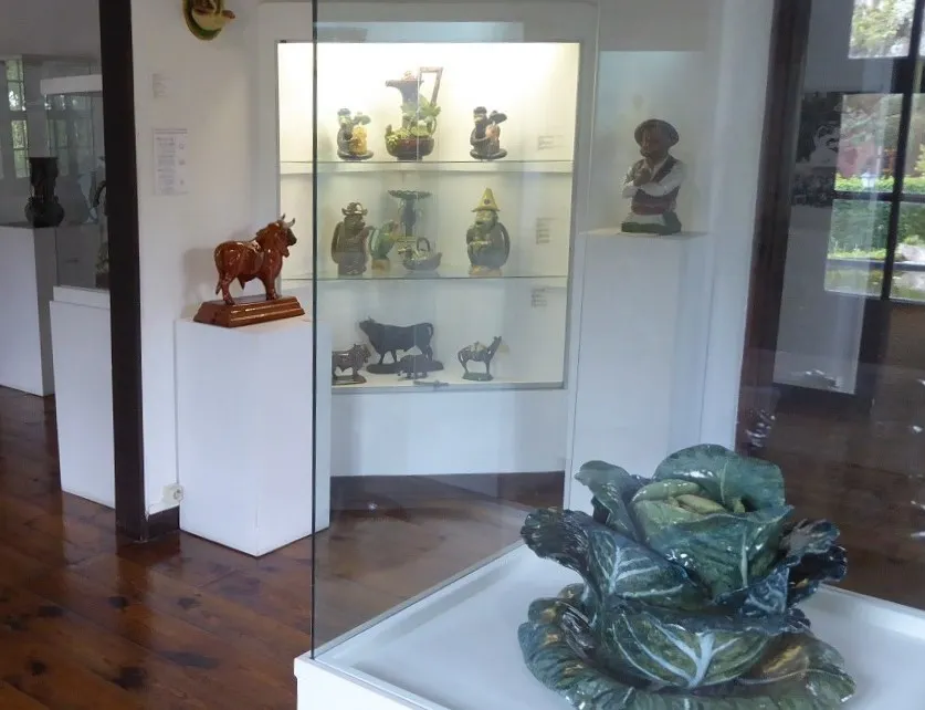 Museu de Cerâmica Museum, União das freguesias de Caldas da Rainha - Nossa Senhora do Pópulo, Coto e São Gregório10 km E
-
Ciranda Mountain, Lisbon District10 km SW
-
Cabeça Gorda Mountain, União das freguesias de Miragaia e Marteleira19 km S
-
Alto dos Campelos Mountain, União das freguesias de Campelos e Outeiro da Cabeça20 km S
-
Serra de Todo Mundo Mountain, Lisbon District21 km SE
-
Outeiro da Cabeça Mountain, União das freguesias de Campelos e Outeiro da Cabeça21 km S
-
Outeiro do Olival Mountain, Ramalhal21 km S
-
Outeiro da Lapa Mountain, Ramalhal23 km S
Sources & licences
Data last updated: