- Elevation
- 70 m
- above sea level
- Local time
- UTC+00:00
- Europe/Lisbon · UTC+00:00
- Airports
- LIS Lisbon Humberto Delgado Airport69 km
- CAT Cascais Airport74 km
About Outeirão
Outeirão is a mountain. Location: Amoreira, Óbidos Municipality. Elevation: 70 m. The best months to visit are June–September. The nearest airport is Lisbon Humberto Delgado Airport (69 km). Nearby sights include Ciranda and Cabeça Gorda.
Climate of Outeirão
Best months for sightseeingBest months for sightseeing: June–September.
This month · November
Outside the best season
Day 17° · Night 11° · Rain 90 mm
- Hottest month
- August (day 23°)
- Coldest month
- January (night 8°)
- Wettest month
- December (96 mm)
- Driest month
- July (6 mm)
Bars: average monthly low and high temperature. Below: precipitation. Monthly averages for 1970–2000 at about 18 km resolution, adjusted for elevation. Highlighted months are mild and relatively dry. Source: WorldClim 2.1 (CC BY 4.0).
Show values as a table
| Month | Jan | Feb | Mar | Apr | May | Jun | Jul | Aug | Sep | Oct | Nov | Dec |
|---|---|---|---|---|---|---|---|---|---|---|---|---|
| Average high (°C) | 14° | 15° | 16° | 17° | 19° | 21° | 23° | 23° | 22° | 20° | 17° | 15° |
| Average low (°C) | 8° | 9° | 10° | 11° | 13° | 15° | 16° | 16° | 16° | 14° | 11° | 9° |
| Precipitation (mm) | 92 | 74 | 47 | 57 | 52 | 20 | 6 | 9 | 27 | 77 | 90 | 96 |
Other places to visit in this season: June July August September
How to get to Outeirão
The nearest airport is Lisbon Humberto Delgado Airport (LIS), 69 km to the south as the crow flies. The nearest large city is Lisbon, 75 km to the south.
Airports
- Lisbon Humberto Delgado Airport (LIS) Lisbon 69 kmsouth
- Cascais Airport (CAT) Cascais 74 kmsouth
- Aerodromo Goncalves Lobato (Viseu Airport) (VSE) Viseu 189 kmnortheast
Nearby large cities
- Lisbon Population: 517.8K 75 kmsouth
- Setúbal Population: 118.2K 102 kmsouth
- Porto Population: 252.7K 203 kmnorth
- Badajoz Population: 150.5K 207 kmeast
- Braga Population: 193.3K 250 kmnorth
Straight-line distances; road distances are longer. Airport data: OurAirports.
Day trips from Outeirão
Within 100 km: 32 historic and cultural sites, 118 natural sites.
0–25 km10 places
- Cabeça Gorda Mountain 22 kmS
- Serra de Todo Mundo Mountain 24 kmSE
- Outeiro do Olival Mountain 24 kmS
- Ciranda Mountain 12 kmS
25–60 km59 places
- Zemaneira Mountain 31 kmSE
- Cabeço Gordo Mountain 42 kmNE
- Outeiro do Vento Mountain 30 kmS
- Cabeço do Vento Mountain 55 kmNE
60–100 km81 places
- Suimo Mountain 67 kmS
- Pena Mountain 68 kmS
- Cabeço Gordo Mountain 60 kmE
- Cabeço das Vacas Mountain 97 kmS
Straight-line distances.
Nearest towns and villages
-
Ferrel Municipality, Peniche Municipality4.9 km SW
-
Ferrel Village, Ferrel5.1 km SW
-
 Serra d'El-Rei Municipality, Peniche Municipality5.6 km S
-
Vau Municipality, Óbidos Municipality5.5 km SE
-
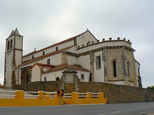 Atouguia da Baleia Town, Atouguia da Baleia7.7 km SW
-
Serra de El-Rei Village, Serra d'El-Rei6.4 km S
Nearby attractions & nature
Everything nearby-
Ciranda Mountain, Lisbon District12 km S
-
Cabeça Gorda Mountain, União das freguesias de Miragaia e Marteleira22 km S
-
Alto dos Campelos Mountain, União das freguesias de Campelos e Outeiro da Cabeça23 km S
-
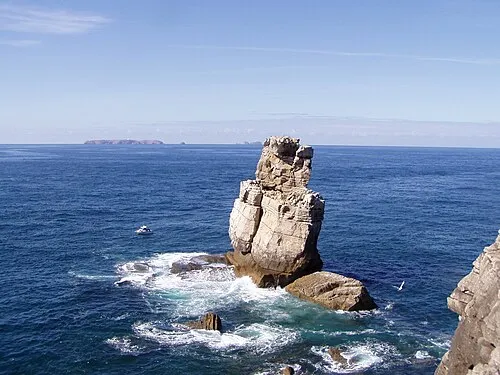 Cabo Carvoeiro Natural site, Peniche13 km W
-
Serra de Todo Mundo Mountain, Lisbon District24 km SE
-
Outeiro da Cabeça Mountain, União das freguesias de Campelos e Outeiro da Cabeça24 km S
-
Outeiro do Olival Mountain, Ramalhal24 km S
-
Vale da Franca Natural site, Leiria District23 km E
Sources & licences
Data last updated: · 2 independent sources