Abaças
Located in Vila Real Municipality, Vila Real District Coordinates: 41°13′15″ N 7°41′13″ W
- Population
- 836
- 836
- Elevation
- 549 m
- above sea level
- Local time
- UTC+00:00
- Europe/Lisbon · UTC+00:00
- Airports
- VRL Vila Real Airport7 km
- VSE Aerodromo Goncalves Lobato (Viseu Airport)58 km
About Abaças
Abaças is a municipality. Location: Vila Real Municipality, Vila Real District. Population: 836. Elevation: 549 m. The best months to visit are June–September. The nearest airport is Vila Real Airport (7 km). Nearby sights include Ponte rodoviária sobre o rio Pinhão and Ponte ferroviária sobre o rio Pinhão.
Climate of Abaças
Best months for sightseeingBest months for sightseeing: June–September.
This month · November
A wet month
Day 14° · Night 6° · Rain 156 mm
- Hottest month
- August (day 25°)
- Coldest month
- January (night 3°)
- Wettest month
- January (176 mm)
- Driest month
- July (13 mm)
Bars: average monthly low and high temperature. Below: precipitation. Monthly averages for 1970–2000 at about 18 km resolution, adjusted for elevation. Highlighted months are mild and relatively dry. Source: WorldClim 2.1 (CC BY 4.0).
Show values as a table
| Month | Jan | Feb | Mar | Apr | May | Jun | Jul | Aug | Sep | Oct | Nov | Dec |
|---|---|---|---|---|---|---|---|---|---|---|---|---|
| Average high (°C) | 10° | 12° | 14° | 15° | 18° | 22° | 25° | 25° | 22° | 18° | 14° | 11° |
| Average low (°C) | 3° | 4° | 5° | 6° | 9° | 12° | 14° | 14° | 12° | 9° | 6° | 4° |
| Precipitation (mm) | 176 | 164 | 104 | 108 | 84 | 53 | 13 | 16 | 60 | 115 | 156 | 172 |
Other places to visit in this season: June July August September
How to get to Abaças
The nearest airport is Vila Real Airport (VRL), 7 km to the northwest as the crow flies. For international flights: Francisco de Sá Carneiro Airport (OPO) (83 km). The nearest large city is Braga, 72 km to the northwest.
Airports
- Vila Real Airport (VRL) Vila Real 7 kmnorthwest
- Aerodromo Goncalves Lobato (Viseu Airport) (VSE) Viseu 58 kmsouth
- Francisco de Sá Carneiro Airport (OPO) Porto 83 kmwest
Nearby large cities
- Braga Population: 193.3K 72 kmnorthwest
- Porto Population: 252.7K 78 kmwest
- Ourense Population: 105.2K 125 kmnorth
- Vigo Population: 293.6K 142 kmnorthwest
- Salamanca Population: 144.8K 172 kmeast
Straight-line distances; road distances are longer. Airport data: OurAirports.
Day trips from Abaças
Within 100 km: 39 historic and cultural sites, 203 natural sites, 69 lakes, rivers and coasts.
0–25 km16 places
- Pedestrian bridge over the Pinhão river Landmark 12 kmE
- Alto das Fontes Mountain 21 kmNW
- Serra da Falperra Mountain 22 kmN
- Alto de Vila Lobos Mountain 25 kmSW
25–60 km80 places
- Serra da Garraia Mountain 35 kmNE
- Monte de Lijó Mountain 54 kmNW
- Serra de Luzim Mountain 49 kmW
- Serra das Lojas Mountain 43 kmN
60–100 km215 places
- Sierra de Larouca Mountain 77 kmN
- Monteagudo Mountain 75 kmN
- Monte Uzal Mountain 89 kmN
- Penedo do Subiado Mountain 82 kmN
Straight-line distances.
Nearby attractions & nature
Everything nearby-
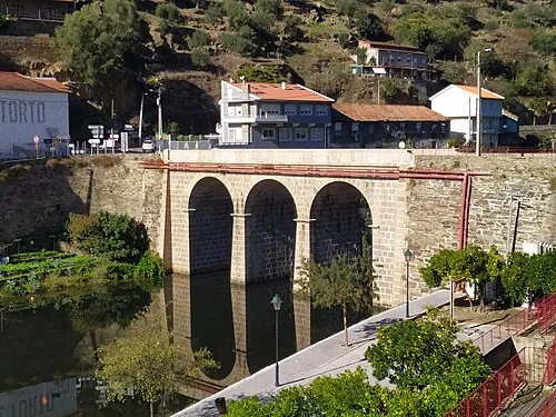 Ponte rodoviária sobre o rio Pinhão Landmark, União das freguesias de Provesende, Gouvães do Douro e São Cristóvão do Douro12 km E
-
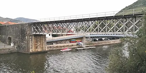 Ponte ferroviária sobre o rio Pinhão Landmark, Pinhão12 km E
-
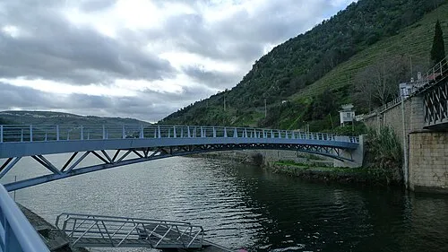 Pedestrian bridge over the Pinhão river Landmark, Pinhão12 km E
-
Alto da Cota Mountain, União das freguesias de Pena, Quintã e Vila Cova16 km NW
-
Vale de Ervedosa Natural site, Ervedosa do Douro16 km E
-
Planalto do Vaqueiro Natural site, Vila Real District18 km NW
-
Alto das Veias Mountain, Ansiães20 km W
-
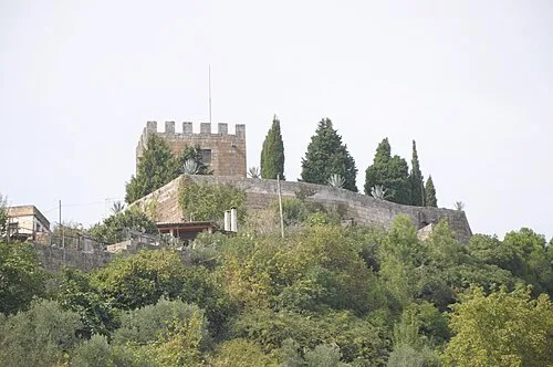 Castelo de Lamego Historic site, Lamego (Almacave e Sé)17 km SW
Sources & licences
Data last updated: