- Population
- 510,626
- 510.6K
- Elevation
- 1,712 m
- above sea level
- Local time
- UTC+03:00
- Europe/Istanbul · UTC+03:00
- Places inside
- 146
- listed under Ağrı Province
- Airports
- AJI Ağrı Airport12 km
- IGD Iğdır Airport70 km
About Ağrı Province
Ağrı Province is a region. Location: Turkey. Population: 510,626.
Ağrı Province (Turkish: Ağrı ili, Armenian: Արարատ մարզ, Kurdish: Parêzgeha Agirîyê) is located in eastern Turkey, bordering Iran to the east and the provinces of Kars to the north, Erzurum to the northwest, Muş and Bitlis to the southwest, Van to the south, and Iğdır to the northeast. Its area is 11,099 km2, and its population is 511,238 (2023). The provincial capital is Ağrı, situated on a 1,650 metres (5,410 ft) high plateau. Doğubayazıt was the capital of the province until 1946.
Source: Wikipedia · CC BY-SA 4.0
Photos of Ağrı Province
-
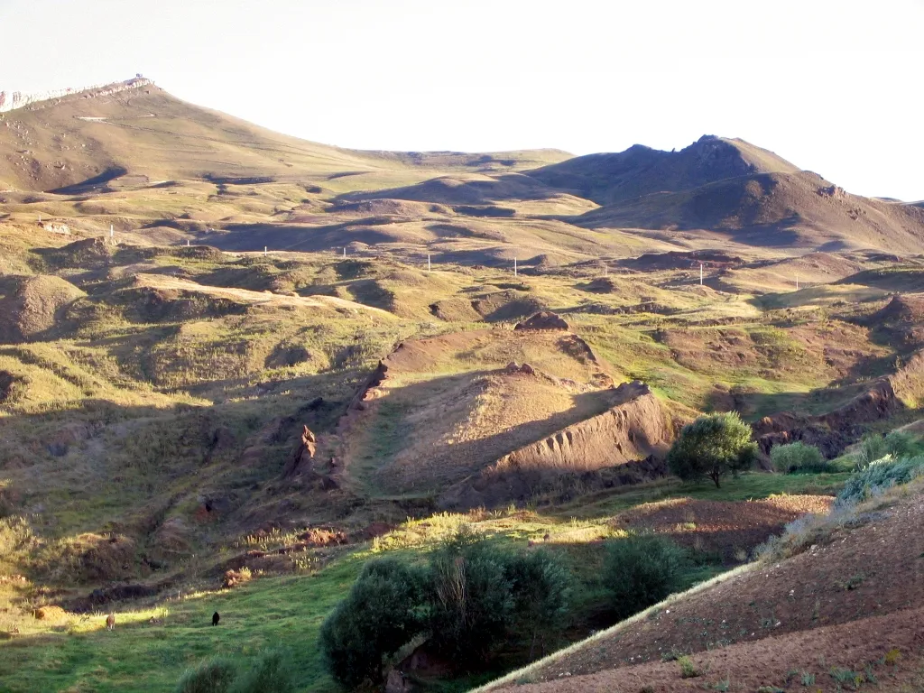
Tendürek Dağı Mfikretyilmaz · CC BY 3.0 -
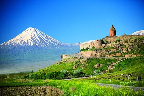
Little Ararat uncredited · CC BY-SA 3.0


Places bordering Ağrı Province
- Bitlis Province
- Kars Province
- Iğdır Province
- Van Province
- Muş Province
- Erzurum Province
Population of Ağrı Province over time
| 2009 | 537,665 | |
|---|---|---|
| 2015 | 547,210 | |
| 2018 | 539,657 | |
| 2021 | 454,387 |
Censuses and official estimates; source: Wikidata.
Climate of Ağrı Province
Best months for sightseeingBest months for sightseeing: June, September.
This month · November
A cold month
Day 8° · Night -2° · Rain 43 mm
Better nearby cities in November
- Cizre · 273 km south20°
- Silopi · 276 km south20°
- Kızıltepe · 356 km southwest19°
- Hottest month
- August (day 29°)
- Coldest month
- January (night -13°)
- Wettest month
- May (75 mm)
- Driest month
- September (21 mm)
Bars: average monthly low and high temperature. Below: precipitation. Monthly averages for 1970–2000 at about 18 km resolution, adjusted for elevation. Highlighted months are mild and relatively dry. Source: WorldClim 2.1 (CC BY 4.0).
Show values as a table
| Month | Jan | Feb | Mar | Apr | May | Jun | Jul | Aug | Sep | Oct | Nov | Dec |
|---|---|---|---|---|---|---|---|---|---|---|---|---|
| Average high (°C) | -3° | -2° | 3° | 11° | 18° | 23° | 28° | 29° | 25° | 17° | 8° | 0° |
| Average low (°C) | -13° | -12° | -6° | 1° | 6° | 9° | 13° | 12° | 8° | 3° | -2° | -8° |
| Precipitation (mm) | 30 | 38 | 39 | 62 | 75 | 51 | 27 | 22 | 21 | 51 | 43 | 36 |
How to get to Ağrı Province
The nearest airport is Ağrı Airport (AJI), 12 km to the west as the crow flies. The nearest large city is Ağrı, 12 km to the northwest.
Airports
- Ağrı Airport (AJI) Ağrı 12 kmwest
- Iğdır Airport (IGD) Iğdır 70 kmnortheast
- Kars Airport (KSY) Kars 100 kmnorth
Nearby large cities
- Ağrı Population: 124.5K 12 kmnorthwest
- Iğdır Population: 101.7K 80 kmeast
- Van Population: 525K 131 kmsouth
- Erzurum Population: 767.8K 164 kmwest
- Siirt Population: 114K 220 kmsouthwest
Straight-line distances; road distances are longer. Airport data: OurAirports.
Places in Ağrı Province
146 places- 1 Patnos District 125.7K
- 2 Doğubayazıt District 119.6K
- 3 Diyadin District 45.4K
- 4 Eleşkirt İlçesi 38.2K
- 5 Tutak İlçesi 33.8K
- 6 Taşlıçay District 22.2K
- 7 Hamur İlçesi 20.9K
Bar: population relative to the most populous place in this list.
Countries & regions1
- Ağrı · District
Cities & villages9
- Adaletabat · Village
- Cumaçay Bucağı · Municipality
- Darkut · Village
- Derekent · Village
- Diyadin Bucağı · Municipality
- Doğansu Bucağı · Municipality
- Doğubayazıt Bucağı · Municipality
- Eleşkirt Bucağı · Municipality
- Gökoğlan · Village
Mountains & nature6
- Akyayla Dağı · Mountain
- Buzkaya Dağı · Mountain
- Çifte Pınar · Natural site
- Demir Tepe · Mountain
- Develi Pınarı · Natural site
- Durak Dağı · Mountain
Lakes, rivers & coasts37
- Ahmetbey Deresi · River
- Ahmetbey Deresi · River
- Araralı Deresi · River
- Aşağıkülecik Deresi · River
- Avharik Deresi · River
- Aydoboğazı Deresi · River
- Bahçeköy Deresi · River
- Balıkgölü Deresi · River
- Balıkgölü Deresi · River
- Başıma Dere · River
- Beyaz Göl · Lake
- Beyaztaş Dere · River
- Bezirgan Deresi · River
- Büyüksu Çayı · River
- Çakçak Deresi · River
- Çakırbey Deresi · River
- Çatalipaşa Deresi · River
- Cem Deresi · River
- Çengel Deresi · River
- Çirpili Deresi · River
- Çögege Deresi · River
- Çoraksu Deresi · River
- Cuma Çayı · River
- Cuma Çayı · River
- Dadıkan Dere · River
- Dede Deresi · River
- Değirmen Deresi · River
- Değirmen Deresi · River
- Derin Dere · River
- Direk Deresi · River
- Doğansu Deresi · River
- Eleşkirt Deresi · River
- Eşkik Deresi · River
- Geli Deresi · River
- Gelutan Dere · River
- Gendel Çayırı Deresi · River
- Gernaoksuyu · River
Largest cities and towns
-
Ağrı City, Ağrı124.5K
-
Doğubeyazıt City, Doğubayazıt District81.1K
-
Patnos City, Patnos District57.9K
-
Fırat Neighbourhood, Ağrı29K
-
Diyadin City, Diyadin District18.9K
-
Doğansu Village, Patnos District4.9K
-
Abide Neighbourhood, Ağrı15K
-
Ahmedihani Neighbourhood, Doğubayazıt District13.2K
Nature and heritage in Ağrı Province
Sources & licences
Data last updated: · 2 independent sources