Artvin Province
Local name: Artvin ili
Located in Turkey Coordinates: 41°10′00″ N 41°50′00″ E
- Population
- 169,403
- 169.4K
- Elevation
- 672 m
- above sea level
- Local time
- UTC+03:00
- Europe/Istanbul · UTC+03:00
- Places inside
- 166
- listed under Artvin Province
- Airports
- BUS Alexander Kartveli Batumi International Airport53 km
- RZV Rize–Artvin Airport83 km
About Artvin Province
Artvin Province is a region. Location: Turkey. Population: 169,403.
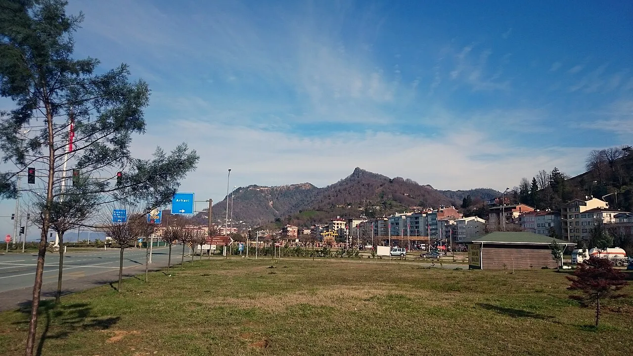
Artvin Province (Turkish: Artvin ili; Georgian: ართვინის პროვინცია, Artvinis p'rovintsia; Laz: ართვინიშ დობადონა Artvinish dobadona;) is a province in Turkey, on the Black Sea coast in the northeastern corner of the country, on the border with Georgia. Artvin also borders the Turkish provinces of Erzurum, Ardahan and Rize. Its area is 7,393 km2, and its population is 169,403 (2022). The provincial capital is the city of Artvin.
Source: Wikipedia · CC BY-SA 4.0
Photos of Artvin Province
-
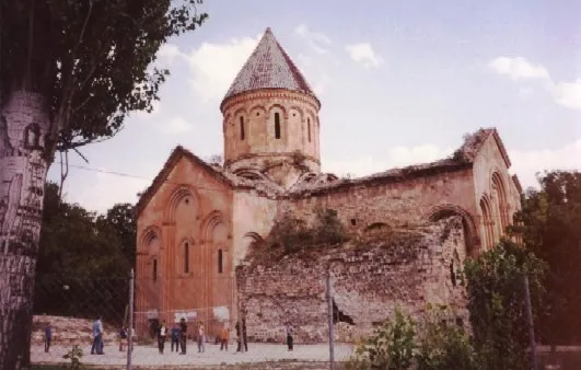
Ishkhani Monastery Island at Georgian Wikipedia · Public domain

Places bordering Artvin Province
- Adjara
- Ardahan Province
- Rize Province
Population of Artvin Province over time
| 2010 | 164,759 | |
|---|---|---|
| 2018 | 174,010 | |
| 2021 | 158,964 |
Censuses and official estimates; source: Wikidata.
Climate of Artvin Province
Best months for sightseeingBest months for sightseeing: May–September.
This month · November
A wet month
Day 12° · Night 5° · Rain 116 mm
- Hottest month
- August (day 27°)
- Coldest month
- January (night -1°)
- Wettest month
- December (127 mm)
- Driest month
- March (70 mm)
Bars: average monthly low and high temperature. Below: precipitation. Monthly averages for 1970–2000 at about 18 km resolution, adjusted for elevation. Highlighted months are mild and relatively dry. Source: WorldClim 2.1 (CC BY 4.0).
Show values as a table
| Month | Jan | Feb | Mar | Apr | May | Jun | Jul | Aug | Sep | Oct | Nov | Dec |
|---|---|---|---|---|---|---|---|---|---|---|---|---|
| Average high (°C) | 6° | 7° | 11° | 16° | 20° | 24° | 27° | 27° | 24° | 19° | 12° | 7° |
| Average low (°C) | -1° | -1° | 2° | 7° | 11° | 13° | 16° | 16° | 13° | 9° | 5° | 1° |
| Precipitation (mm) | 104 | 86 | 70 | 75 | 78 | 100 | 70 | 75 | 89 | 116 | 116 | 127 |
Other places to visit in this season: May June July August September
How to get to Artvin Province
The nearest airport is Alexander Kartveli Batumi International Airport (BUS), 53 km to the north as the crow flies. The nearest large city is Batumi, 55 km to the north.
Airports
- Alexander Kartveli Batumi International Airport (BUS) Batumi 53 kmnorth
- Rize–Artvin Airport (RZV) Rize 83 kmwest
- David the Builder Kutaisi International Airport (KUT) Kopitnari 125 kmnortheast
Nearby large cities
- Batumi Population: 186.9K 55 kmnorth
- Rize Population: 119.8K 111 kmwest
- Kutaisi Population: 135.2K 142 kmnortheast
- Erzurum Population: 767.8K 147 kmsouth
- Trabzon Population: 244.1K 178 kmwest
Straight-line distances; road distances are longer. Airport data: OurAirports.
Places in Artvin Province
166 places- 1 Hopa İlçesi 33.7K
- 2 Borçka İlçesi 24.7K
- 3 Yusufeli İlçesi 22.1K
- 4 Arhavi İlçesi 19.9K
- 5 Şavşat İlçesi 17.5K
- 6 Ardanuç İlçesi 11.4K
- 7 Murgul İlçesi 6.7K
Bar: population relative to the most populous place in this list.
Countries & regions1
- Artvin · District
Cities & villages9
- Arak · Village
- Ardanuç Bucağı · Municipality
- Arhavi Bucağı · Municipality
- Aşağı Irmaklar Bucağı · Municipality
- Borçka Bucağı · Municipality
- Bucak · Village
- Çam · Village
- Camili Bucağı · Municipality
- Demirkent Bucağı · Municipality
Mountains & nature4
- Cehennem Deresi Kanyonu · Natural site
- Cisatsuyu Pınarı · Natural site
- Çürükgöl Tepesi · Mountain
- Doğu Karadeniz Dağları · Mountain
Lakes, rivers & coasts39
- Akgöl · Lake
- Aksu Deresi · River
- Altıparmak Çayı · River
- Arpa Deresi · River
- Avres Deresi. · River
- Ayazan Deresi · River
- Balaban Deresi · River
- Balaban Deresi · River
- Balıklı Deresi · River
- Ballı Deresi · River
- Barhal Çayı · River
- Basilat Deresi · River
- Başil Deresi · River
- Başköy Deresi · River
- Borbal Deresi · River
- Borçka Baraj Gölü · Lake
- Boslovan Deresi · River
- Bulanık Çay · River
- Bulanık Çayı · River
- Büyük Çay · River
- Büyük Dere · River
- Büyükköy Deresi · River
- Çam Deresi · River
- Çatal Deresi · River
- Çatkaya Deresi · River
- Çekem Deresi · River
- Çermik Deresi · River
- Çevreli Dere · River
- Çoruh Nehri · River
- Çoruh Nehri · River
- Çoruh Nehri · River
- Çuhala Çay · River
- Delinin Deresi · River
- Demirkepı Deresi · River
- Deriner Baraj Gölü · Lake
- Detobensuyu · River
- Deviskel Deresi · River
- Didgar Deresi · River
- Didket Deresi · River
Largest cities and towns
Nature and heritage in Artvin Province
Sources & licences
Data last updated: · 2 independent sources