Arhavi
Local name: آرخوه
Located in Arhavi İlçesi, Artvin Province Coordinates: 41°21′04″ N 41°18′16″ E
- Population
- 16,217
- 16.2K
- Elevation
- 6 m
- above sea level
- Local time
- UTC+03:00
- Europe/Istanbul · UTC+03:00
- Airports
- BUS Alexander Kartveli Batumi International Airport38 km
- RZV Rize–Artvin Airport43 km
About Arhavi
Arhavi is a city. Location: Arhavi İlçesi, Artvin Province. Population: 16,217. Elevation: 6 m.
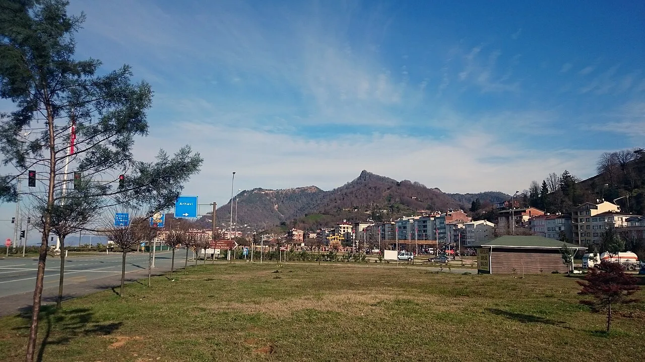
Arhavi (Laz: არქაბი/Arǩabi; Georgian: არქაბი/Arkabi) is a town in Artvin Province located in the Black Sea Region of Turkey. It is the seat of Arhavi District. Its population is 17,558 (2022), making it the third most populous municipality in Artvin Province. Laz people form a large portion of the population. The terrain is hilly and mountainous. Area of the city center is about 6 km2 (2.3 sq mi). The length of the coast is about 10 km (6.2 mi).
Source: Wikipedia · CC BY-SA 4.0
Photos of Arhavi
-

Jaba1977 · CC BY-SA 4.0 -

Jaba1977 · CC BY-SA 4.0 -

Jaba1977 · CC BY-SA 4.0


Population of Arhavi over time
| 2007 | 19,136 | |
|---|---|---|
| 2008 | 19,189 | |
| 2009 | 19,132 | |
| 2010 | 19,319 | |
| 2011 | 19,362 | |
| 2013 | 19,899 | |
| 2014 | 20,306 | |
| 2015 | 20,565 | |
| 2016 | 20,533 | |
| 2017 | 20,452 | |
| 2018 | 21,003 | |
| 2019 | 20,926 |
Censuses and official estimates; source: Wikidata.
Climate of Arhavi
Best months for sightseeingBest months for sightseeing: May–July, September–October.
This month · November
A wet month
Day 17° · Night 9° · Rain 220 mm
- Hottest month
- August (day 27°)
- Coldest month
- January (night 4°)
- Wettest month
- October (249 mm)
- Driest month
- May (84 mm)
Bars: average monthly low and high temperature. Below: precipitation. Monthly averages for 1970–2000 at about 18 km resolution, adjusted for elevation. Highlighted months are mild and relatively dry. Source: WorldClim 2.1 (CC BY 4.0).
Show values as a table
| Month | Jan | Feb | Mar | Apr | May | Jun | Jul | Aug | Sep | Oct | Nov | Dec |
|---|---|---|---|---|---|---|---|---|---|---|---|---|
| Average high (°C) | 11° | 12° | 14° | 17° | 21° | 25° | 27° | 27° | 25° | 21° | 17° | 13° |
| Average low (°C) | 4° | 4° | 5° | 9° | 12° | 16° | 19° | 20° | 16° | 13° | 9° | 6° |
| Precipitation (mm) | 188 | 139 | 117 | 93 | 84 | 133 | 122 | 162 | 207 | 249 | 220 | 226 |
Other places to visit in this season: May June July September October
How to get to Arhavi
The nearest airport is Alexander Kartveli Batumi International Airport (BUS), 38 km to the northeast as the crow flies. The nearest large city is Batumi, 42 km to the northeast.
Airports
- Alexander Kartveli Batumi International Airport (BUS) Batumi 38 kmnortheast
- Rize–Artvin Airport (RZV) Rize 43 kmsouthwest
- Trabzon International Airport (TZX) Trabzon 133 kmwest
Nearby large cities
- Batumi Population: 186.9K 42 kmnortheast
- Rize Population: 119.8K 75 kmsouthwest
- Trabzon Population: 244.1K 138 kmwest
- Kutaisi Population: 135.2K 154 kmnortheast
- Erzurum Population: 767.8K 160 kmsouth
Straight-line distances; road distances are longer. Airport data: OurAirports.
Day trips from Arhavi
Within 100 km: 12 historic and cultural sites, 265 natural sites, 252 lakes, rivers and coasts.
0–25 km35 places
- Koca Göl Lake 23 kmS
- Sultanselim Tepesi Mountain 23 kmNE
- Balıklı Dağı Mountain 17 kmE
- Çatalkaya Tepesi Mountain 22 kmS
25–60 km185 places
- Bat’umis Qure Natural site 46 kmNE
- Çoruh Nehri River 36 kmNE
- K’orolists’q’ali River 47 kmNE
- Acharistsqali River 41 kmNE
60–100 km309 places
- Arsianis K’edi Mountain 95 kmE
- Kintrishi Reserve Natural site 74 kmNE
- Kolkheti National Park Natural site 97 kmNE
- Mtirala National Park Natural site 62 kmNE
Straight-line distances.
Nearby attractions & nature
Everything nearby-
Kabısra Çayı River, Artvin Province0.6 km W
-
İsina Tepesi Mountain, Arhavi İlçesi3.2 km SE
-
Chia Kalesi Historic site, Arhavi İlçesi3.8 km SE
-
Cifte Köprü Landmark, Arhavi İlçesi10 km SE
-
Mete Tepesi Mountain, Arhavi İlçesi16 km SE
-
Sazlık Tepesi Mountain, Rize Province12 km S
-
Sivritaş Tepesi Mountain, Arhavi İlçesi13 km E
-
Boğa Tepesi Mountain, Arhavi İlçesi22 km SE
Sources & licences
Data last updated: · 2 independent sources