- Elevation
- 831 m
- above sea level
- Local time
- UTC+03:00
- Europe/Istanbul · UTC+03:00
- Airports
- MZH Amasya Merzifon Airport40 km
- TJK Tokat Airport96 km
About Mecitözü Bucağı
Mecitözü Bucağı is a municipality. Location: Çorum Province, Turkey. Elevation: 831 m. The best months to visit are May–October. The nearest airport is Amasya Merzifon Airport (40 km). Nearby sights include Özdere and Yapracık Tepesi.
Climate of Mecitözü Bucağı
Best months for sightseeingBest months for sightseeing: May–October.
This month · November
A cold month
Day 12° · Night 1° · Rain 38 mm
Better nearby cities in November
- Osmaniye · 392 km south21°
- Adana · 393 km south21°
- Hottest month
- August (day 28°)
- Coldest month
- January (night -4°)
- Wettest month
- May (63 mm)
- Driest month
- August (17 mm)
Bars: average monthly low and high temperature. Below: precipitation. Monthly averages for 1970–2000 at about 18 km resolution, adjusted for elevation. Highlighted months are mild and relatively dry. Source: WorldClim 2.1 (CC BY 4.0).
Show values as a table
| Month | Jan | Feb | Mar | Apr | May | Jun | Jul | Aug | Sep | Oct | Nov | Dec |
|---|---|---|---|---|---|---|---|---|---|---|---|---|
| Average high (°C) | 4° | 6° | 11° | 17° | 21° | 25° | 28° | 28° | 25° | 19° | 12° | 6° |
| Average low (°C) | -4° | -3° | 0° | 4° | 8° | 10° | 13° | 12° | 9° | 5° | 1° | -2° |
| Precipitation (mm) | 43 | 34 | 42 | 59 | 63 | 49 | 21 | 17 | 22 | 42 | 38 | 52 |
Other places to visit in this season: May June July August September October
How to get to Mecitözü Bucağı
The nearest airport is Amasya Merzifon Airport (MZH), 40 km to the northeast as the crow flies. The nearest large city is Çorum, 29 km to the west.
Airports
- Amasya Merzifon Airport (MZH) Amasya 40 kmnortheast
- Tokat Airport (TJK) Tokat 96 kmeast
- Samsun-Çarşamba Airport (SZF) Samsun 135 kmnortheast
Nearby large cities
- Çorum Population: 269.6K 29 kmwest
- Amasya Population: 114.9K 48 kmeast
- Turhal Population: 110.9K 69 kmeast
- Tokat Province Population: 129.7K 110 kmeast
- Samsun Population: 394K 122 kmnortheast
Straight-line distances; road distances are longer. Airport data: OurAirports.
Day trips from Mecitözü Bucağı
Within 100 km: 77 historic and cultural sites, 611 natural sites, 196 lakes, rivers and coasts.
0–25 km81 places
- Kara Göl Lake 21 kmSW
- Kırlar Dağı Mountain 14 kmSW
- Karadağ Mountain 25 kmS
- Çalbaşı Tepesi Mountain 13 kmE
25–60 km332 places
- Maşat Höyük Historic site 58 kmSE
- Örükaya Göleti Lake 57 kmSW
- Çitli Gölü Lake 29 kmN
- Alacahüyük Sulama Göleti Lake 60 kmSW
60–100 km471 places
- Ladik Lake Lake 75 kmNE
- Kaz Gölü Lake 78 kmE
- Altınkaya Baraj Gölü Lake 89 kmN
- Topçu Göleti Lake 96 kmSW
Straight-line distances.
Nearby attractions & nature
Everything nearby-
Özdere River, Çorum Province5.8 km W
-
Yapracık Tepesi Mountain, Mecitözü İlçesi6.4 km NE
-
Avkat Dağı Mountain, Mecitözü İlçesi7.9 km NW
-
Göbel Tepesi Mountain, Mecitözü İlçesi7.9 km SW
-
Orta Dağ Mountain, Mecitözü İlçesi9.6 km SW
-
Boncukluk Tepesi Mountain, Mecitözü İlçesi8.6 km NW
-
Efinnik Çayı River, Çorum Province9.3 km NE
-
Karasivri Tepesi Mountain, Mecitözü İlçesi11 km S
Other cities and towns in Çorum Province
-
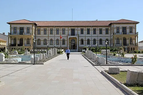 Çorum City, Corum29 km W
-
Cemilbey Bucağı Municipality, Çorum Province26 km SW
-
Hamamözü Bucağı Municipality, Çorum Province37 km NW
-
Alaca City, Alaca İlçesi54 km SW
-
Laçin City, Laçin İlçesi45 km NW
-
Osmancık City, Osmancık65 km NW
Sources & licences
Data last updated: