- Population
- 147,919
- 147.9K
- Elevation
- 693 m
- above sea level
- Local time
- UTC+03:00
- Europe/Istanbul · UTC+03:00
- Places inside
- 73
- listed under Kilis Province
- Airports
- GZT Gaziantep Oğuzeli International Airport39 km
- ALP Aleppo International Airport61 km
About Kilis Province
Kilis Province is a region. Location: Turkey. Population: 147,919.
Kilis Province (Turkish: Kilis ili) is a province in southern Turkey, on the border with Syria. Its area is 1,412 km2, and its population is 147,919 (2022). The province was created in 1995 from the southern part of Gaziantep Province. The city of Kilis is home to over 75% of the inhabitants of the province; the other towns and villages are very small.
Source: Wikipedia · CC BY-SA 4.0
At a glance
- Area
- 1,412 km²
Source: Wikidata
Places bordering Kilis Province
Climate of Kilis Province
Best months for sightseeingBest months for sightseeing: April–May, October.
This month · November
Outside the best season
Day 17° · Night 5° · Rain 53 mm
Better nearby cities in November
- İskenderun · 88 km west22°
- Osmaniye · 88 km northwest21°
- Antakya · 105 km southwest21°
- Hottest month
- August (day 35°)
- Coldest month
- January (night 0°)
- Wettest month
- January (97 mm)
- Driest month
- July (1 mm)
Bars: average monthly low and high temperature. Below: precipitation. Monthly averages for 1970–2000 at about 18 km resolution, adjusted for elevation. Highlighted months are mild and relatively dry. Source: WorldClim 2.1 (CC BY 4.0).
Show values as a table
| Month | Jan | Feb | Mar | Apr | May | Jun | Jul | Aug | Sep | Oct | Nov | Dec |
|---|---|---|---|---|---|---|---|---|---|---|---|---|
| Average high (°C) | 9° | 11° | 15° | 21° | 27° | 32° | 35° | 35° | 32° | 26° | 17° | 11° |
| Average low (°C) | 0° | 1° | 4° | 8° | 13° | 17° | 20° | 20° | 16° | 11° | 5° | 2° |
| Precipitation (mm) | 97 | 83 | 71 | 50 | 29 | 5 | 1 | 3 | 4 | 33 | 53 | 97 |
How to get to Kilis Province
The nearest airport is Gaziantep Oğuzeli International Airport (GZT), 39 km to the northeast as the crow flies. The nearest large city is Kilis, 3 km to the southwest.
Airports
- Gaziantep Oğuzeli International Airport (GZT) Gaziantep 39 kmnortheast
- Aleppo International Airport (ALP) Aleppo 61 kmsouth
- Hatay Airport (HTY) Antakya 87 kmsouthwest
Nearby large cities
- Kilis Population: 111.6K 3 kmsouthwest
- Gaziantep Population: 2.2M 42 kmnortheast
- İskenderun Population: 251.7K 88 kmwest
- Osmaniye Population: 202.8K 88 kmnorthwest
- Kahramanmaraş Population: 385K 97 kmnorth
Straight-line distances; road distances are longer. Airport data: OurAirports.
Places in Kilis Province
73 placesBar: population relative to the most populous place in this list.
Countries & regions1
- Kilis Merkez · District
Cities & villages4
- Elbeyli Bucağı · Municipality
- Karakuyu · Village
- Kilis Bucağı · Municipality
- Kyuchyuk-Byykyr · Village
Mountains & nature29
- Acar Pınarı · Natural site
- Albazın Kaynağı · Natural site
- Aym Pınarı · Natural site
- Bezirgângedik Tepesi · Mountain
- Çevlik Pınarı · Natural site
- Çörten Kaynağı · Natural site
- Dudlu Kaynak · Natural site
- Elifkaya Pınarı · Natural site
- Eminin Kaynağı · Natural site
- Eyrak Kaynağı · Natural site
- Ferik Pınar · Natural site
- Göktepe · Mountain
- Hasanağa Dağı · Mountain
- Hasan ali Pınarı · Natural site
- Havuzlu Kaynak · Natural site
- Hoca Pınar · Natural site
- Hülbül Pınar · Natural site
- İnkılâp Dağı · Mountain
- Karaen Pınarı · Natural site
- Kara Pınar · Natural site
- Kızıl Pınar · Natural site
- Kızlar Pınarı · Natural site
- Körpınar · Natural site
- Kör Pınar · Natural site
- Kuk Pınarı · Natural site
- Külâh Pınarı · Natural site
- Meğaral · Natural site
- Müşetil Pınarı · Natural site
- Palazlı Tepe · Mountain
Lakes, rivers & coasts22
- Afrin Çayı · River
- Altıbağ Deresi · River
- Balıksuyu · River
- Balıksuyu Deresi · River
- Bozatrin Deresi · River
- Boz Dere · River
- Deli Çay · River
- Deliçay Dere · River
- Dercik Dere · River
- Dereaşağı Deresi · River
- Derin Dere · River
- Esme Dere · River
- Gevrik Dere · River
- Kazılıçayır Deresi · River
- Kefiz Deresi · River
- Kınacık Deresi · River
- Köktaş Deresi · River
- Konak Göleti · Lake
- Merç Boğazı Deresi · River
- Narlıca Deresi · River
- Narlıca Deresi · River
- Nelvel Deresi · River
Largest cities and towns
Nature and heritage in Kilis Province
Other regions in Turkey
-
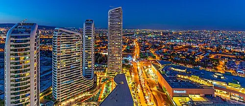 Gaziantep Province Region, Turkey43 km NE
-
Osmaniye Province Region, Turkey97 km NW
-
Hatay Province Region, Turkey84 km W
-
Şahinbey İlçesi District, Gaziantep Province40 km NE
-
Oğuzeli İlçesi District, Gaziantep Province41 km NE
-
Şehitkamil District, Gaziantep Province53 km N
Sources & licences
Data last updated: · 2 independent sources