Kırklareli Province
Local name: Kirklareli ili
Located in Turkey Coordinates: 41°40′00″ N 27°30′00″ E
- Population
- 379,031
- 379K
- Elevation
- 270 m
- above sea level
- Local time
- UTC+03:00
- Europe/Istanbul · UTC+03:00
- Places inside
- 105
- listed under Kırklareli Province
- Airports
- TEQ Tekirdağ Çorlu Airport68 km
- BOJ Burgas Airport100 km
About Kırklareli Province
Kırklareli Province is a region. Location: Turkey. Population: 379,031.
Kırklareli Province (Turkish: Kırklareli ili) is a province in northwestern Turkey on the west coast of the Black Sea. The province neighbours Bulgaria to the north along a 180-kilometre (110 mi) long border. It borders the province of Edirne to the west, the province of Tekirdağ to the south, and the province of Istanbul to the southeast. Kırklareli is the capital city of the province. Its area is 6,459 km2, and its population is 369,347 (2022).
Source: Wikipedia · CC BY-SA 4.0
Places bordering Kırklareli Province
- Yambol
- Burgas
- Tekirdağ Province
- Edirne Province
Climate of Kırklareli Province
Best months for sightseeingBest months for sightseeing: May–June, August–September.
This month · November
Outside the best season
Day 13° · Night 6° · Rain 74 mm
- Hottest month
- July (day 28°)
- Coldest month
- January (night 0°)
- Wettest month
- December (78 mm)
- Driest month
- August (27 mm)
Bars: average monthly low and high temperature. Below: precipitation. Monthly averages for 1970–2000 at about 18 km resolution, adjusted for elevation. Highlighted months are mild and relatively dry. Source: WorldClim 2.1 (CC BY 4.0).
Show values as a table
| Month | Jan | Feb | Mar | Apr | May | Jun | Jul | Aug | Sep | Oct | Nov | Dec |
|---|---|---|---|---|---|---|---|---|---|---|---|---|
| Average high (°C) | 7° | 8° | 11° | 16° | 21° | 25° | 28° | 28° | 24° | 18° | 13° | 9° |
| Average low (°C) | 0° | 1° | 3° | 7° | 11° | 15° | 17° | 17° | 14° | 10° | 6° | 3° |
| Precipitation (mm) | 65 | 56 | 57 | 55 | 52 | 49 | 28 | 27 | 34 | 54 | 74 | 78 |
Other places to visit in this season: May June August September
How to get to Kırklareli Province
The nearest airport is Tekirdağ Çorlu Airport (TEQ), 68 km to the southeast as the crow flies. For international flights: Burgas Airport (BOJ) (100 km). The nearest large city is Çorlu, 62 km to the southeast.
Airports
- Tekirdağ Çorlu Airport (TEQ) Çorlu 68 kmsoutheast
- Burgas Airport (BOJ) Burgas 100 kmnorth
- İstanbul Airport (IST) Istanbul 112 kmsoutheast
Nearby large cities
- Çorlu Population: 202.6K 62 kmsoutheast
- Tekirdağ Population: 122.3K 76 kmsouth
- Edirne Population: 180K 79 kmwest
- Burgas Population: 210.6K 93 kmnorth
- Büyükçekmece Population: 163.1K 116 kmsoutheast
Straight-line distances; road distances are longer. Airport data: OurAirports.
Places in Kırklareli Province
105 places- 1 Lüleburgaz İlçesi 138.8K
- 2 Babaeski İlçesi 50K
- 3 Vize İlçesi 27.9K
- 4 Pınarhisar İlçesi 19K
- 5 Demirköy İlçesi 8.5K
- 6 Pehlivanköy İlçesi 4.1K
- 7 Kofçaz İlçesi 2.7K
Bar: population relative to the most populous place in this list.
Countries & regions1
- Kirklareli · District
Cities & villages8
- Babaeski Bucağı · Municipality
- Bahçeköy · Village
- Büyükkarıştıran Bucaçğı · Municipality
- Demirköy Bucağı · Municipality
- Dereköy Bucaçğı · Municipality
- İğneada Bucaçğı · Municipality
- İnece Bucaçğı · Municipality
- Karacaoğlan Bucaçğı · Municipality
Mountains & nature2
- Beypınar Çeşmesi · Natural site
- Kaynarca Çeşmesi · Natural site
Lakes, rivers & coasts42
- Ahmetbey Deresi · River
- Akan Dere · River
- Akdere · River
- Aksu Deresi · River
- Babaeski Deresi · River
- Bağlık Dere · River
- Balaban Deresi · River
- Birinci Dere · River
- Bulanık Dere · River
- Büyük Dere · River
- Büyük Dere · River
- Büyük Dere · River
- Büyük Dere · River
- Çatal Deresi · River
- Çavdar Deresi · River
- Çavdar Deresi · River
- Çavuş Deresi · River
- Çilingier Deresi · River
- Çimenli Dere · River
- Değirmen Dere · River
- Dikenler Deresi · River
- Dolap Dere · River
- Dolhan Dere · River
- Efendi Dere · River
- Eğri Dere · River
- Emirali Deresi · River
- Erikleryurdu Deresi · River
- Fındıklı Dere · River
- Gökçesu Deresi · River
- Gürgen Dere · River
- Hamam Dere · River
- Hamam Deresi · River
- Hamam Deresi · River
- Hamam Gölü · Lake
- Havsa Deresi · River
- Höyük Deresi · River
- İnece Deresi · River
- Kavak Dere · River
- Kavala Deresi · River
- Kaynarca Deresi · River
- Kaynarlı Dere · River
- Kazan Deresi · River
Largest cities and towns
-
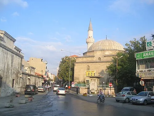 Kırklareli City, Kirklareli58.2K
-
Lüleburgaz City, Lüleburgaz İlçesi90.9K
-
Babaeski City, Babaeski İlçesi26.7K
-
 Kıyıköy Village, Vize İlçesi2.4K
-
Pınarhisar City, Pınarhisar İlçesi11.2K
-
 Üsküp Village, Kirklareli2.3K
-
Sakızköy Village, Lüleburgaz İlçesi1.3K
-
Vize City, Vize İlçesi11K
Nature and heritage in Kırklareli Province
Other regions in Turkey
-
Tekirdağ Province Region, Turkey74 km S
-
 Edirne Province Region, Turkey84 km SW
-
Saray İlçesi District, Tekirdağ Province43 km SE
-
Kapaklı District, Tekirdağ Province54 km SE
-
Çorlu District, Tekirdağ Province64 km SE
-
Ergene District, Tekirdağ Province57 km SE
Sources & licences
Data last updated: · 2 independent sources