- Elevation
- 107 m
- above sea level
- Local time
- UTC+03:00
- Europe/Istanbul · UTC+03:00
- Airports
- TEQ Tekirdağ Çorlu Airport94 km
- BOJ Burgas Airport101 km
About Eğri Dere
Eğri Dere is a river. Location: Kırklareli Province, Turkey. The best months to visit are May, September–October. The nearest airport is Tekirdağ Çorlu Airport (94 km). Nearby sights include Bağlık Dere and Sırtgöl Tepesi.
Climate of Eğri Dere
Best months for sightseeingBest months for sightseeing: May, September–October.
This month · November
Outside the best season
Day 14° · Night 6° · Rain 72 mm
- Hottest month
- July (day 31°)
- Coldest month
- January (night 0°)
- Wettest month
- November (72 mm)
- Driest month
- August (26 mm)
Bars: average monthly low and high temperature. Below: precipitation. Monthly averages for 1970–2000 at about 18 km resolution, adjusted for elevation. Highlighted months are mild and relatively dry. Source: WorldClim 2.1 (CC BY 4.0).
Show values as a table
| Month | Jan | Feb | Mar | Apr | May | Jun | Jul | Aug | Sep | Oct | Nov | Dec |
|---|---|---|---|---|---|---|---|---|---|---|---|---|
| Average high (°C) | 7° | 9° | 12° | 18° | 24° | 29° | 31° | 31° | 27° | 20° | 14° | 9° |
| Average low (°C) | 0° | 1° | 3° | 7° | 12° | 15° | 17° | 17° | 14° | 9° | 6° | 2° |
| Precipitation (mm) | 59 | 53 | 54 | 52 | 51 | 48 | 27 | 26 | 31 | 52 | 72 | 71 |
How to get to Eğri Dere
The nearest airport is Tekirdağ Çorlu Airport (TEQ), 94 km to the southeast as the crow flies. For international flights: Burgas Airport (BOJ) (101 km). The nearest large city is Edirne, 45 km to the west.
Airports
- Tekirdağ Çorlu Airport (TEQ) Çorlu 94 kmsoutheast
- Burgas Airport (BOJ) Burgas 101 kmnorth
- Alexandroupoli Democritus Airport (AXD) Alexandroupolis 135 kmsouthwest
Nearby large cities
- Edirne Population: 180K 45 kmwest
- Çorlu Population: 202.6K 85 kmsoutheast
- Tekirdağ Population: 122.3K 88 kmsoutheast
- Burgas Population: 210.6K 94 kmnorth
- Stara Zagora Population: 121.6K 145 kmnorthwest
Straight-line distances; road distances are longer. Airport data: OurAirports.
Day trips from Eğri Dere
Within 100 km: 73 historic and cultural sites, 123 natural sites, 191 lakes, rivers and coasts.
0–25 km25 places
- Tuzlakaya Tepesi Mountain 23 kmN
- Maraşal Tepesi Mountain 10 kmNE
- Kıtlık Tepe Mountain 25 kmN
- Kayrak Tepesi Mountain 9 kmN
25–60 km208 places
- Koca Göl Lake 47 kmS
- Büyükkarakarlı Göleti Lake 51 kmS
- Sinit Gölü Lake 27 kmSW
- Yumrukaya Tepesi Mountain 34 kmN
60–100 km154 places
- Pedina Gölü Lake 71 kmE
- Mert Gölü Lake 74 kmE
- Hamam Gölü Lake 73 kmE
- Sakpınar Gölü Lake 75 kmE
Straight-line distances.
Nearest towns and villages
-
Koyunbaba Village, Kirklareli1.4 km N
-
İnece Bucaçğı Municipality, Kırklareli Province2.7 km SW
-
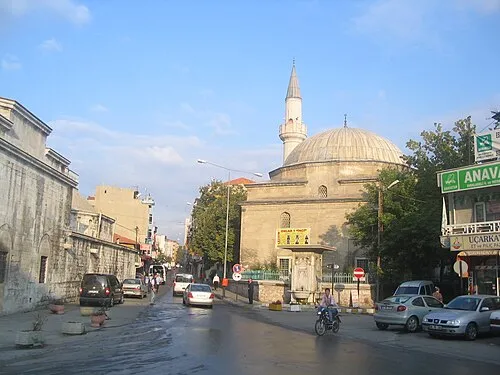 Kırklareli City, Kirklareli11 km E
-
İnece Village, Kirklareli4.7 km SW
-
Paşayeri Village, Kirklareli7 km W
-
Dolhan Village, Kirklareli7.4 km NW
Nearby attractions & nature
Everything nearby-
Bağlık Dere River, Kırklareli Province6.5 km SE
-
Sırtgöl Tepesi Mountain, Kirklareli7.5 km E
-
Saksağan Deresi River, Kırklareli Province6.9 km SW
-
Dikenler Deresi River, Kırklareli Province7 km SW
-
Dolhan Dere River, Kırklareli Province8.1 km W
-
Kayrak Tepesi Mountain, Kirklareli8.5 km N
-
Kocataş Tepesi Mountain, Kirklareli12 km N
-
Maraşal Tepesi Mountain, Kirklareli9.9 km NE
Sources & licences
Data last updated: