- Elevation
- 1,562 m
- above sea level
- Local time
- UTC+03:00
- Europe/Istanbul · UTC+03:00
- Airports
- NAV Nevşehir Kapadokya Airport45 km
- ASR Kayseri Erkilet International Airport52 km
About Avla Dağı
Avla Dağı is a mountain. Location: Ürgüp, Nevşehir Province. Elevation: 1,562 m. The best months to visit are June–September. The nearest airport is Nevşehir Kapadokya Airport (45 km). Nearby sights include Akıllı Çeşme and Damsa Çayı.
Climate of Avla Dağı
Best months for sightseeingBest months for sightseeing: June–September.
This month · November
A cold month
Day 9° · Night -1° · Rain 34 mm
Better nearby cities in November
- Adana · 177 km south21°
- Tarsus · 182 km south22°
- Mersin · 195 km south22°
- Hottest month
- July (day 26°)
- Coldest month
- January (night -7°)
- Wettest month
- May (55 mm)
- Driest month
- August (6 mm)
Bars: average monthly low and high temperature. Below: precipitation. Monthly averages for 1970–2000 at about 18 km resolution, adjusted for elevation. Highlighted months are mild and relatively dry. Source: WorldClim 2.1 (CC BY 4.0).
Show values as a table
| Month | Jan | Feb | Mar | Apr | May | Jun | Jul | Aug | Sep | Oct | Nov | Dec |
|---|---|---|---|---|---|---|---|---|---|---|---|---|
| Average high (°C) | 1° | 3° | 8° | 14° | 18° | 23° | 26° | 26° | 23° | 16° | 9° | 3° |
| Average low (°C) | -7° | -5° | -3° | 2° | 5° | 8° | 10° | 10° | 7° | 3° | -1° | -5° |
| Precipitation (mm) | 37 | 32 | 40 | 53 | 55 | 34 | 9 | 6 | 12 | 31 | 34 | 42 |
Other places to visit in this season: June July August September
How to get to Avla Dağı
The nearest airport is Nevşehir Kapadokya Airport (NAV), 45 km to the northwest as the crow flies. The nearest large city is Kayseri, 49 km to the northeast.
Airports
- Nevşehir Kapadokya Airport (NAV) Nevşehir 45 kmnorthwest
- Kayseri Erkilet International Airport (ASR) Kayseri 52 kmnortheast
- Çukurova International Airport (COV) Tarsus 184 kmsouth
Nearby large cities
- Kayseri Population: 1.5M 49 kmnortheast
- Aksaray Population: 327.6K 84 kmwest
- Kırşehir Population: 150.7K 96 kmnorthwest
- Heraclea Population: 156.3K 141 kmsouthwest
- Adana Population: 1.8M 176 kmsouth
Straight-line distances; road distances are longer. Airport data: OurAirports.
Day trips from Avla Dağı
Within 100 km: 15 historic and cultural sites, 322 natural sites, 131 lakes, rivers and coasts.
0–25 km36 places
- Pürçüklü Tepe Mountain 11 kmNE
- Tepebaşı Tepesi Mountain 11 kmE
- Düğün Tepesi Mountain 9 kmS
- Hodul Dağı Mountain 7 kmSE
25–60 km141 places
- Söbe Göl Lake 30 kmSE
- Yaygölü Lake 35 kmSE
- Kanlı Gölü Lake 32 kmNE
- Camız Gölü Lake 39 kmSE
60–100 km291 places
- Kültepe Historic site 67 kmNE
- Tuzla Gölü Lake 90 kmNE
- Lake Suğla Lake 89 kmNW
- Engir Gölü Lake 61 kmNE
Straight-line distances.
Nearest towns and villages

Nearby attractions & nature
Everything nearby-
Akıllı Çeşme Natural site, Nevşehir Province1.9 km N
-
Damsa Çayı River, Nevşehir Province3.8 km W
-
Hodul Dağı Mountain, Ürgüp6.8 km SE
-
Kara Tepe Mountain, Ürgüp7.5 km SW
-
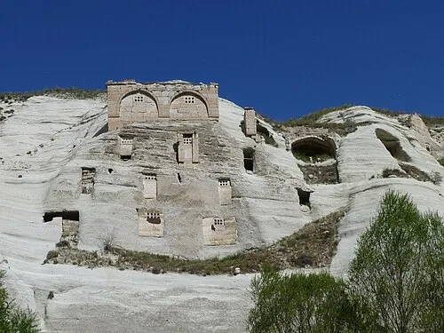 Gomeda Vadisi Natural site, Nevşehir Province9.6 km W
-
Düğün Tepesi Mountain, Ürgüp9.2 km S
-
Büyükoluk Deresi River, Nevşehir Province7.3 km NW
-
Pancarlık Vadisi Natural site, Nevşehir Province9.7 km NW
Sources & licences
Data last updated: