Vezirköprü Bucağı
Located in Samsun Province, Turkey Coordinates: 41°08′15″ N 35°27′16″ E
- Population
- 87,575
- 87.6K
- Elevation
- 368 m
- above sea level
- Local time
- UTC+03:00
- Europe/Istanbul · UTC+03:00
- Airports
- MZH Amasya Merzifon Airport35 km
- SZF Samsun-Çarşamba Airport94 km
About Vezirköprü Bucağı
Vezirköprü Bucağı is a municipality. Location: Samsun Province, Turkey. Population: 87,575. Elevation: 368 m. The best months to visit are May–October. The nearest airport is Amasya Merzifon Airport (35 km). Nearby sights include Ulu Çay and Gök Çay.
Climate of Vezirköprü Bucağı
Best months for sightseeingBest months for sightseeing: May–October.
This month · November
Outside the best season
Day 13° · Night 5° · Rain 48 mm
- Hottest month
- August (day 28°)
- Coldest month
- January (night 0°)
- Wettest month
- May (62 mm)
- Driest month
- August (22 mm)
Bars: average monthly low and high temperature. Below: precipitation. Monthly averages for 1970–2000 at about 18 km resolution, adjusted for elevation. Highlighted months are mild and relatively dry. Source: WorldClim 2.1 (CC BY 4.0).
Show values as a table
| Month | Jan | Feb | Mar | Apr | May | Jun | Jul | Aug | Sep | Oct | Nov | Dec |
|---|---|---|---|---|---|---|---|---|---|---|---|---|
| Average high (°C) | 6° | 8° | 12° | 17° | 21° | 25° | 28° | 28° | 25° | 19° | 13° | 8° |
| Average low (°C) | 0° | 0° | 3° | 7° | 10° | 13° | 16° | 16° | 13° | 9° | 5° | 2° |
| Precipitation (mm) | 52 | 39 | 44 | 58 | 62 | 49 | 24 | 22 | 30 | 50 | 48 | 62 |
Other places to visit in this season: May June July August September October
How to get to Vezirköprü Bucağı
The nearest airport is Amasya Merzifon Airport (MZH), 35 km to the south as the crow flies. The nearest large city is Amasya, 63 km to the southeast.
Airports
- Amasya Merzifon Airport (MZH) Amasya 35 kmsouth
- Samsun-Çarşamba Airport (SZF) Samsun 94 kmeast
- Sinop Airport (NOP) Sinop 103 kmnorth
Nearby large cities
- Amasya Population: 114.9K 63 kmsoutheast
- Samsun Population: 394K 76 kmeast
- Çorum Population: 269.6K 78 kmsouthwest
- Turhal Population: 110.9K 99 kmsoutheast
- Tokat Province Population: 129.7K 130 kmsoutheast
Straight-line distances; road distances are longer. Airport data: OurAirports.
Day trips from Vezirköprü Bucağı
Within 100 km: 69 historic and cultural sites, 580 natural sites, 228 lakes, rivers and coasts.
0–25 km39 places
- Karlıgöl Lake 12 kmW
- Altınkaya Barajı Lake 16 kmN
- Tavşan Dağı Mountain 21 kmSW
- Evliyaçalı Tepe Mountain 20 kmNE
25–60 km169 places
- Ladik Lake Lake 54 kmSE
- Altınkaya Baraj Gölü Lake 29 kmNW
- Çitli Gölü Lake 45 kmSW
- Soluk Dağ Mountain 46 kmNW
60–100 km669 places
- Uzun Gölü Lake 72 kmNE
- Tuzlu Göl Lake 79 kmNE
- Liman Göl Lake 78 kmNE
- Liman Göl Lake 78 kmNE
Straight-line distances.
Vezirköprü Bucağı and similar cities
Side by side with cities of similar size in the same country: population, elevation and climate.
| Measure | Vezirköprü Bucağı | Yozgat | Kozan | Ereğli |
|---|---|---|---|---|
| Population | 87.6K | 87.9K | 88.1K | 88.8K |
| Elevation | 368 m | 1,290 m | 140 m | 43 m |
| Summer day (hottest month) | 28° | 27° | 36° | 26° |
| Winter night (coldest month) | 0° | -6° | 5° | 2° |
| Annual rainfall | 540 mm | 491 mm | 787 mm | 1,027 mm |
| Best months | May–Oct | Jun, Sep | Apr, Nov | May–Sep |
| Distance | — | 156 km | 410 km | 339 km |
Climate values are 1970–2000 monthly averages; straight-line distance.
Nearby attractions & nature
Everything nearby-
Ulu Çay River, Samsun Province4 km NE
-
Gök Çay River, Samsun Province4.5 km NE
-
Kaya Pınarı Natural site, Samsun Province6 km W
-
Kuz Çay River, Samsun Province5.5 km NE
-
Yürükçal Tepesi Mountain, Vezirköprü İlçesi7 km NE
-
Davut Pınarı Natural site, Samsun Province8.1 km NW
-
Tuğluca Tepesi Mountain, Vezirköprü İlçesi8.1 km NW
-
Tepelice Tepesi Mountain, Vezirköprü İlçesi7.2 km N
Other cities and towns in Samsun Province
-
Köprübaşı Bucağı Municipality, Samsun Province11 km SE
-
Beşpınar Bucağı Municipality, Samsun Province19 km W
-
Havza City, Havza İlçesi25 km SE
-
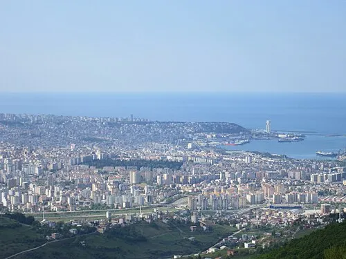 Samsun City, Samsun Province76 km E
-
19 Mayıs Bucağı Municipality, Samsun Province65 km NE
-
Havza Bucağı Municipality, Samsun Province26 km SE
Sources & licences
Data last updated: