- Population
- 331,311
- 331.3K
- Elevation
- 944 m
- above sea level
- Local time
- UTC+03:00
- Europe/Istanbul · UTC+03:00
- Places inside
- 209
- listed under Siirt Province
- Airports
- NKT Şırnak Şerafettin Elçi Airport67 km
- BAL Batman Airport73 km
About Siirt Province
Siirt Province is a region. Location: Turkey. Population: 331,311.
Siirt Province, (Turkish: Siirt ili, Kurdish: Parêzgeha Sêrtê; is a province of Turkey, located in the southeast. The province borders Bitlis to the north, Batman to the west, Mardin to the southwest, Şırnak to the south, and Van to the east. Its area is 5,717 km2, and its population is 331,311 (2022). Its capital is Siirt. It encompasses 12 municipalities, 280 villages and 214 hamlets. The province is considered part of Turkish Kurdistan and has a Kurdish majority.
Source: Wikipedia · CC BY-SA 4.0
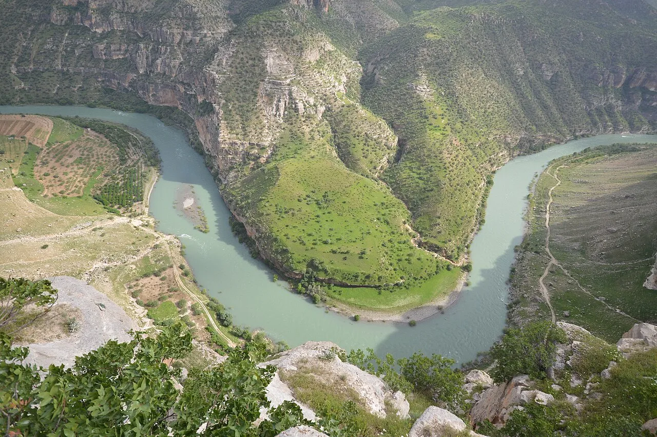
Photos of Siirt Province
-

Dûrzan Cîrano · CC BY-SA 4.0 -

Yunusnky · CC BY-SA 4.0


Places bordering Siirt Province
Population of Siirt Province over time
| 2014 | 318,366 | |
|---|---|---|
| 2018 | 331,670 | |
| 2021 | 288,138 |
Censuses and official estimates; source: Wikidata.
Climate of Siirt Province
Best months for sightseeingBest months for sightseeing: May, October.
This month · November
Outside the best season
Day 15° · Night 5° · Rain 84 mm
Better nearby cities in November
- Cizre · 73 km south20°
- Silopi · 92 km southeast20°
- Kızıltepe · 148 km southwest19°
- Hottest month
- July (day 37°)
- Coldest month
- January (night -2°)
- Wettest month
- March (105 mm)
- Driest month
- July (2 mm)
Bars: average monthly low and high temperature. Below: precipitation. Monthly averages for 1970–2000 at about 18 km resolution, adjusted for elevation. Highlighted months are mild and relatively dry. Source: WorldClim 2.1 (CC BY 4.0).
Show values as a table
| Month | Jan | Feb | Mar | Apr | May | Jun | Jul | Aug | Sep | Oct | Nov | Dec |
|---|---|---|---|---|---|---|---|---|---|---|---|---|
| Average high (°C) | 6° | 9° | 13° | 19° | 25° | 32° | 37° | 37° | 32° | 24° | 15° | 8° |
| Average low (°C) | -2° | 0° | 3° | 8° | 13° | 18° | 22° | 22° | 17° | 11° | 5° | 1° |
| Precipitation (mm) | 93 | 102 | 105 | 103 | 60 | 10 | 2 | 2 | 4 | 48 | 84 | 98 |
How to get to Siirt Province
The nearest airport is Şırnak Şerafettin Elçi Airport (NKT), 67 km to the south as the crow flies. The nearest large city is Siirt, 4 km to the south.
Airports
- Şırnak Şerafettin Elçi Airport (NKT) Şırnak 67 kmsouth
- Batman Airport (BAL) Batman 73 kmwest
- Muş Airport (MSR) Muş 91 kmnorth
Nearby large cities
- Siirt Population: 114K 4 kmsouth
- Batman Population: 452.2K 72 kmwest
- Cizre Population: 134K 73 kmsouth
- Silopi Population: 114.6K 92 kmsoutheast
- Mardin Population: 129.9K 128 kmsouthwest
Straight-line distances; road distances are longer. Airport data: OurAirports.
Places in Siirt Province
209 places- 1 Siirt Merkez 160.3K
- 2 Kurtalan İlçesi 36.3K
- 3 Pervari İlçesi 33.5K
- 4 Baykan İlçesi 27.8K
- 5 Şirvan İlçesi 24K
- 6 Eruh District 19.9K
- 7 Tillo İlçesi 4K
- 8 Sugeldi 383
- 9 Kayatepe 250
- 10 Kurukavak 193
Bar: population relative to the most populous place in this list.
Cities & villages8
- Aydınlar Bucağı · Municipality
- Bağgöze Bucağı · Municipality
- Bağlıca Bucağı · Municipality
- Baykan Bucağı · Municipality
- Beşpınar Bucağı · Municipality
- Bizinka · Village
- Çalaş · Village
- Cevizlik Bucağı · Municipality
Mountains & nature11
- Alikaplan Pınarı · Natural site
- Andık Pınarı · Natural site
- Aynbir Çeşmesi · Natural site
- Badik Pınar · Natural site
- Beyaz Çeşme · Natural site
- Bimuç Pınarı · Natural site
- Birayo Pınarı · Natural site
- Birberroç Pınarı · Natural site
- Bitilo Çeşmesi · Natural site
- Cayir Pınar · Natural site
- Çimenlik Tepesi · Mountain
Lakes, rivers & coasts31
- Alakan Deresi · River
- Ancilik Deresi · River
- Angüs Deresi · River
- Arapçınarı Deresi · River
- Avgira Deresi · River
- Avriş Deresi · River
- Ayngevri Deresi · River
- Bahçe Deresi · River
- Bargı Dere · River
- Başören Çayı · River
- Bastokan Gölü · Lake
- Benemazen Deresi · River
- Bent Deresi · River
- Berha Deresi · River
- Beşlik Deresi · River
- Besri Deresi · River
- Besteberiker Deresi · River
- Besti Deresi · River
- Bigiret Deresi · River
- Bistanşeyh Deresi · River
- Bitlis Çayı · River
- Buhtom Deresi · River
- Bunlu Dere · River
- Büyük Çay · River
- Büyükkepı Dere · River
- Çadere · River
- Çatak Çayı · River
- Çatak Çayı · River
- Çay Deresi · River
- Cemikari Deresi · River
- Cip Deresi · River
Largest cities and towns
-
Siirt City, Siirt Merkez114K
-
Gölgelikonak Village, Eruh District4.9K
-
Kurtalan City, Kurtalan İlçesi32.1K
-
Gökçebağ Village, Siirt Merkez2.6K
-
Baykan City, Baykan İlçesi11.3K
-
Palamutlu Village, Pervari İlçesi1.4K
-
Eruh City, Eruh District7.9K
-
Konakpınar Village, Kurtalan İlçesi767
Nature and heritage in Siirt Province
Sources & licences
Data last updated: · 2 independent sources