Şırnak Province
Local name: Şırnak ili
Located in Turkey Coordinates: 37°30′00″ N 42°30′00″ E
- Population
- 557,605
- 557.6K
- Elevation
- 1,379 m
- above sea level
- Local time
- UTC+03:00
- Europe/Istanbul · UTC+03:00
- Places inside
- 203
- listed under Şırnak Province
- Airports
- NKT Şırnak Şerafettin Elçi Airport42 km
- KAC Qamishli International Airport128 km
About Şırnak Province
Şırnak Province is a region. Location: Turkey. Population: 557,605.
Şırnak Province (Turkish: Şırnak ili, Kurdish: Parêzgeha Şirnex) is a province in Turkey in the Southeastern Anatolia Region. Şırnak Province was created in 1990, with areas that were formerly part of the Siirt, Hakkâri and Mardin Provinces. It borders both Kurdistan Region of Iraq and Syria. The current Governor of the province is Cevdet Atay. The province had a population of 570,745 in 2023. Its area is 7,078 km2. It encompasses 19 municipalities, 240 villages and 192 hamlets.
Source: Wikipedia · CC BY-SA 4.0
Places bordering Şırnak Province
Climate of Şırnak Province
Best months for sightseeingBest months for sightseeing: May, October.
This month · November
Outside the best season
Day 14° · Night 5° · Rain 91 mm
Better nearby cities in November
- Silopi · 29 km south20°
- Cizre · 34 km southwest20°
- Kızıltepe · 173 km west19°
- Hottest month
- July (day 34°)
- Coldest month
- January (night -3°)
- Wettest month
- March (124 mm)
- Driest month
- July (1 mm)
Bars: average monthly low and high temperature. Below: precipitation. Monthly averages for 1970–2000 at about 18 km resolution, adjusted for elevation. Highlighted months are mild and relatively dry. Source: WorldClim 2.1 (CC BY 4.0).
Show values as a table
| Month | Jan | Feb | Mar | Apr | May | Jun | Jul | Aug | Sep | Oct | Nov | Dec |
|---|---|---|---|---|---|---|---|---|---|---|---|---|
| Average high (°C) | 5° | 7° | 11° | 17° | 23° | 30° | 34° | 34° | 30° | 22° | 14° | 7° |
| Average low (°C) | -3° | -2° | 2° | 7° | 12° | 17° | 21° | 20° | 16° | 10° | 5° | 0° |
| Precipitation (mm) | 106 | 121 | 124 | 116 | 64 | 5 | 1 | 1 | 4 | 45 | 91 | 113 |
How to get to Şırnak Province
The nearest airport is Şırnak Şerafettin Elçi Airport (NKT), 42 km to the west as the crow flies. The nearest large city is Silopi, 29 km to the south.
Airports
- Şırnak Şerafettin Elçi Airport (NKT) Şırnak 42 kmwest
- Qamishli International Airport (KAC) Qamishli 128 kmsouthwest
- Van Ferit Melen Airport (VAN) Van 130 kmnortheast
Nearby large cities
- Silopi Population: 114.6K 29 kmsouth
- Cizre Population: 134K 34 kmsouthwest
- Siirt Population: 114K 69 kmnorthwest
- Batman Population: 452.2K 128 kmwest
- Van Population: 525K 135 kmnortheast
Straight-line distances; road distances are longer. Airport data: OurAirports.
Places in Şırnak Province
203 places- 1 Cizre İlçesi 130.9K
- 2 Silopi İlçesi 117.7K
- 3 İdil İlçesi 77.1K
- 4 Şırnak İlçesi 63.3K
- 5 Uludere İlçesi 46.7K
- 6 Beytüşşebap 16.1K
- 7 Güçlükonak İlçesi 11.7K
Bar: population relative to the most populous place in this list.
Cities & villages3
- Beytüşşebap Bucağı · Municipality
- Bölek · Village
- Cizre Bucağı · Municipality
Mountains & nature16
- Ağpınarı · Natural site
- Alem Dağı · Mountain
- Altın Dağları · Mountain
- Bandikeseve Pınarı · Natural site
- Bekir Pınarı · Natural site
- Besin Kaynağı · Natural site
- Beş Pınarları · Natural site
- Betonpınarı · Natural site
- Büyük Pınar · Natural site
- Büyükrefikdüzü Tepesi · Mountain
- Çaçi Dağları · Mountain
- Çamaşır Pınarı · Natural site
- Çayır Pınarı · Natural site
- Celekuzege Tepesi · Mountain
- Çimen Pınarı · Natural site
- Çınar Kaynak · Natural site
Lakes, rivers & coasts34
- Acı Dere · River
- Afkamasya Deresi · River
- Ağıl Deresi · River
- Aksu Deresi · River
- Atarkin Deresi · River
- Avaslu Deresi · River
- Avmasori Deresi · River
- Avyar Deresi · River
- Aziz Dere · River
- Bahçe Deresi · River
- Baki Deresi · River
- Ballıkaya Deresi · River
- Başköy Deresi · River
- Behrancı Deresi · River
- Berçiya Gölü · Lake
- Bere Deresi · River
- Beribeş Deresi · River
- Besrabuluze Deresi · River
- Bestegebu Deresi · River
- Beyazgöl Dere · River
- Bezirhane Deresi · River
- Bilmat Deresi · River
- Binat Deresi · River
- Bincan Deresi · River
- Bişoka Deresi · River
- Büyük Dere · River
- Çağlayan Deresi · River
- Çar Deresi · River
- Cehennem Deresi · River
- Cemibahri Deresi · River
- Çemişeyli Dere · River
- Çeşme Dere · River
- Çeşme Dere · River
- Cevizdüzü Deresi · River
Largest cities and towns

Nature and heritage in Şırnak Province
Other regions in Turkey
-
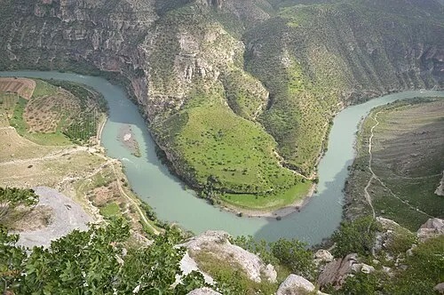 Siirt Province Region, Turkey71 km NW
-
Bitlis Province Region, Turkey94 km N
-
Batman Province Region, Turkey117 km NW
-
Eruh District District, Siirt Province40 km NW
-
Pervari İlçesi District, Siirt Province42 km N
-
Siirt Merkez District, Siirt Province70 km NW
Sources & licences
Data last updated: · 2 independent sources