Tekirdağ Province
Local name: Tekirdağ ili
Located in Turkey Coordinates: 41°00′00″ N 27°30′00″ E
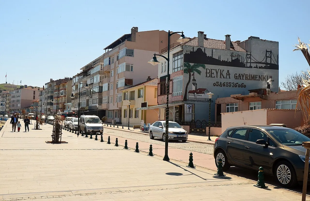
- Population
- 1,142,451
- 1.1M
- Elevation
- 113 m
- above sea level
- Local time
- UTC+03:00
- Europe/Istanbul · UTC+03:00
- Places inside
- 109
- listed under Tekirdağ Province
- Airports
- TEQ Tekirdağ Çorlu Airport38 km
- IST İstanbul Airport108 km
About Tekirdağ Province
Tekirdağ Province is a region. Location: Turkey. Population: 1,142,451.
Tekirdağ Province (Turkish: Tekirdağ ili, pronounced [teˈciɾdaː]) is a province and metropolitan municipality of Turkey. Its area is 6,190 km2, and its population is 1,142,451 (2022). It is located in the East Thrace region of the country, also known as European Turkey, one of only three provinces entirely within continental Europe.
Source: Wikipedia · CC BY-SA 4.0
Places bordering Tekirdağ Province
- Edirne Province
- Kırklareli Province
- Istanbul
- Çanakkale Province
Population of Tekirdağ Province over time
| 2013 | 874,475 | |
|---|---|---|
| 2014 | 906,732 | |
| 2015 | 937,910 | |
| 2016 | 972,875 | |
| 2017 | 1,005,463 | |
| 2018 | 1,029,927 | |
| 2019 | 1,055,412 | |
| 2020 | 1,081,065 | |
| 2021 | 1,113,400 | |
| 2022 | 1,142,451 | |
| 2023 | 1,167,059 | |
| 2024 | 1,187,162 |
Censuses and official estimates; source: Wikidata.
Climate of Tekirdağ Province
Best months for sightseeingBest months for sightseeing: May–September.
This month · November
Outside the best season
Day 14° · Night 6° · Rain 77 mm
Better nearby cities in November
- Aydin · 352 km south19°
- Hottest month
- July (day 27°)
- Coldest month
- January (night 1°)
- Wettest month
- December (89 mm)
- Driest month
- August (17 mm)
Bars: average monthly low and high temperature. Below: precipitation. Monthly averages for 1970–2000 at about 18 km resolution, adjusted for elevation. Highlighted months are mild and relatively dry. Source: WorldClim 2.1 (CC BY 4.0).
Show values as a table
| Month | Jan | Feb | Mar | Apr | May | Jun | Jul | Aug | Sep | Oct | Nov | Dec |
|---|---|---|---|---|---|---|---|---|---|---|---|---|
| Average high (°C) | 8° | 8° | 10° | 16° | 20° | 25° | 27° | 27° | 24° | 19° | 14° | 10° |
| Average low (°C) | 1° | 1° | 3° | 7° | 11° | 15° | 18° | 18° | 15° | 11° | 6° | 3° |
| Precipitation (mm) | 77 | 56 | 56 | 45 | 39 | 36 | 22 | 17 | 35 | 55 | 77 | 89 |
Other places to visit in this season: May June July August September
How to get to Tekirdağ Province
The nearest airport is Tekirdağ Çorlu Airport (TEQ), 38 km to the northeast as the crow flies. For international flights: İstanbul Airport (IST) (108 km). The nearest large city is Tekirdağ, 3 km to the south.
Airports
- Tekirdağ Çorlu Airport (TEQ) Çorlu 38 kmnortheast
- İstanbul Airport (IST) Istanbul 108 kmeast
- Alexandroupoli Democritus Airport (AXD) Alexandroupolis 131 kmwest
Nearby large cities
- Tekirdağ Population: 122.3K 3 kmsouth
- Çorlu Population: 202.6K 31 kmnortheast
- Bandırma Population: 107.6K 82 kmsoutheast
- Büyükçekmece Population: 163.1K 91 kmeast
- Beylikduzu Population: 415.3K 96 kmeast
Straight-line distances; road distances are longer. Airport data: OurAirports.
Places in Tekirdağ Province
109 places- 1 Çorlu 300.3K
- 2 Çerkezköy 206.8K
- 3 Süleymanpaşa 179.2K
- 4 Tekirdağ 122.3K
- 5 Kapaklı 85.9K
- 6 Ergene 56.8K
- 7 Malkara İlçesi 53.3K
- 8 Saray İlçesi 47.2K
- 9 Hayrabolu İlçesi 33.8K
- 10 Şarköy İlçesi 30K
- 11 Muratlı İlçesi 26.8K
- 12 Marmara Ereğlisi İlçesi 22.8K
Bar: population relative to the most populous place in this list.
Cities & villages12
- Akarca · Village
- Ballı Bucağı · Municipality
- Banarlı Bucağı · Municipality
- Barbaros Bucağı · Municipality
- Barbaros Bucağı · Municipality
- Beyazköy Bucağı · Municipality
- Çamköy · Village
- Çerkezköy Bucağı · Municipality
- Çorlu Bucağı · Municipality
- Dambaslar Bucağı · Municipality
- Hayrabolu Bucağı · Municipality
- İnecik Bucağı · Municipality
Mountains & nature5
- Balta Ali Çeşmesi · Natural site
- Ereğli Limanı · Natural site
- Fehim Çeşmesi · Natural site
- Haşimağa Çeşmesi · Natural site
- Kabahöyük Tepesi · Mountain
Lakes, rivers & coasts31
- Ağıl Deresi · River
- Ali Gölü Deresi · River
- Araplı Dere · River
- Aydın Dere · River
- Azmak Deresi · River
- Balık Deresi · River
- Bent Deresi · River
- Bulgur Deresi · River
- Büyükkarakarlı Göleti · Lake
- Çamurca Deresi · River
- Çay Deresi · River
- Çayır Deresi · River
- Çayırlar Deresi · River
- Çengelli Dere · River
- Çeşme Deresi · River
- Çiftlik Deresi · River
- Çitlenbik Deresi · River
- Çorlu Çayı · River
- Çukurçengel Deresi · River
- Değirmen Dere · River
- Değirmen Deresi · River
- Değirmen Deresi · River
- Dolap Deresi · River
- Eğlek Deresi · River
- Galata Deresi · River
- Gölcük Deresi · River
- Hacımuratlı Deresi · River
- Hayrabolu Deresi · River
- Hora Deresi · River
- Işıklar Deresi · River
- Kadıköy Deresi · River
Largest cities and towns
-
 Erekli City, Marmara Ereğlisi İlçesi11K
-
Çorlu City, Çorlu202.6K
-
 Kızılpınar Village, Çerkezköy25.4K
-
Yeniçiftlik Village, Marmara Ereğlisi İlçesi11.1K
-
Çerkezköy Town, Çerkezköy84.2K
-
Marmaracık Town, Ergene6.2K
-
Malkara City, Malkara İlçesi27.4K
-
Önerler Village, Çorlu4.3K
Nature and heritage in Tekirdağ Province
Other regions in Turkey
-
 Edirne Province Region, Turkey75 km W
-
Kırklareli Province Region, Turkey74 km N
-
Lüleburgaz İlçesi District, Kırklareli Province47 km N
-
Silivri District, Istanbul62 km E
-
Babaeski İlçesi District, Kırklareli Province59 km NW
-
Keşan İlçesi District, Edirne Province74 km W
Sources & licences
Data last updated: · 2 independent sources