Çerkezköy Bucağı
Located in Tekirdağ Province, Turkey Coordinates: 41°16′35″ N 27°59′28″ E
- Elevation
- 143 m
- above sea level
- Local time
- UTC+03:00
- Europe/Istanbul · UTC+03:00
- Airports
- TEQ Tekirdağ Çorlu Airport16 km
- IST İstanbul Airport62 km
About Çerkezköy Bucağı
Çerkezköy Bucağı is a municipality. Location: Tekirdağ Province, Turkey. Elevation: 143 m. The best months to visit are May–October. The nearest airport is Tekirdağ Çorlu Airport (16 km). Nearby sights include Kartal Tepesi and Paşa Deresi.
Climate of Çerkezköy Bucağı
Best months for sightseeingBest months for sightseeing: May–October.
This month · November
Outside the best season
Day 14° · Night 6° · Rain 78 mm
Better nearby cities in November
- Aydin · 382 km south19°
- Hottest month
- July (day 28°)
- Coldest month
- January (night 1°)
- Wettest month
- December (87 mm)
- Driest month
- August (20 mm)
Bars: average monthly low and high temperature. Below: precipitation. Monthly averages for 1970–2000 at about 18 km resolution, adjusted for elevation. Highlighted months are mild and relatively dry. Source: WorldClim 2.1 (CC BY 4.0).
Show values as a table
| Month | Jan | Feb | Mar | Apr | May | Jun | Jul | Aug | Sep | Oct | Nov | Dec |
|---|---|---|---|---|---|---|---|---|---|---|---|---|
| Average high (°C) | 7° | 8° | 11° | 16° | 21° | 26° | 28° | 28° | 25° | 19° | 14° | 10° |
| Average low (°C) | 1° | 1° | 3° | 7° | 11° | 15° | 18° | 18° | 14° | 10° | 6° | 3° |
| Precipitation (mm) | 74 | 54 | 55 | 45 | 42 | 39 | 23 | 20 | 33 | 54 | 78 | 87 |
Other places to visit in this season: May June July August September October
How to get to Çerkezköy Bucağı
The nearest airport is Tekirdağ Çorlu Airport (TEQ), 16 km to the south as the crow flies. For international flights: İstanbul Airport (IST) (62 km). The nearest large city is Çorlu, 20 km to the southwest.
Airports
- Tekirdağ Çorlu Airport (TEQ) Çorlu 16 kmsouth
- İstanbul Airport (IST) Istanbul 62 kmeast
- Istanbul Sabiha Gökçen International Airport (SAW) Pendik, Istanbul 118 kmeast
Nearby large cities
- Çorlu Population: 202.6K 20 kmsouthwest
- Tekirdağ Population: 122.3K 52 kmsouthwest
- Büyükçekmece Population: 163.1K 57 kmsoutheast
- Beylikduzu Population: 415.3K 64 kmsoutheast
- Arnavutköy Population: 198.2K 64 kmeast
Straight-line distances; road distances are longer. Airport data: OurAirports.
Day trips from Çerkezköy Bucağı
Within 100 km: 147 historic and cultural sites, 151 natural sites, 271 lakes, rivers and coasts.
0–25 km45 places
- Sinekli Gölü Lake 18 kmE
- Uzunhacı Tepesi Mountain 18 kmNW
- Sarıçalı Tepesi Mountain 19 kmNE
- Poyraz Tepesi Mountain 25 kmSE
25–60 km139 places
- Karaburun Plajı Beach 60 kmE
- Karaburun Sahili Plaj Beach 57 kmE
- Kara Burun Plaji Beach 59 kmE
- Lake Durusu Lake 49 kmE
60–100 km385 places
- Yeniköy Plajı Beach 61 kmE
- Kısırka Village Beach 82 kmE
- Avşa Adası Island 95 kmSW
- Sedef Adası Island 90 kmS
Straight-line distances.
Nearby attractions & nature
Everything nearby-
Kartal Tepesi Mountain, Çerkezköy1.3 km SE
-
Paşa Deresi River, Turkey1.1 km NE
-
Derviş Tepesi Mountain, Kapaklı7.8 km NW
-
Amber Deresi River, Istanbul7.6 km E
-
Kurtdere Çeşmesi Natural site, Istanbul8.9 km E
-
Turna Deresi River, Istanbul10 km E
-
Çukurçengel Deresi River, Tekirdağ Province13 km S
-
Eyrek Tepesi Mountain, Kapaklı12 km N
Other cities and towns in Tekirdağ Province
-
Marmaracık Town, Ergene21 km W
-
Çorlu City, Çorlu20 km SW
-
Kapaklı City, Kapaklı5.9 km N
-
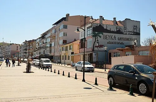 Erekli City, Marmara Ereğlisi İlçesi34 km S
-
Saray Bucağı Municipality, Tekirdağ Province19 km N
-
Çorlu Bucağı Municipality, Tekirdağ Province21 km SW
Sources & licences
Data last updated: