- Population
- 306,286
- 306.3K
- Elevation
- 150 m
- above sea level
- Local time
- UTC+03:00
- Europe/Istanbul · UTC+03:00
- Places inside
- 64
- listed under Ortahisar
- Airports
- TZX Trabzon International Airport7 km
- RZV Rize–Artvin Airport98 km
About Ortahisar
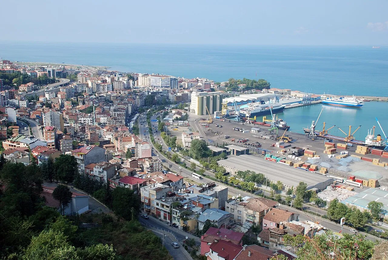
Ortahisar is a district. Location: Trabzon Province, Turkey. Population: 306,286. The best months to visit are May–October. The nearest airport is Trabzon International Airport (7 km). Nearby sights include Koştul Deresi and Kisarna Madensuyu.
Climate of Ortahisar
Best months for sightseeingBest months for sightseeing: May–October.
This month · November
Outside the best season
Day 16° · Night 8° · Rain 95 mm
- Hottest month
- August (day 27°)
- Coldest month
- January (night 3°)
- Wettest month
- October (114 mm)
- Driest month
- July (50 mm)
Bars: average monthly low and high temperature. Below: precipitation. Monthly averages for 1970–2000 at about 18 km resolution, adjusted for elevation. Highlighted months are mild and relatively dry. Source: WorldClim 2.1 (CC BY 4.0).
Show values as a table
| Month | Jan | Feb | Mar | Apr | May | Jun | Jul | Aug | Sep | Oct | Nov | Dec |
|---|---|---|---|---|---|---|---|---|---|---|---|---|
| Average high (°C) | 10° | 11° | 13° | 17° | 21° | 25° | 27° | 27° | 25° | 21° | 16° | 12° |
| Average low (°C) | 3° | 3° | 5° | 9° | 13° | 17° | 19° | 19° | 16° | 13° | 8° | 5° |
| Precipitation (mm) | 75 | 63 | 63 | 65 | 70 | 78 | 50 | 60 | 86 | 114 | 95 | 86 |
Other places to visit in this season: May June July August September October
How to get to Ortahisar
The nearest airport is Trabzon International Airport (TZX), 7 km to the east as the crow flies. The nearest large city is Trabzon, 2 km to the northeast.
Airports
- Trabzon International Airport (TZX) Trabzon 7 kmeast
- Rize–Artvin Airport (RZV) Rize 98 kmeast
- Ordu–Giresun Airport (OGU) Ordu 137 kmwest
Nearby large cities
- Trabzon Population: 244.1K 2 kmnortheast
- Rize Population: 119.8K 68 kmeast
- Giresun Population: 125.7K 112 kmwest
- Erzincan Population: 150.7K 140 kmsouth
- Ordu Population: 229.2K 153 kmwest
Straight-line distances; road distances are longer. Airport data: OurAirports.
Day trips from Ortahisar
Within 100 km: 8 historic and cultural sites, 176 natural sites, 169 lakes, rivers and coasts.
0–25 km34 places
- Hıdırnebi Mountain 24 kmW
- Hidirnebi Plateau Natural site 24 kmW
- Sera Gölü Lake 8 kmW
- Üçpınar Tepesi Mountain 21 kmS
25–60 km97 places
- Çakır Gölü Lake 46 kmS
- Cos Dağı Mountain 51 kmE
- Sis Dağı Mountain 45 kmW
- Pervane Dağı Mountain 30 kmSE
60–100 km222 places
- Salyazı Barajı Lake 82 kmS
- Beş Göller Lake 85 kmSW
- Kara Göl Lake 75 kmSE
- Zilfo Dağı Mountain 63 kmS
Straight-line distances.
Places in Ortahisar
64 placesBar: population relative to the most populous place in this list.
Cities & villages50
- Ağıllı · Village
- Ağrıt · Village
- Akkaya · Village
- Akoluk · Village
- Aktoprak · Village
- Akyazı · Village
- Anifa · Village
- Aydınlı · Village
- Ayvalı · Village
- Bahçecik · Neighbourhood
- Bektaş · Village
- Bengisu · Village
- Beşirli · Village
- Bostancı · Village
- Boztepe · Neighbourhood
- Bulak · Village
- Çamoba · Village
- Çimenli · Village
- Çukurçayır · Village
- Degirmen · Village
- Doğançay · Village
- Dolaylı · Village
- Düzyurt · Village
- Esenyurt · Village
- Fatih · Village
- (former) Diocese of Trebizond · Village
- Geçit · Village
- Gölçayır · Village
- Gözalan · Village
- Gündoğdu · Village
- Gürbulak · Village
- İncesu · Village
- Karakaya · Village
- Karakaya · Village
- Karlık · Village
- Kavala · Village
- Kireçhane · Village
- Konaklar · Village
- Özbirlik · Village
- Pınaraltı · Village
- Sayvan · Village
- Sevimli · Village
- Soğuksu · Village
- Subaşı · Village
- Toklu · Village
- Trabzon Bucağı · Municipality
- Uğurlu · Village
- Yeniköy · Village
- Yeşilbük · Village
- Yeşilköy · Village
Mountains & nature2
- Kalakafa Tepesi · Mountain
- Üçpınar Tepesi · Mountain
Heritage & sights2
- Deliktas Mediumwave Transmitter · Landmark
- Hagia Sophia · Museum
Nearby attractions & nature
Everything nearby-
Koştul Deresi River, Trabzon Province0.5 km N
-
Kisarna Madensuyu Natural site, Trabzon Province2.6 km W
-
Trabzon Limanı Natural site, Trabzon Province3.4 km NE
-
Maçka Dere River, Trabzon Province4.7 km E
-
Sera Gölü Lake, Trabzon Province8.1 km W
-
Karadağ Deresi River, Trabzon Province9.2 km S
Sources & licences
Data last updated: