Uzungöl Bucağı
Located in Trabzon Province, Turkey Coordinates: 40°37′15″ N 40°17′25″ E
- Elevation
- 1,123 m
- above sea level
- Local time
- UTC+03:00
- Europe/Istanbul · UTC+03:00
- Airports
- TZX Trabzon International Airport59 km
- RZV Rize–Artvin Airport78 km
About Uzungöl Bucağı
Uzungöl Bucağı is a municipality. Location: Trabzon Province, Turkey. Elevation: 1,123 m. The best months to visit are May–October. The nearest airport is Trabzon International Airport (59 km). Nearby sights include Kusba Tepesi and Soğanlı Dağları.
Climate of Uzungöl Bucağı
Best months for sightseeingBest months for sightseeing: May–October.
This month · November
A cold month
Day 11° · Night 3° · Rain 59 mm
Better nearby cities in November
- Viranşehir · 381 km south18°
- Kızıltepe · 382 km south19°
- Hottest month
- August (day 28°)
- Coldest month
- January (night -5°)
- Wettest month
- May (88 mm)
- Driest month
- July (32 mm)
Bars: average monthly low and high temperature. Below: precipitation. Monthly averages for 1970–2000 at about 18 km resolution, adjusted for elevation. Highlighted months are mild and relatively dry. Source: WorldClim 2.1 (CC BY 4.0).
Show values as a table
| Month | Jan | Feb | Mar | Apr | May | Jun | Jul | Aug | Sep | Oct | Nov | Dec |
|---|---|---|---|---|---|---|---|---|---|---|---|---|
| Average high (°C) | 4° | 5° | 8° | 15° | 20° | 24° | 28° | 28° | 25° | 19° | 11° | 6° |
| Average low (°C) | -5° | -4° | 0° | 6° | 9° | 12° | 15° | 14° | 11° | 7° | 3° | -2° |
| Precipitation (mm) | 44 | 40 | 49 | 75 | 88 | 74 | 32 | 32 | 44 | 67 | 59 | 54 |
Other places to visit in this season: May June July August September October
How to get to Uzungöl Bucağı
The nearest airport is Trabzon International Airport (TZX), 59 km to the northwest as the crow flies. The nearest large city is Rize, 49 km to the northeast.
Airports
- Trabzon International Airport (TZX) Trabzon 59 kmnorthwest
- Rize–Artvin Airport (RZV) Rize 78 kmnortheast
- Erzurum International Airport (ERZ) Erzurum 105 kmsoutheast
Nearby large cities
- Rize Population: 119.8K 49 kmnortheast
- Trabzon Population: 244.1K 64 kmnorthwest
- Erzurum Population: 767.8K 115 kmsoutheast
- Erzincan Population: 150.7K 119 kmsouthwest
- Batumi Population: 186.9K 160 kmnortheast
Straight-line distances; road distances are longer. Airport data: OurAirports.
Day trips from Uzungöl Bucağı
Within 100 km: 10 historic and cultural sites, 462 natural sites, 309 lakes, rivers and coasts.
0–25 km26 places
- Kara Göl Lake 12 kmSE
- Ziyaret Tepesi Mountain 16 kmE
- Koçalak Tepe Mountain 24 kmN
- Kirazlı Dağ Mountain 19 kmNE
25–60 km211 places
- Salyazı Barajı Lake 58 kmSW
- Çakır Gölü Lake 51 kmW
- Yedi Göller Lake 51 kmE
- Zilfo Dağı Mountain 34 kmSW
60–100 km544 places
- Hıdırnebi Mountain 82 kmNW
- Hidirnebi Plateau Natural site 81 kmNW
- Şenyurt Plajı Beach 83 kmNE
- Pazar Kirazlık Plajı Beach 81 kmNE
Straight-line distances.
Nearby attractions & nature
Everything nearby-
Kusba Tepesi Mountain, Çaykara İlçesi6.1 km NE
-
Soğanlı Dağları Mountain, Turkey14 km S
-
Cinis Deresi River, Trabzon Province13 km NE
-
Haldizen Dağı Mountain, Çaykara İlçesi13 km SE
-
Karakaya Tepe Mountain, Bayburt13 km SE
-
Kara Göl Lake, Bayburt Province12 km SE
-
Demirkapı Tepesi Mountain, Bayburt18 km SE
-
Karakaya Tepesi Mountain, Bayburt20 km S
Other cities and towns in Trabzon Province
-
Çaykara City, Çaykara İlçesi14 km N
-
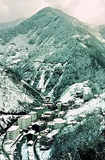 Köprübaşı City, Köprübaşı İlçesi25 km NW
-
Çaykara Bucağı Municipality, Trabzon Province14 km N
-
Dernekpazarı City, Dernekpazarı İlçesi20 km N
-
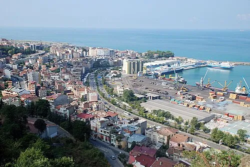 Trabzon City, Ortahisar64 km NW
-
Dernekpazarı Bucağı Municipality, Trabzon Province20 km N
Sources & licences
Data last updated: