Reşiţa
Local name: Reșița
Located in Municipiul Reşiţa, Caraș-Severin County Coordinates: 45°18′03″ N 21°53′21″ E
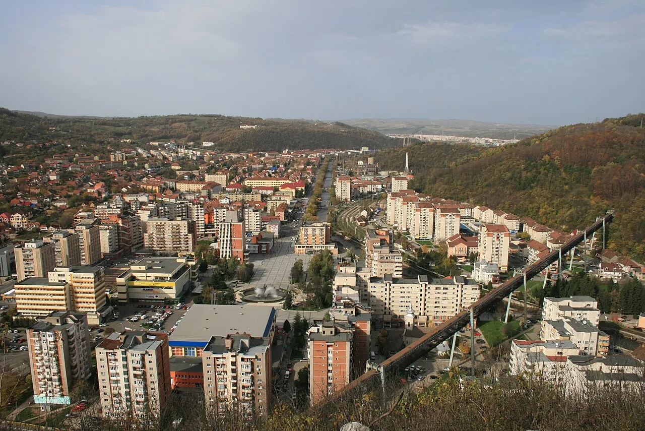
- Population
- 81,228
- 81.2K
- Elevation
- 301 m
- above sea level
- Local time
- UTC+02:00
- Europe/Bucharest · UTC+02:00
- Airports
- TSR Timișoara Traian Vuia International Airport71 km
- ARW Arad International Airport109 km
About Reşiţa
Reşiţa is a city. Location: Municipiul Reşiţa, Caraș-Severin County. Population: 81,228. Elevation: 301 m. The best months to visit are May–September. The nearest airport is Timișoara Traian Vuia International Airport (71 km).
At a glance
- Built
- 1673
Source: Wikidata
Climate of Reşiţa
Best months for sightseeingBest months for sightseeing: May–September.
This month · November
A cold month
Day 9° · Night 1° · Rain 48 mm
- Hottest month
- July (day 25°)
- Coldest month
- January (night -4°)
- Wettest month
- June (102 mm)
- Driest month
- February (41 mm)
Bars: average monthly low and high temperature. Below: precipitation. Monthly averages for 1970–2000 at about 18 km resolution, adjusted for elevation. Highlighted months are mild and relatively dry. Source: WorldClim 2.1 (CC BY 4.0).
Show values as a table
| Month | Jan | Feb | Mar | Apr | May | Jun | Jul | Aug | Sep | Oct | Nov | Dec |
|---|---|---|---|---|---|---|---|---|---|---|---|---|
| Average high (°C) | 3° | 5° | 9° | 15° | 20° | 23° | 25° | 25° | 21° | 15° | 9° | 4° |
| Average low (°C) | -4° | -3° | 0° | 5° | 9° | 12° | 14° | 14° | 10° | 6° | 1° | -2° |
| Precipitation (mm) | 44 | 41 | 43 | 68 | 82 | 102 | 82 | 69 | 64 | 52 | 48 | 54 |
Other places to visit in this season: May June July August September
How to get to Reşiţa
The nearest airport is Timișoara Traian Vuia International Airport (TSR), 71 km to the northwest as the crow flies. The nearest large city is Timișoara, 72 km to the northwest.
Airports
- Timișoara Traian Vuia International Airport (TSR) Timişoara 71 kmnorthwest
- Arad International Airport (ARW) Arad 109 kmnorthwest
- Belgrade Nikola Tesla Airport (BEG) Belgrade 136 kmsouthwest
Nearby large cities
- Timișoara Population: 250.8K 72 kmnorthwest
- Arad Population: 169.1K 108 kmnorthwest
- Belgrade Population: 1.3M 125 kmsouthwest
- Zemun Population: 155.6K 128 kmsouthwest
- New Belgrade Population: 209.8K 128 kmsouthwest
Straight-line distances; road distances are longer. Airport data: OurAirports.
Day trips from Reşiţa
Within 100 km: 2 historic and cultural sites, 74 natural sites, 6 lakes, rivers and coasts.
25–60 km49 places
- Kudrički Vrh Mountain 42 kmSW
- Moravica River 51 kmW
- Valea Ohabei Natural site 43 kmNE
- Valea Cladovii Natural site 59 kmN
60–100 km33 places
- Veliki Liškovac Mountain 95 kmS
- Čačalica Mountain 93 kmSW
- Krak River 87 kmSW
- Golubac Historic site 73 kmS
Straight-line distances.
Reşiţa and similar cities
Side by side with cities of similar size in the same country: population, elevation and climate.
| Measure | Reşiţa | Drobeta-Turnu Severin | Bistriţa | Suceava |
|---|---|---|---|---|
| Population | 81.2K | 79.9K | 78.9K | 84.3K |
| Elevation | 301 m | 76 m | 362 m | 360 m |
| Summer day (hottest month) | 25° | 29° | 25° | 25° |
| Winter night (coldest month) | -4° | -3° | -8° | -7° |
| Annual rainfall | 749 mm | 607 mm | 696 mm | 574 mm |
| Best months | May–Sep | May, Sep | May–Sep | May–Sep |
| Distance | — | 96 km | 286 km | 423 km |
Climate values are 1970–2000 monthly averages; straight-line distance.
Sources & licences
Data last updated: · 2 independent sources