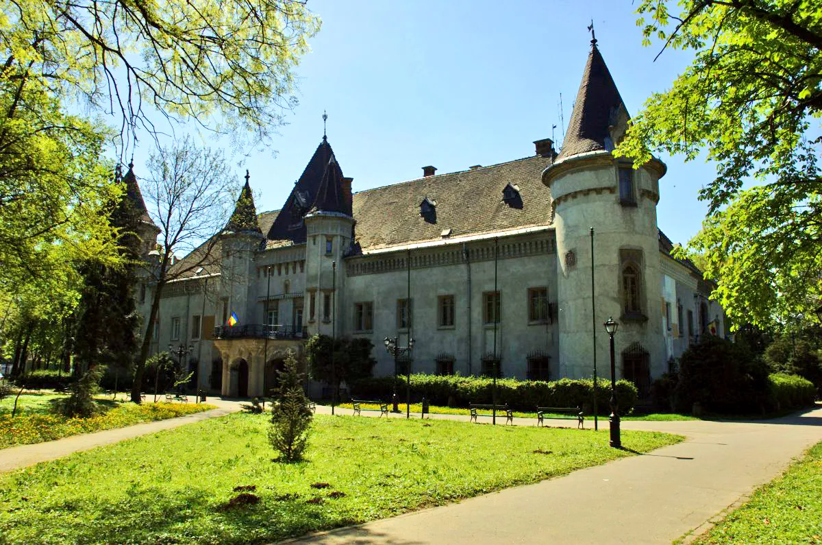
- Population
- 20,775
- 20.8K
- Elevation
- 139 m
- above sea level
- Local time
- UTC+02:00
- Europe/Bucharest · UTC+02:00
- Airports
- SUJ Satu Mare International Airport32 km
- DEB Debrecen International Airport67 km
About Carei
Carei is a city. Location: Municipiul Carei, Satu Mare County. Population: 20,775. Elevation: 139 m. The best months to visit are May–September. The nearest airport is Satu Mare International Airport (32 km). Nearby sights include Nagykároly Ghetto and Nagytag.
Photos of Carei
-

Szemes Elek · CC BY-SA 3.0 -

Pudelek · CC BY-SA 4.0 -

Derzsi Elekes Andor · CC BY-SA 3.0 -

Kelemen Barna Kadosa · CC BY-SA 4.0 -

Fortepan — ID 85815 : Adományozó/Donor: Schermann Ákos · Public domain


Travel notes for Carei
From Wikivoyage
Carei (Hungarian:Nagykároly) is a small town in the Crişana region of Romania, near the Hungarian border at the northwest. Traditionally the more famous and more urbanized nearby sister town of Mátészalka and capital of the former Szatmár county, which contained cities like Mátészalka, Nyírbátor and Satu Mare (Szatmárnémeti), its history became significantly different in the 20th century, after it became part of Romania and received influences from Romanian culture and during communist times, experienced the heavy-industry oriented hard-line Ceauşescu-government, rather than the more liberal service-oriented Kádár-government of Hungary.
Understand+
Many important events in Hungarian history took place in this town or in nearby places. Like Mátészalka, this town also existed since the Middle Ages. It became an important city of Medieval Hungary, getting various rights and privileges which usually only bigger settlements received. Various population exchanges, emigration and immigration happened during the Medieval and Early Modern periods, Hungarians, Swabians, Romanians and Jews came and went and the town became very multicultural and multireligious. It soon became the capital of the former Szatmár county.
During the 19th century various events concerning Jewish history, especially Jewish religious history happened in the town.
In the 20th century the town became part of Romania as Carei, first a less important town of Sălaj county, then as a more important town of Satu Mare county. During communist times the town received many blocks of apartments, had bases in several branches of light and heavy industry and was an important place of agricultural research.
Now, Carei is a multicultural, prosperous and exciting travel destination that is best described as a more urbanized and Romanian version of Mátészalka. Both Central European and Eastern European culture is present here, with some Balkan influence. Here you will find traditional Central European architecture, a Communist-influenced cityscape in the more modern areas of the town, and a laid-back and life-enjoying mentality that is also visible in countries like Bulgaria and Turkey, binding it all together to a concentrated mixture of everything Central Europe, Eastern Europe and the Balkans have to offer.
Get in+
By train:
Carei is directly connected to Mátészalka, Hungary by train. Using this route you can easily move between Northeast Hungary and Northwest Romania without a car. This train is very slow (the trip is about 30 km and takes more than an hour), the international trains only come-and-go twice a day, and the ticket is a bit expensive.
But once you're in Carei, the town has very good and fast train connections to every part of Romania, including the Satu Mare-Bucharest sleeper train, which also stops here.
The train station is on the edge of town, and a somewhat long walk down a desolate suburban street is needed to reach the city center. Keep this in mind when you have a train to catch soon and you are in the city center!
By car:
The car is the main method of transport in this area, and in Romania in general. The town has good roads towards Satu Mare and other parts of Romania and there is a border crossing at the nearby village of Urziceni to Hungary.
By bus:
By thumb:
You can try catching a bus or hitching a ride to Vállaj in Hungary, walking through the border crossing and once on the Romanian side at Urziceni, hitching a ride to the city center.
Source: Wikivoyage · CC BY-SA 4.0 · abridged
Climate of Carei
Best months for sightseeingBest months for sightseeing: May–September.
This month · November
A cold month
Day 8° · Night 0° · Rain 49 mm
- Hottest month
- July (day 26°)
- Coldest month
- January (night -5°)
- Wettest month
- June (80 mm)
- Driest month
- February (35 mm)
Bars: average monthly low and high temperature. Below: precipitation. Monthly averages for 1970–2000 at about 18 km resolution, adjusted for elevation. Highlighted months are mild and relatively dry. Source: WorldClim 2.1 (CC BY 4.0).
Show values as a table
| Month | Jan | Feb | Mar | Apr | May | Jun | Jul | Aug | Sep | Oct | Nov | Dec |
|---|---|---|---|---|---|---|---|---|---|---|---|---|
| Average high (°C) | 2° | 4° | 10° | 16° | 22° | 24° | 26° | 26° | 22° | 16° | 8° | 3° |
| Average low (°C) | -5° | -4° | 0° | 5° | 10° | 13° | 14° | 14° | 10° | 5° | 0° | -3° |
| Precipitation (mm) | 39 | 35 | 37 | 46 | 65 | 80 | 71 | 60 | 42 | 39 | 49 | 53 |
Other places to visit in this season: May June July August September
How to get to Carei
The nearest airport is Satu Mare International Airport (SUJ), 32 km to the east as the crow flies. For international flights: Debrecen International Airport (DEB) (67 km). The nearest large city is Satu Mare, 32 km to the northeast.
Airports
- Satu Mare International Airport (SUJ) Satu Mare 32 kmeast
- Debrecen International Airport (DEB) Debrecen 67 kmwest
- Maramureș International Airport (BAY) Tăuții-Măgherăuș 75 kmeast
Nearby large cities
- Satu Mare Population: 112.5K 32 kmnortheast
- Nyíregyháza Population: 117.7K 64 kmnorthwest
- Debrecen Population: 202.4K 66 kmwest
- Oradea Population: 183.1K 82 kmsouthwest
- Baia Mare Population: 108.8K 83 kmeast
Straight-line distances; road distances are longer. Airport data: OurAirports.
Day trips from Carei
Within 100 km: 18 historic and cultural sites, 19 natural sites, 2 lakes, rivers and coasts.
0–25 km2 places
- Nagytag Mountain 23 kmNW
- Nagykároly Ghetto Historic site 1 kmN
25–60 km6 places
- Tetemhegy Mountain 59 kmNW
- Valea Suplac Natural site 47 kmS
- Halmeu Ghetto Historic site 53 kmNE
- Satu Mare Ghetto Historic site 32 kmNE
60–100 km31 places
- Valea Lazurilor Natural site 66 kmS
- Valea Bârsăului Natural site 61 kmE
- Valea Banului Natural site 71 kmSE
- Pietroasa Mountain 80 kmE
Straight-line distances.
Nearby attractions & nature
Everything nearby-
Nagykároly Ghetto Historic site, Municipiul Carei<0.1 km N
-
Nagytag Mountain, Szabolcs-Szatmár-Bereg23 km NW
Sources & licences
Data last updated: