Častkovce
Located in Nové Mesto nad Váhom District, Trenčín Region Coordinates: 48°41′32″ N 17°47′10″ E
- Population
- 1,723
- 1.7K
- Elevation
- 176 m
- above sea level
- Local time
- UTC+01:00
- Europe/Bratislava · UTC+01:00
- Airports
- BTS M. R. Štefánik Airport72 km
- BRQ Brno-Tuřany Airport95 km
About Častkovce
Častkovce is a village. Location: Nové Mesto nad Váhom District, Trenčín Region. Population: 1,723. Elevation: 176 m.
Častkovce (Hungarian: Császtó, German: Czastkowitz) is a village and municipality in Nové Mesto nad Váhom District in the Trenčín Region of western Slovakia.
Source: Wikipedia · CC BY-SA 4.0
Population of Častkovce over time
| 2017 | 1,486 | |
|---|---|---|
| 2021 | 1,639 | |
| 2024 | 1,719 | |
| 2025 | 1,723 |
Censuses and official estimates; source: Wikidata.
Climate of Častkovce
Best months for sightseeingBest months for sightseeing: May–September.
This month · November
A cold month
Day 7° · Night 1° · Rain 50 mm
- Hottest month
- July (day 25°)
- Coldest month
- January (night -4°)
- Wettest month
- June (83 mm)
- Driest month
- February (32 mm)
Bars: average monthly low and high temperature. Below: precipitation. Monthly averages for 1970–2000 at about 18 km resolution, adjusted for elevation. Highlighted months are mild and relatively dry. Source: WorldClim 2.1 (CC BY 4.0).
Show values as a table
| Month | Jan | Feb | Mar | Apr | May | Jun | Jul | Aug | Sep | Oct | Nov | Dec |
|---|---|---|---|---|---|---|---|---|---|---|---|---|
| Average high (°C) | 2° | 4° | 9° | 15° | 20° | 23° | 25° | 25° | 20° | 14° | 7° | 3° |
| Average low (°C) | -4° | -3° | 0° | 4° | 9° | 12° | 13° | 13° | 9° | 5° | 1° | -2° |
| Precipitation (mm) | 33 | 32 | 33 | 46 | 69 | 83 | 73 | 71 | 58 | 45 | 50 | 47 |
Other places to visit in this season: May June July August September
How to get to Častkovce
The nearest airport is M. R. Štefánik Airport (BTS), 72 km to the southwest as the crow flies. The nearest large city is Bratislava, 79 km to the southwest.
Airports
- M. R. Štefánik Airport (BTS) Bratislava 72 kmsouthwest
- Brno-Tuřany Airport (BRQ) Brno 95 kmnorthwest
- Sliač Airport (SLD) Sliač 99 kmeast
Nearby large cities
- Bratislava Population: 423.7K 79 kmsouthwest
- Brno Population: 404.3K 103 kmnorthwest
- Győr Population: 129.3K 113 kmsouth
- Székesfehérvár Population: 101.6K 173 kmsouth
- Miskolc Population: 154.5K 231 kmeast
Straight-line distances; road distances are longer. Airport data: OurAirports.
Day trips from Častkovce
Within 100 km: 78 historic and cultural sites, 444 natural sites, 86 lakes, rivers and coasts.
0–25 km5 places
- Zřícenina Tematín Historic site 11 kmE
- Považský Inovec Mountain 16 kmE
- Březová Dolina Natural site 23 kmN
- Hradisko Mountain 25 kmNW
25–60 km50 places
- Tríbeč Mountain 44 kmSE
- Strážov Mountain 58 kmNE
- Záruby Mountain 35 kmSW
- Klokoč Mountain 43 kmSW
60–100 km553 places
- Tlstá Mountain 91 kmE
- Ostrý Vrch Mountain 90 kmE
- Devínska Kobyla Mountain 81 kmSW
- Mirbach Palace Historic site 79 kmSW
Straight-line distances.
Nearby attractions & nature
Everything nearby-
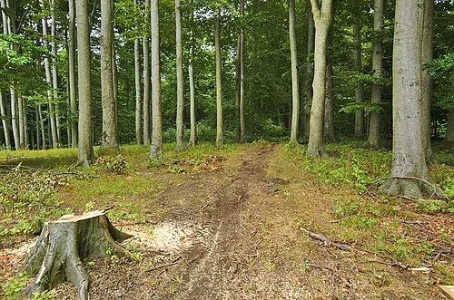 Hradisko Mountain, Javorník25 km NW
-
Zřícenina Tematín Historic site, Nové Mesto nad Váhom District11 km E
-
Kamenná Vrata Mountain, Javorník23 km NW
-
Březová Dolina Natural site, Czechia23 km N
-
 Považský Inovec Mountain, Slovakia16 km E
Other cities and towns in Nové Mesto nad Váhom District
-
 Bzince pod Javorinou Village, Nové Mesto nad Váhom District11 km N
-
 Lubina Village, Nové Mesto nad Váhom District11 km N
-
 Moravské Lieskové Village, Nové Mesto nad Váhom District14 km N
-
 Dolné Srnie Village, Nové Mesto nad Váhom District12 km N
-
Očkov Village, Nové Mesto nad Váhom District4.6 km S
-
 Brunovce Village, Nové Mesto nad Váhom District5.3 km E
Sources & licences
Data last updated: · 2 independent sources