- Elevation
- 330 m
- above sea level
- Local time
- UTC+01:00
- Europe/Ljubljana · UTC+01:00
- Airports
- MBX Maribor Edvard Rusjan Airport52 km
- KLU Klagenfurt Airport53 km
About Meža
Meža is a river. Location: Slovenia.
The Meža (Slovene) or Mieß (German; pronounced [miːs] ) is a river in the Austrian state of Carinthia and in Slovenia, a right tributary of the Drava. It is 43 kilometers (27 mi) long, of which 42 kilometers (26 mi) are in Slovenia. Its catchment area is 551.7 square kilometers (213.0 sq mi), of which 543 square kilometers (210 sq mi) in Slovenia.
Source: Wikipedia · CC BY-SA 4.0
At a glance
- Length
- 43 km
Source: Wikidata
Photos of Meža
-
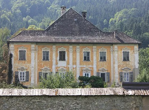
Schloss Eberwein Mefusbren69 · Public domain

Climate of Meža
Best months for sightseeingBest months for sightseeing: May–September.
This month · November
A wet month
Day 9° · Night 1° · Rain 105 mm
- Hottest month
- July (day 26°)
- Coldest month
- January (night -4°)
- Wettest month
- July (151 mm)
- Driest month
- January (45 mm)
Bars: average monthly low and high temperature. Below: precipitation. Monthly averages for 1970–2000 at about 18 km resolution, adjusted for elevation. Highlighted months are mild and relatively dry. Source: WorldClim 2.1 (CC BY 4.0).
Show values as a table
| Month | Jan | Feb | Mar | Apr | May | Jun | Jul | Aug | Sep | Oct | Nov | Dec |
|---|---|---|---|---|---|---|---|---|---|---|---|---|
| Average high (°C) | 4° | 7° | 11° | 15° | 21° | 24° | 26° | 25° | 21° | 16° | 9° | 4° |
| Average low (°C) | -4° | -3° | 1° | 5° | 9° | 13° | 14° | 14° | 10° | 6° | 1° | -2° |
| Precipitation (mm) | 45 | 53 | 74 | 91 | 106 | 149 | 151 | 135 | 116 | 111 | 105 | 72 |
Other places to visit in this season: May June July August September
How to get to Meža
The nearest airport is Maribor Edvard Rusjan Airport (MBX), 52 km to the east as the crow flies. For international flights: Klagenfurt Airport (KLU) (53 km). The nearest large city is Klagenfurt, 55 km to the west.
Airports
- Maribor Edvard Rusjan Airport (MBX) Maribor 52 kmeast
- Klagenfurt Airport (KLU) Klagenfurt am Wörthersee 53 kmwest
- Graz Airport (GRZ) Feldkirchen bei Graz 55 kmnortheast
Nearby large cities
- Klagenfurt Population: 100.3K 55 kmwest
- Graz Population: 303.3K 62 kmnortheast
- Ljubljana Population: 272.2K 72 kmsouthwest
- Zagreb Population: 663.6K 113 kmsoutheast
- Rijeka Population: 108K 147 kmsouth
Straight-line distances; road distances are longer. Airport data: OurAirports.
Day trips from Meža
Within 100 km: 231 historic and cultural sites, 1,050 natural sites, 482 lakes, rivers and coasts.
0–25 km60 places
- Ribnica Lake Lake 21 kmSE
- Črni Vrh Mountain 20 kmSE
- Mislinja River 1 kmS
- Peca Mountain 23 kmW
25–60 km483 places
- Pohorje Mountain 35 kmE
- Mrzla Gora Mountain 42 kmSW
- Grintavec Mountain 45 kmSW
- Rača River 58 kmSW
60–100 km1,220 places
- Lake Bohinj Lake 95 kmW
- Lake Bled Lake 75 kmW
- Triglav Mountain 94 kmW
- Šmarna gora Mountain 67 kmSW
Straight-line distances.
Nearest towns and villages
-
Otiški Vrh Village, Municipality of Dravograd1.7 km SE
-
Črneče Village, Municipality of Dravograd1.6 km W
-
Dobrova pri Dravogradu Village, Municipality of Dravograd1.4 km SW
-
Podklanc Village, Municipality of Dravograd1.7 km S
-
Vič Village, Municipality of Dravograd2.2 km NW
-
Bukovje Village, Municipality of Dravograd2 km E
Nearby attractions & nature
Everything nearby-
Mislinja River, Slovenia1.3 km S
-
Hühnerkogel Mountain, Eibiswald6.5 km N
-
Jankitzkogel Mountain, Lavamünd7.3 km N
-
Hirschkogel Mountain, Lavamünd9.6 km N
-
Lavant River, Carinthia8.4 km NW
-
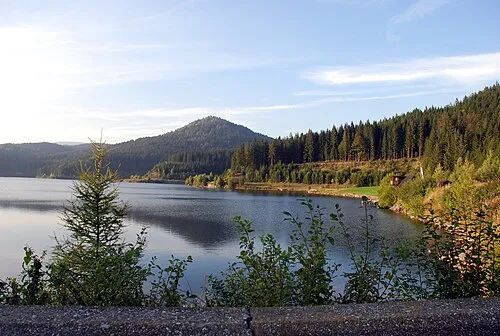 Gradischkogel Mountain, Lavamünd12 km N
-
Krumbach River, Austria11 km NE
-
Soboth Mountain, Eibiswald13 km N
Sources & licences
Data last updated: · 2 independent sources