- Population
- 33
- 33
- Elevation
- 443 m
- above sea level
- Local time
- UTC+01:00
- Europe/Ljubljana · UTC+01:00
- Airports
- LJU Ljubljana Jože Pučnik Airport13 km
- KLU Klagenfurt Airport49 km
About Podjelše
Podjelše is a village. Location: Municipality of Kamnik, Slovenia. Population: 33. Elevation: 443 m. The best months to visit are May–September. The nearest airport is Ljubljana Jože Pučnik Airport (13 km). Nearby sights include Vellacher Kotschna and Reka.
Climate of Podjelše
Best months for sightseeingBest months for sightseeing: May–September.
This month · November
A wet month
Day 8° · Night 0° · Rain 176 mm
- Hottest month
- July (day 25°)
- Coldest month
- January (night -5°)
- Wettest month
- June (182 mm)
- Driest month
- February (83 mm)
Bars: average monthly low and high temperature. Below: precipitation. Monthly averages for 1970–2000 at about 18 km resolution, adjusted for elevation. Highlighted months are mild and relatively dry. Source: WorldClim 2.1 (CC BY 4.0).
Show values as a table
| Month | Jan | Feb | Mar | Apr | May | Jun | Jul | Aug | Sep | Oct | Nov | Dec |
|---|---|---|---|---|---|---|---|---|---|---|---|---|
| Average high (°C) | 3° | 6° | 10° | 14° | 19° | 22° | 25° | 24° | 20° | 15° | 8° | 4° |
| Average low (°C) | -5° | -4° | -1° | 3° | 8° | 11° | 13° | 12° | 9° | 5° | 0° | -3° |
| Precipitation (mm) | 90 | 83 | 113 | 137 | 141 | 182 | 152 | 146 | 150 | 174 | 176 | 125 |
Other places to visit in this season: May June July August September
How to get to Podjelše
The nearest airport is Ljubljana Jože Pučnik Airport (LJU), 13 km to the west as the crow flies. The nearest large city is Ljubljana, 23 km to the south.
Airports
- Ljubljana Jože Pučnik Airport (LJU) Zgornji Brnik 13 kmwest
- Klagenfurt Airport (KLU) Klagenfurt am Wörthersee 49 kmnorthwest
- Maribor Edvard Rusjan Airport (MBX) Maribor 86 kmeast
Nearby large cities
- Ljubljana Population: 272.2K 23 kmsouth
- Klagenfurt Population: 100.3K 48 kmnorthwest
- Rijeka Population: 108K 103 kmsouth
- Graz Population: 303.3K 111 kmnortheast
- Zagreb Population: 663.6K 116 kmsoutheast
Straight-line distances; road distances are longer. Airport data: OurAirports.
Day trips from Podjelše
Within 100 km: 135 historic and cultural sites, 694 natural sites, 270 lakes, rivers and coasts.
0–25 km67 places
- Šmarna gora Mountain 18 kmSW
- Mrzla Gora Mountain 13 kmN
- Grintavec Mountain 14 kmNW
- Rača River 11 kmS
25–60 km322 places
- Ribnica Lake Lake 57 kmNE
- Lake Bohinj Lake 58 kmW
- Lake Bled Lake 42 kmW
- Rjavina Mountain 59 kmW
60–100 km710 places
- Raša River 74 kmSW
- Triglav Mountain 62 kmW
- Veliki Snežnik Mountain 75 kmS
- Prestreljenik Mountain 89 kmW
Straight-line distances.
Nearby attractions & nature
Everything nearby-
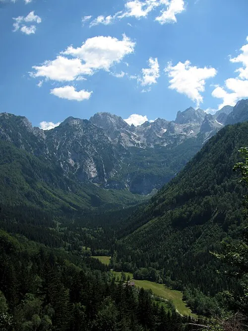 Vellacher Kotschna Natural site, Carinthia16 km N
-
Reka River, Slovenia7.2 km SW
-
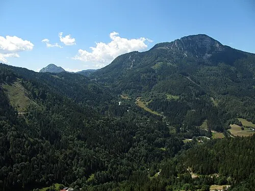 Kärntner Storschitz Mountain, Eisenkappel-Vellach22 km N
-
Kotschnatal Natural site, Carinthia18 km N
-
Rebangraben Natural site, Carinthia19 km N
-
Mrzla Gora Mountain, Eisenkappel-Vellach15 km N
Sources & licences
Data last updated: