Zagomila
Located in Municipality of Kanal ob Soči, Slovenia Coordinates: 46°00′37″ N 13°37′45″ E
- Population
- 6
- 6
- Elevation
- 280 m
- above sea level
- Local time
- UTC+01:00
- Europe/Ljubljana · UTC+01:00
- Airports
- TRS Trieste Airport24 km
- LJU Ljubljana Jože Pučnik Airport68 km
About Zagomila
Zagomila is a village. Location: Municipality of Kanal ob Soči, Slovenia. Population: 6. Elevation: 280 m.
Zagomila (pronounced [zaɡɔˈmiːla]) is a small settlement in the Municipality of Kanal ob Soči in western Slovenia. Until 2007, the area was part of the settlement of Plave. The settlement is part of the traditional region of the Slovenian Littoral and is included in the Gorizia Statistical Region.
Source: Wikipedia · CC BY-SA 4.0
At a glance
- Area
- 4.7 km²
Source: Wikidata
Climate of Zagomila
Best months for sightseeingBest months for sightseeing: May–September.
This month · November
A wet month
Day 10° · Night 3° · Rain 254 mm
- Hottest month
- August (day 27°)
- Coldest month
- January (night -1°)
- Wettest month
- November (254 mm)
- Driest month
- February (106 mm)
Bars: average monthly low and high temperature. Below: precipitation. Monthly averages for 1970–2000 at about 18 km resolution, adjusted for elevation. Highlighted months are mild and relatively dry. Source: WorldClim 2.1 (CC BY 4.0).
Show values as a table
| Month | Jan | Feb | Mar | Apr | May | Jun | Jul | Aug | Sep | Oct | Nov | Dec |
|---|---|---|---|---|---|---|---|---|---|---|---|---|
| Average high (°C) | 6° | 8° | 11° | 15° | 20° | 24° | 26° | 27° | 22° | 17° | 10° | 6° |
| Average low (°C) | -1° | -1° | 2° | 6° | 10° | 14° | 16° | 16° | 12° | 8° | 3° | 0° |
| Precipitation (mm) | 154 | 106 | 149 | 194 | 198 | 209 | 155 | 149 | 212 | 244 | 254 | 199 |
Other places to visit in this season: May June July August September
How to get to Zagomila
The nearest airport is Trieste Airport (TRS), 24 km to the southwest as the crow flies. The nearest large city is Ljubljana, 68 km to the east.
Airports
- Trieste Airport (TRS) Ronchi dei Legionari/Trieste 24 kmsouthwest
- Ljubljana Jože Pučnik Airport (LJU) Zgornji Brnik 68 kmeast
- Klagenfurt Airport (KLU) Klagenfurt am Wörthersee 89 kmnortheast
Nearby large cities
- Ljubljana Population: 272.2K 68 kmeast
- Klagenfurt Population: 100.3K 86 kmnortheast
- Rijeka Population: 108K 99 kmsoutheast
- Graz Population: 303.3K 182 kmnortheast
- Zagreb Population: 663.6K 184 kmeast
Straight-line distances; road distances are longer. Airport data: OurAirports.
Day trips from Zagomila
Within 100 km: 96 historic and cultural sites, 762 natural sites, 186 lakes, rivers and coasts.
0–25 km16 places
- Banjšice Natural site 12 kmNE
- Solkan Bridge Landmark 4 kmSE
- Matajur Mountain 24 kmN
- Trnovski Gozd Natural site 21 kmE
25–60 km171 places
- Raša River 29 kmSE
- Lake Bohinj Lake 35 kmNE
- Lake Bled Lake 53 kmNE
- Triglav Mountain 44 kmN
60–100 km857 places
- Veliki Snežnik Mountain 80 kmSE
- Šmarna gora Mountain 66 kmE
- Mrzla Gora Mountain 84 kmNE
- Mala Gora Mountain 90 kmE
Straight-line distances.
Nearby attractions & nature
Everything nearby-
Solkan Bridge Landmark, Urban Municipality of Nova Gorica3.9 km SE
-
Banjšice Natural site, Municipality of Kanal ob Soči12 km NE
-
 Matajur Mountain, Municipality of Kobarid24 km N
-
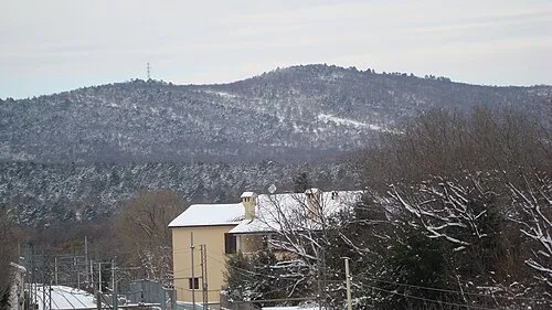 Monte Ermada Mountain, Duino Aurisina-Devin Nabrežina24 km S
-
 Idrijca River, Slovenia18 km NE
-
Monte dei Bovi Mountain, Cividale del Friuli19 km NW
Other cities and towns in Municipality of Kanal ob Soči
-
Morsko Village, Municipality of Kanal ob Soči6.9 km N
-
Deskle Village, Municipality of Kanal ob Soči4.9 km N
-
Močila Village, Municipality of Kanal ob Soči6.9 km N
-
 Avče Village, Municipality of Kanal ob Soči10 km NE
-
Gorenja Vas Village, Municipality of Kanal ob Soči8.5 km N
-
Ložice Village, Municipality of Kanal ob Soči5.3 km N
Sources & licences
Data last updated: · 2 independent sources