- Population
- 126
- 126
- Elevation
- 245 m
- above sea level
- Local time
- UTC+01:00
- Europe/Ljubljana · UTC+01:00
- Airports
- MBX Maribor Edvard Rusjan Airport36 km
- ZAG Zagreb Franjo Tuđman International Airport75 km
About Dobrava
Dobrava is a village. Location: Municipality of Ormož, Slovenia. Population: 126. Elevation: 245 m.
Dobrava (pronounced [ˈdoːbɾaʋa]) is a settlement immediately north of the town of Ormož in northeastern Slovenia. The area belongs to the traditional region of Styria and is now included in the Drava Statistical Region.
Source: Wikipedia · CC BY-SA 4.0
At a glance
- Area
- 2.6 km²
Source: Wikidata
Climate of Dobrava
Best months for sightseeingBest months for sightseeing: May–September.
This month · November
A cold month
Day 8° · Night 1° · Rain 87 mm
- Hottest month
- July (day 26°)
- Coldest month
- January (night -4°)
- Wettest month
- June (109 mm)
- Driest month
- January (42 mm)
Bars: average monthly low and high temperature. Below: precipitation. Monthly averages for 1970–2000 at about 18 km resolution, adjusted for elevation. Highlighted months are mild and relatively dry. Source: WorldClim 2.1 (CC BY 4.0).
Show values as a table
| Month | Jan | Feb | Mar | Apr | May | Jun | Jul | Aug | Sep | Oct | Nov | Dec |
|---|---|---|---|---|---|---|---|---|---|---|---|---|
| Average high (°C) | 3° | 6° | 11° | 15° | 21° | 24° | 26° | 25° | 21° | 15° | 8° | 4° |
| Average low (°C) | -4° | -3° | 1° | 5° | 9° | 12° | 14° | 13° | 10° | 5° | 1° | -3° |
| Precipitation (mm) | 42 | 47 | 64 | 73 | 82 | 109 | 104 | 97 | 89 | 88 | 87 | 65 |
Other places to visit in this season: May June July August September
How to get to Dobrava
The nearest airport is Maribor Edvard Rusjan Airport (MBX), 36 km to the west as the crow flies. For international flights: Zagreb Franjo Tuđman International Airport (ZAG) (75 km). The nearest large city is Zagreb, 68 km to the south.
Airports
- Maribor Edvard Rusjan Airport (MBX) Maribor 36 kmwest
- Zagreb Franjo Tuđman International Airport (ZAG) Velika Gorica 75 kmsouth
- Hévíz–Balaton Airport (SOB) Sármellék 83 kmeast
Nearby large cities
- Zagreb Population: 663.6K 68 kmsouth
- Graz Population: 303.3K 90 kmnorthwest
- Ljubljana Population: 272.2K 133 kmwest
- Klagenfurt Population: 100.3K 143 kmwest
- Pécs Population: 145.3K 165 kmeast
Straight-line distances; road distances are longer. Airport data: OurAirports.
Day trips from Dobrava
Within 100 km: 94 historic and cultural sites, 269 natural sites, 232 lakes, rivers and coasts.
0–25 km7 places
- Ščavnica River 17 kmNE
- Lake Ptuj Lake 19 kmW
- Polskava River 21 kmW
- Dravinja River 17 kmW
25–60 km177 places
- Pohorje Mountain 54 kmW
- Ledava River 36 kmE
- Jezero Pernica Lake 37 kmNW
- Boč Mountain 44 kmW
60–100 km411 places
- Kašina River 65 kmS
- Ribnica Lake Lake 68 kmW
- Krka River 72 kmSW
- Lake Žovnek Lake 88 kmW
Straight-line distances.
Nearby attractions & nature
Everything nearby-
Pesnica River, Austria5 km SW
-
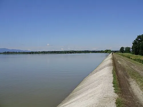 Lake Varaždin Lake, Croatia23 km SE
-
Lake Trakoščan Lake, Municipality of Bednja24 km SW
-
Ščavnica River, Slovenia17 km NE
-
Dravinja River, Slovenia17 km W
-
Lake Ptuj Lake, Slovenia19 km W
Sources & licences
Data last updated: · 2 independent sources