- Population
- 466
- 466
- Elevation
- 444 m
- above sea level
- Local time
- UTC+01:00
- Europe/Ljubljana · UTC+01:00
- Airports
- MBX Maribor Edvard Rusjan Airport31 km
- GRZ Graz Airport45 km
About Brezno
Brezno is a village. Location: Municipality of Podvelka, Slovenia. Population: 466. Elevation: 444 m.
Brezno (pronounced [ˈbɾeːznɔ]) is a settlement on the left bank of the Drava River in the Municipality of Podvelka in Slovenia. The local parish church is dedicated to the Assumption of Mary and belongs to the Roman Catholic Archdiocese of Maribor. It was first mentioned in written documents dating to 1161 and 1184 and is Romanesque and early Gothic in its origins. The belfry was added in 1671. The internal furnishings are Baroque.
Source: Wikipedia · CC BY-SA 4.0
At a glance
- Heritage designation
- registered immobile cultural heritage of Slovenia
- Area
- 5 km²
Source: Wikidata
Photos of Brezno
-
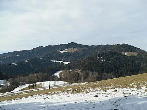
Pongrac dominkod · CC BY 3.0

Climate of Brezno
Best months for sightseeingBest months for sightseeing: May–September.
This month · November
A wet month
Day 8° · Night 1° · Rain 101 mm
- Hottest month
- July (day 25°)
- Coldest month
- January (night -4°)
- Wettest month
- June (151 mm)
- Driest month
- January (44 mm)
Bars: average monthly low and high temperature. Below: precipitation. Monthly averages for 1970–2000 at about 18 km resolution, adjusted for elevation. Highlighted months are mild and relatively dry. Source: WorldClim 2.1 (CC BY 4.0).
Show values as a table
| Month | Jan | Feb | Mar | Apr | May | Jun | Jul | Aug | Sep | Oct | Nov | Dec |
|---|---|---|---|---|---|---|---|---|---|---|---|---|
| Average high (°C) | 3° | 6° | 10° | 14° | 20° | 23° | 25° | 25° | 21° | 15° | 8° | 4° |
| Average low (°C) | -4° | -3° | 0° | 4° | 9° | 12° | 14° | 13° | 10° | 6° | 1° | -3° |
| Precipitation (mm) | 44 | 53 | 74 | 92 | 108 | 151 | 151 | 139 | 115 | 108 | 101 | 71 |
Other places to visit in this season: May June July August September
How to get to Brezno
The nearest airport is Maribor Edvard Rusjan Airport (MBX), 31 km to the southeast as the crow flies. For international flights: Graz Airport (GRZ) (45 km). The nearest large city is Graz, 53 km to the north.
Airports
- Maribor Edvard Rusjan Airport (MBX) Maribor 31 kmsoutheast
- Graz Airport (GRZ) Feldkirchen bei Graz 45 kmnorth
- Klagenfurt Airport (KLU) Klagenfurt am Wörthersee 75 kmwest
Nearby large cities
- Graz Population: 303.3K 53 kmnorth
- Klagenfurt Population: 100.3K 78 kmwest
- Ljubljana Population: 272.2K 87 kmsouthwest
- Zagreb Population: 663.6K 101 kmsoutheast
- Rijeka Population: 108K 157 kmsouthwest
Straight-line distances; road distances are longer. Airport data: OurAirports.
Day trips from Brezno
Within 100 km: 212 historic and cultural sites, 846 natural sites, 399 lakes, rivers and coasts.
0–25 km40 places
- Ribnica Lake Lake 11 kmS
- Pohorje Mountain 13 kmSE
- Rogla Mountain 16 kmS
- Črni Vrh Mountain 14 kmSW
25–60 km483 places
- Lake Ptuj Lake 50 kmSE
- Jezero Pernica Lake 31 kmE
- Lake Žovnek Lake 43 kmSW
- Raduha Mountain 48 kmSW
60–100 km934 places
- Lake Bled Lake 97 kmW
- Šmarna gora Mountain 84 kmSW
- Mrzla Gora Mountain 62 kmSW
- Krim Mountain 99 kmSW
Straight-line distances.
Nearby attractions & nature
Everything nearby-
Pongrac Mountain, Eibiswald6.4 km N
-
Remschnigg Mountain, Austria9.3 km NE
-
Montikogel Mountain, Leutschach an der Weinstraße12 km NE
-
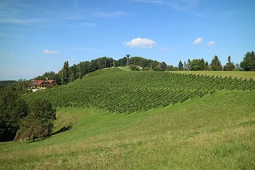 Kreuzberg Mountain, Leutschach an der Weinstraße17 km NE
-
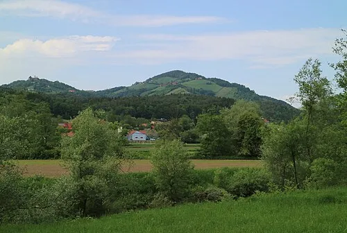 Demmerkogel Mountain, Sankt Andrä-Höch23 km N
-
Kozjak Mountain, Austria11 km E
Sources & licences
Data last updated: · 2 independent sources