- Population
- 3,534
- 3.5K
- Elevation
- 201 m
- above sea level
- Local time
- UTC+01:00
- Europe/Ljubljana · UTC+01:00
- Airports
- TRS Trieste Airport45 km
- LJU Ljubljana Jože Pučnik Airport56 km
About Tolmin
Tolmin is a city. Location: Municipality of Tolmin, Slovenia. Population: 3,534. Elevation: 201 m. The best months to visit are May–September. The nearest airport is Trieste Airport (45 km). Nearby sights include Idrijca and Bača.
Travel notes for Tolmin
From Wikivoyage
Tolmin is a city in Slovenia.
Understand+
Tolmin is the largest town and an administrative centre of the Soča Valley. Its greatest attractions are the old town centre, great sports facilities and the Museum of Tolmin which features an ethnological and archeological collection.
The most visited attraction nearby are Tolmin Gorges, the lowest entrance into the Triglav National Park. Confluence of two Alpine rivers into a gorge is quite rare phenomenon. Gorges are one of the deepest in Slovenia, too (60 m under the Devil's bridge).
A few kilometres away we can see Javorca, the most beautiful monument from the First World War in Soča Valley. It was entered into the list of European cultural heritage in 2006.
Get in+
By car:
From Ljubljana via Idrija town is 104 km (1 hour 40 minutes).
From Ljubljana via Nova Gorica is 150 km (1 hour 50 minutes).
From airport Brnik 110 km.
From Nova Gorica is 41 km (40 minutes).
By train:
From Ljubljana to Most na Soci train station: about 10 trains per day (about 3 hours drive). From Trieste, there are regular trains to Gorizia Centrale; from there you can walk or short bus ride across the Slovenian border to Nova Gorica and take a train from there to Most na Soči.
By bus:
There is a bus route for Ljubljana - Tolmin - Bovec and for Tolmin - Nova Gorica.
Source: Wikivoyage · CC BY-SA 4.0 · abridged
Climate of Tolmin
Best months for sightseeingBest months for sightseeing: May–September.
This month · November
A wet month
Day 12° · Night 5° · Rain 238 mm
- Hottest month
- August (day 26°)
- Coldest month
- January (night 0°)
- Wettest month
- November (238 mm)
- Driest month
- February (103 mm)
Bars: average monthly low and high temperature. Below: precipitation. Monthly averages for 1970–2000 at about 18 km resolution, adjusted for elevation. Highlighted months are mild and relatively dry. Source: WorldClim 2.1 (CC BY 4.0).
Show values as a table
| Month | Jan | Feb | Mar | Apr | May | Jun | Jul | Aug | Sep | Oct | Nov | Dec |
|---|---|---|---|---|---|---|---|---|---|---|---|---|
| Average high (°C) | 7° | 8° | 11° | 14° | 19° | 23° | 26° | 26° | 22° | 18° | 12° | 8° |
| Average low (°C) | 0° | 0° | 2° | 6° | 10° | 14° | 16° | 16° | 13° | 9° | 5° | 1° |
| Precipitation (mm) | 129 | 103 | 141 | 189 | 191 | 206 | 172 | 161 | 203 | 222 | 238 | 172 |
Other places to visit in this season: May June July August September
How to get to Tolmin
The nearest airport is Trieste Airport (TRS), 45 km to the southwest as the crow flies. The nearest large city is Ljubljana, 61 km to the east.
Airports
- Trieste Airport (TRS) Ronchi dei Legionari/Trieste 45 kmsouthwest
- Ljubljana Jože Pučnik Airport (LJU) Zgornji Brnik 56 kmeast
- Klagenfurt Airport (KLU) Klagenfurt am Wörthersee 69 kmnortheast
Nearby large cities
- Ljubljana Population: 272.2K 61 kmeast
- Klagenfurt Population: 100.3K 66 kmnortheast
- Rijeka Population: 108K 110 kmsoutheast
- Graz Population: 303.3K 164 kmnortheast
- Zagreb Population: 663.6K 179 kmeast
Straight-line distances; road distances are longer. Airport data: OurAirports.
Day trips from Tolmin
Within 100 km: 124 historic and cultural sites, 994 natural sites, 257 lakes, rivers and coasts.
0–25 km27 places
- Lake Bohinj Lake 15 kmNE
- Triglav Mountain 23 kmN
- Porezen Mountain 19 kmE
- Krn Mountain 11 kmNW
25–60 km391 places
- Raša River 43 kmS
- Lake Bled Lake 34 kmNE
- Šmarna gora Mountain 57 kmE
- Rjavina Mountain 26 kmNE
60–100 km957 places
- Markovec Mountain 72 kmS
- Veliki Snežnik Mountain 88 kmSE
- Mrzla Gora Mountain 69 kmE
- Mala Gora Mountain 91 kmSE
Straight-line distances.
Nearby attractions & nature
Everything nearby-
Idrijca River, Slovenia5 km SE
-
Bača River, Slovenia5.4 km SE
-
Vogel Mountain, Municipality of Tolmin8.7 km NE
-
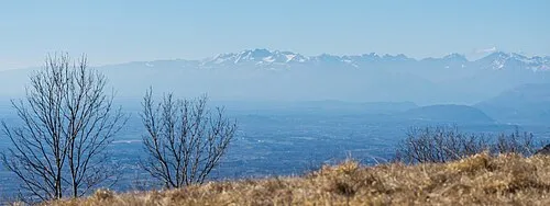 Monte Ioànaz Mountain, Torreano24 km W
-
Monte Mia Mountain, Pulfero20 km W
-
Monte Lubia Mountain, Pulfero22 km W
-
Monte Mladesena Mountain, Torreano22 km W
-
Monte dei Bovi Mountain, Cividale del Friuli23 km W
Sources & licences
Data last updated: