Maribor
Located in Urban Municipality of Maribor, Slovenia Coordinates: 46°33′21″ N 15°38′45″ E
- Population
- 96,209
- 96.2K
- Elevation
- 262 m
- above sea level
- Local time
- UTC+01:00
- Europe/Ljubljana · UTC+01:00
- Airports
- MBX Maribor Edvard Rusjan Airport9 km
- GRZ Graz Airport51 km
About Maribor
Maribor is a city. Location: Urban Municipality of Maribor, Slovenia. Population: 96,209. Elevation: 262 m.
Maribor (UK: MARR-ib-or, US: MAR-, Slovene: [ˈmáːɾibɔɾ] ; also known by other historical names) is the second-largest city in Slovenia and the largest city of the traditional region of Lower Styria. It is the seat of the Urban Municipality of Maribor and the Drava Statistical Region. Maribor is also the economic, administrative, educational, and cultural centre of eastern Slovenia. Maribor was first mentioned as a castle in 1164, as a settlement in 1209, and as a city in 1254.
Source: Wikipedia · CC BY-SA 4.0
Photos of Maribor
-
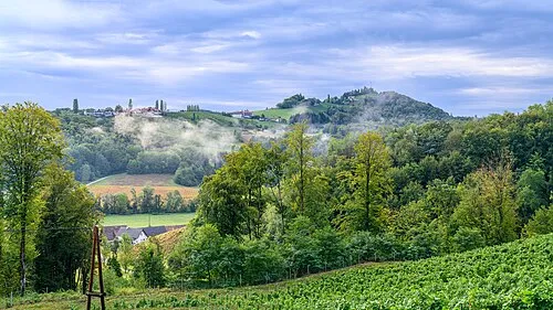
Urlkogel Isiwal · CC BY-SA 4.0

Travel notes for Maribor
From Wikivoyage
Maribor is the second most important centre and the second largest city of Slovenia. It has about 114,000 inhabitants (2021) who live embraced in its wine growing hills and the Mariborsko Pohorje mountain. Maribor is near Slovenian border with Austria, beside the Drava River and at the centre of five natural geographic regions. It is the capital of Štajerska, the Slovenian Styria.
Understand+
Maribor was first mentioned in the 12th century. Though the city had been attacked by the Turks several times, it was constantly under the rule of the Austrian Habsburgs until the end of the World War I. After the war was over the city was claimed by both the Austrians and by the new state of Yugoslavia. Finally it fell to Yugoslavia. It was occupied by the Germans during World War II but became part of Yugoslavia again after the war was over. In 1975 the University of Maribor was founded and this has helped the city to become more and more an attractive, vibrant, student city. After Slovenia declared independence in 1991, the city suffered from the economic consequences.
Today, Maribor is a trans-regional financial, educational, trade and cultural centre. And since it's pleasantly small and lodged in the nature of Pohorje Mountain on the one side, the wine growing hills on the other, and with the river Drava wending its way through it, Maribor has grown into one of the country’s most important tourist destinations. Its key features are: the rich wine culture (the oldest vine in the world, numerous wine roads and wine cellars), the old town's cultural offer (theatre, traditional events, galleries and museums), and the recreational activities (hiking, cycling and skiing).
Orientation:
Maribor sits among the Pohorje Mountain, the Slovenske Gorice Hills and the Kozjak Hills on the gravel terrace of the Drava Valley. The river Drava divides the city on the so-called left (north) and the right (south) bank. The city's old town core is on the left bank of the river Drava. On north, Maribor is embraced with the town (wine-growing) hills, and on the south-western part of the city, the foothills of the Pohorje Mountain start to rise.
A good first stop in the city is Infopeka, an information centre which gives out free advice, free internet usage and free rent-a-bicycle. They can be found across the old bridge from the Glavni Trg, on the right side of the street.
Get in+
By car:
By car, you can travel to the Maribor region from the direction of Ljubljana (Slovenia) on the A1/E57, from the direction of Zagreb (Croatia) on the E59, from the direction of Budapest (Hungary) on the E59/E65/E71/M7, and from the direction of Trieste (Italy) on the E57/E70. Maribor is a few minutes from the Austrian border: you can travel to Maribor from the direction of Graz on the A9/E57/E59, from the direction of Klagenfurt on the road B80/B70, and from the direction of Villach on the B80/B70/E66/B83.
In order to use motorways and express roads in Slovenia, a vignette is required. You can purchase the vignette at the border, at petrol stations in Slovenia and neighbouring countries, at post offices in Slovenia, at some kiosks, etc. The monthly vignette is €30, while the weekly one is €15 (for motorcycles €7.50).
Between Maribor and other ex-Yugoslavia countries' capitals is a distance of: Ljubljana 123 km, Zagreb 110 km (Croatia, Sarajevo 487 km (BiH), Belgrade 512 km (Serbia), Podgorica 703 (Montenegro) and Skopje 945 km (North Macedonia).
Between Maribor and other European cities is a distance of: Paris 1299 km (France), Venice 365 km (Italy), Prague 548 km (Czech Republic), Budapest 340 km (Hungary), Berehove 653 km (Ukraine), Shkodra 759 km (Albania), Hamburg 1163 km (Germany), London 1488 km (United Kingdom), Nordkapp 3699 km (Norway), Lisbon 2739 km (Portugal), Belgorod 1925 km (Russia), Thessaloniki 1134 km (Greece), Frankfurt 1050 km, Graz 68 km, Milan 622 km, Munich 493 km, Prague 595 km, Salzburg 352 km, Split 460 km, Trieste 216 km, Vienna 255 km, Zürich 803 km.
By train:
The 1 Maribor railway station is in the eastern part of the Maribor city centre (at Partizanska cesta 50). By train, you can travel to Maribor for example from:
Vienna Meidling – Maribor (3 hr 30 min)
Graz – Maribor (1 hr)
Venezia Santa Lucia – Ljubljana – Maribor (9 - 10 hr)
Zagreb – Dobova – Zidani most – Celje – Pragersko – Maribor (3 hr 30 min)
Source: Wikivoyage · CC BY-SA 4.0 · abridged
Twin towns and sister cities of Maribor
- Graz· Austria
- Kutaisi· Georgia
Source: Wikidata. Only places with a page on this site are shown.
Population of Maribor over time
| 2012 | 94,984 | |
|---|---|---|
| 2013 | 94,809 | |
| 2014 | 95,586 | |
| 2015 | 95,881 | |
| 2016 | 95,589 | |
| 2017 | 94,876 | |
| 2018 | 94,642 | |
| 2019 | 95,767 | |
| 2020 | 96,211 | |
| 2021 | 97,019 | |
| 2022 | 96,302 | |
| 2025 | 114,301 |
Censuses and official estimates; source: Wikidata.
Climate of Maribor
Best months for sightseeingBest months for sightseeing: May–September.
This month · November
A cold month
Day 9° · Night 1° · Rain 93 mm
- Hottest month
- July (day 26°)
- Coldest month
- January (night -4°)
- Wettest month
- June (130 mm)
- Driest month
- January (43 mm)
Bars: average monthly low and high temperature. Below: precipitation. Monthly averages for 1970–2000 at about 18 km resolution, adjusted for elevation. Highlighted months are mild and relatively dry. Source: WorldClim 2.1 (CC BY 4.0).
Show values as a table
| Month | Jan | Feb | Mar | Apr | May | Jun | Jul | Aug | Sep | Oct | Nov | Dec |
|---|---|---|---|---|---|---|---|---|---|---|---|---|
| Average high (°C) | 4° | 6° | 11° | 15° | 21° | 24° | 26° | 25° | 21° | 15° | 9° | 4° |
| Average low (°C) | -4° | -3° | 1° | 5° | 9° | 13° | 14° | 14° | 10° | 6° | 1° | -2° |
| Precipitation (mm) | 43 | 49 | 68 | 79 | 95 | 130 | 127 | 126 | 103 | 100 | 93 | 67 |
Other places to visit in this season: May June July August September
How to get to Maribor
The nearest airport is Maribor Edvard Rusjan Airport (MBX), 9 km to the south as the crow flies. For international flights: Graz Airport (GRZ) (51 km). The nearest large city is Graz, 59 km to the north.
Airports
- Maribor Edvard Rusjan Airport (MBX) Maribor 9 kmsouth
- Graz Airport (GRZ) Feldkirchen bei Graz 51 kmnorth
- Zagreb Franjo Tuđman International Airport (ZAG) Velika Gorica 96 kmsouth
Nearby large cities
- Graz Population: 303.3K 59 kmnorth
- Zagreb Population: 663.6K 86 kmsouth
- Klagenfurt Population: 100.3K 103 kmwest
- Ljubljana Population: 272.2K 104 kmsouthwest
- Rijeka Population: 108K 165 kmsouthwest
Straight-line distances; road distances are longer. Airport data: OurAirports.
Day trips from Maribor
Within 100 km: 151 historic and cultural sites, 645 natural sites, 328 lakes, rivers and coasts.
0–25 km24 places
- Pohorje Mountain 14 kmW
- Jezero Pernica Lake 7 kmNE
- Kozjak Mountain 15 kmNW
- Karner Berg Mountain 19 kmNW
25–60 km385 places
- Ribnica Lake Lake 30 kmW
- Ščavnica River 51 kmE
- Lake Ptuj Lake 27 kmSE
- Lake Žovnek Lake 57 kmSW
60–100 km715 places
- Kašina River 92 kmSE
- Mrzla Gora Mountain 84 kmW
- Grintavec Mountain 88 kmW
- Ledava River 74 kmE
Straight-line distances.
Nearby attractions & nature
Everything nearby-
Jezero Pernica Lake, Municipality of Pesnica7.2 km NE
-
Urlkogel Mountain, Gamlitz16 km NW
-
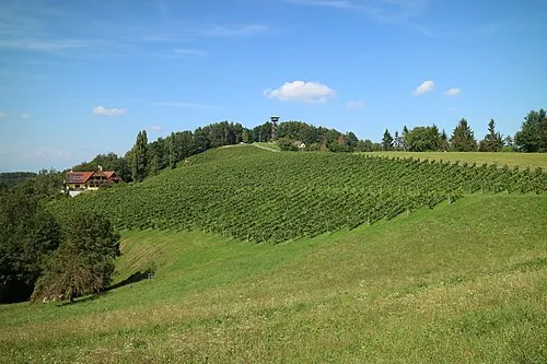 Kreuzberg Mountain, Leutschach an der Weinstraße22 km NW
-
Steinberg Mountain, Ehrenhausen an der Weinstraße15 km N
-
Montikogel Mountain, Leutschach an der Weinstraße19 km NW
-
Pohorje Mountain, Municipality of Ruše14 km W
-
Hammerkogel Mountain, Großklein24 km NW
-
Kozjak Mountain, Austria15 km NW
Sources & licences
Data last updated: · 2 independent sources