- Elevation
- 2,049 m
- above sea level
- Local time
- UTC+01:00
- Europe/Madrid · UTC+01:00
- Airports
- LEI Almería Airport45 km
- GRX F.G.L. Airport Granada-Jaén Airport121 km
About Tetica
Tetica is a mountain. Location: Bacares, Almeria. Elevation: 2,049 m. The best months to visit are June–September. The nearest airport is Almería Airport (45 km). Nearby sights include Sierra de los Filabres and Sierra Bermeja.
Climate of Tetica
Best months for sightseeingBest months for sightseeing: June–September.
This month · November
A cold month
Day 8° · Night -3° · Rain 57 mm
Better nearby cities in November
- Almería · 46 km south20°
- Cartagena · 132 km east21°
- Murcia · 139 km northeast20°
- Hottest month
- July (day 26°)
- Coldest month
- January (night -6°)
- Wettest month
- December (59 mm)
- Driest month
- July (7 mm)
Bars: average monthly low and high temperature. Below: precipitation. Monthly averages for 1970–2000 at about 18 km resolution, adjusted for elevation. Highlighted months are mild and relatively dry. Source: WorldClim 2.1 (CC BY 4.0).
Show values as a table
| Month | Jan | Feb | Mar | Apr | May | Jun | Jul | Aug | Sep | Oct | Nov | Dec |
|---|---|---|---|---|---|---|---|---|---|---|---|---|
| Average high (°C) | 4° | 5° | 8° | 11° | 15° | 21° | 26° | 26° | 20° | 13° | 8° | 4° |
| Average low (°C) | -6° | -6° | -4° | -2° | 2° | 6° | 9° | 9° | 6° | 1° | -3° | -5° |
| Precipitation (mm) | 57 | 50 | 50 | 54 | 48 | 27 | 7 | 7 | 25 | 50 | 57 | 59 |
Other places to visit in this season: June July August September
How to get to Tetica
The nearest airport is Almería Airport (LEI), 45 km to the south as the crow flies. For international flights: Region of Murcia International Airport (RMU) (129 km). The nearest large city is Almería, 46 km to the south.
Airports
- Almería Airport (LEI) Almería 45 kmsouth
- F.G.L. Airport Granada-Jaén Airport (GRX) Granada 121 kmwest
- Region of Murcia International Airport (RMU) Corvera 129 kmnortheast
Nearby large cities
- Almería Population: 196.9K 46 kmsouth
- Granada Population: 233.5K 106 kmwest
- Cartagena Population: 213.9K 132 kmeast
- Jaén Population: 113.5K 135 kmnorthwest
- Murcia Population: 472K 140 kmnortheast
Straight-line distances; road distances are longer. Airport data: OurAirports.
Day trips from Tetica
Within 100 km: 141 historic and cultural sites, 135 natural sites, 190 lakes, rivers and coasts.
0–25 km17 places
- Sierra de los Filabres Mountain 8 kmSE
- Cerro de los Corzos Mountain 20 kmN
- Sierra Bermeja Mountain 14 kmSE
- Río Sierro River 12 kmN
25–60 km198 places
- Playa de Carboneras Beach 54 kmSE
- Playa de Nueva Almería Beach 48 kmS
- Playa de los muertos Beach 56 kmSE
- Playa la Garrofa Beach 48 kmS
60–100 km251 places
- Playa de las Delicias Beach 77 kmE
- Playa de San Nicolás Beach 78 kmSW
- Playa Ancón Beach 62 kmS
- Cala Rajá Beach 62 kmS
Straight-line distances.
Nearest towns and villages
Nearby attractions & nature
Everything nearby-
Sierra de los Filabres Mountain, Senés8.1 km SE
-
Sierra Bermeja Mountain, Senés14 km SE
-
Cerro de los Corzos Mountain, Purchena20 km N
-
Río de Bacarés River, Tíjola11 km N
-
Río Sierro River, Purchena12 km N
-
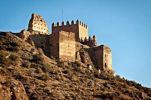 Castillo de Tabernas Historic site, Tabernas22 km S
-
Río de las Herrerías River, Serón16 km NW
-
Río Alcóntar River, Serón17 km NW
Sources & licences
Data last updated: